The much delayed and much anticipated Fall weather appears to be shaping up for the long-haul later this week.
In true Arkansas/Oklahoma fashion the dramatic shift in the pattern won’t occur without some sort of battle of air masses.
The time to watch is late Tuesday night into Wednesday.
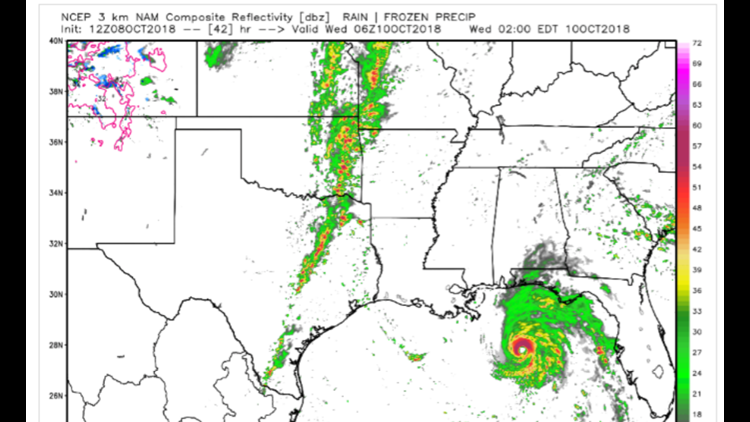
The image above shows a line of strong to severe thunderstorms that will be underway at 1am Wednesday morning. The line will shift east into Arkansas during the overnight hours.
Shear and instability (although not overly impressive) will be enough for wind damage and even a few squall line (spin-up) tornadoes as the line moves into our area.
Storms will quickly move east on Wednesday with cooler weather likely for the rest of the week.
Rain totals will also be decent with the front’s passage. The muggy air already in place should lead to rain totals around 1-2″.
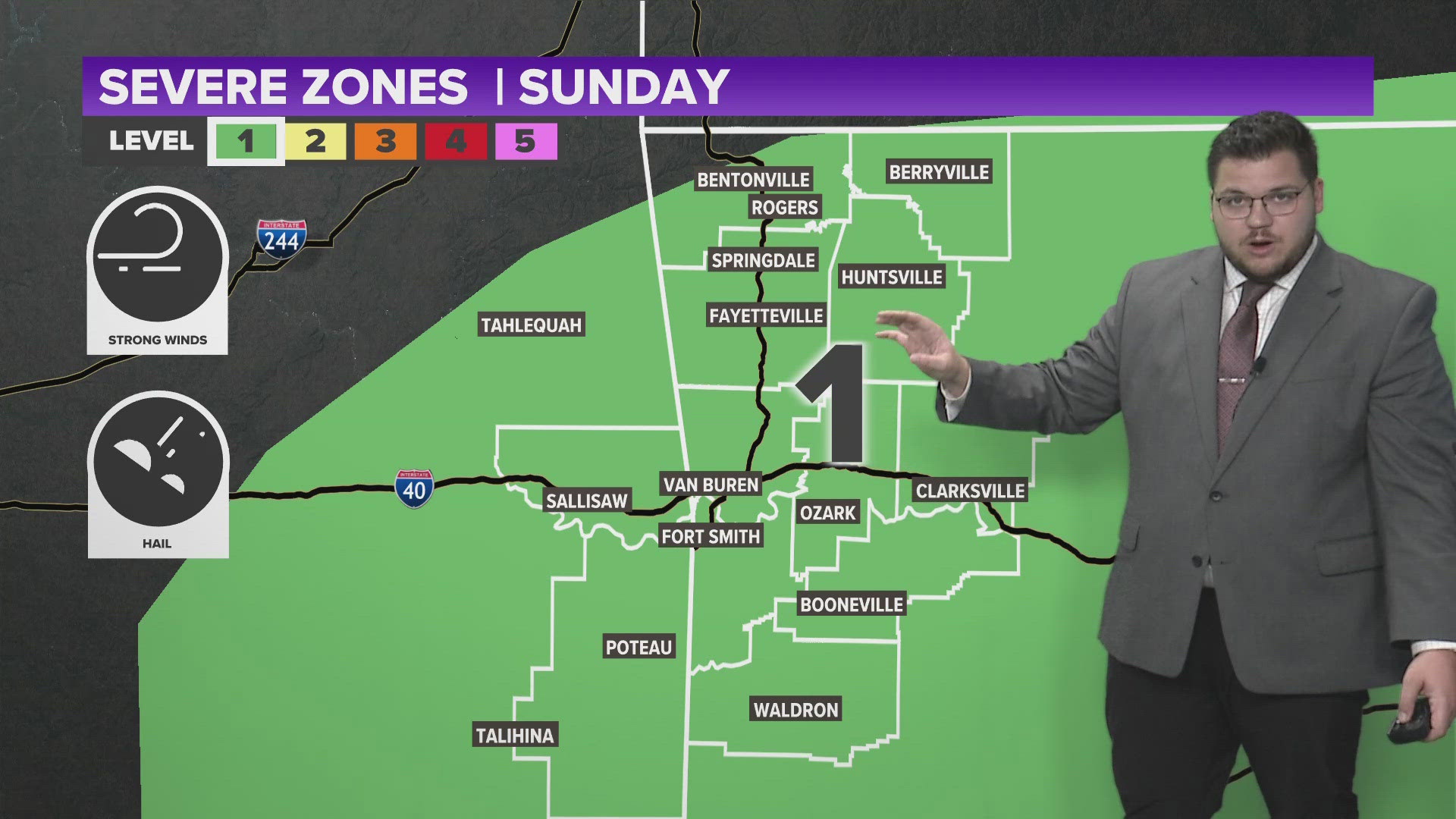
Extended severe weather coverage is likely on 5NEWS & KXNW late Tuesday into Wednesday.
-Garrett