The National Weather Service records their storm survey information into ArcGIS which will allow you to see the path, width, & damage caused by tornadoes in our area.

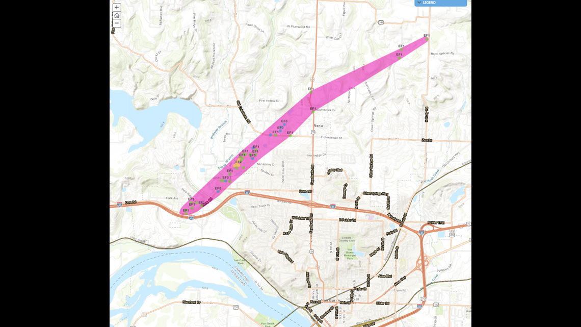
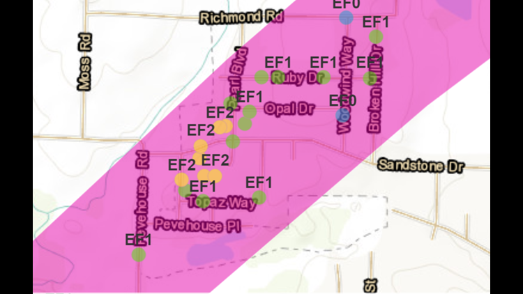
This is the path across Van Buren with the tornado touching down near I40 and continuing to near Bond Special Road.

If you click on the colored dots you’ll get information from the storm survey as well as comments as to how the rating was assigned.
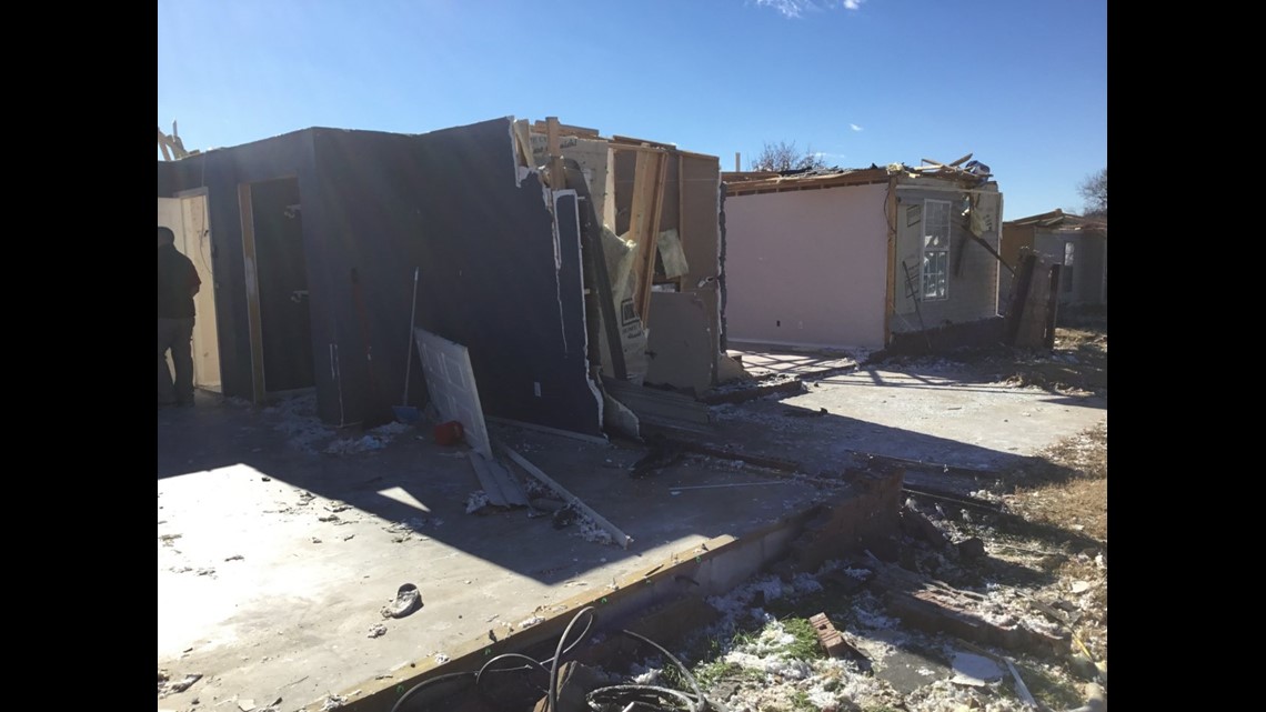
For instance, this damage would normally be classified as EF3 but the damage survey found that the walls failed because the “fastening from sill plate to frame didn’t use bolts” so it failed at a lower wind speed thus the EF2 rating.
This is an example of an interactive feature which shows you the results of the damage survey and the GPS coordinates of where the tornado track was.

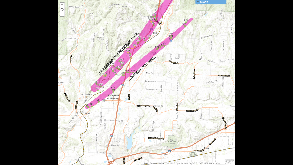
This map shows the most recent tornado track compared to the Mountainburg Spring Tornado Track.
This is the tornado track in Western Sequoyah County. Notice the tornado first touched down east of Gore, Oklahoma but then lifted and touched down again Blackgum.

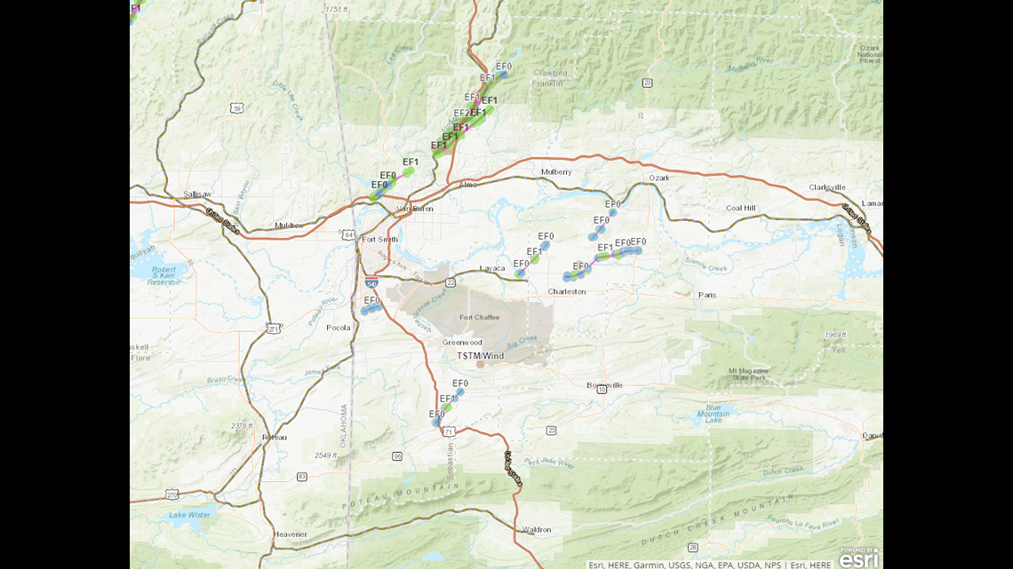
All of the tornadoes in 2018 have hit locations within the River Valley.
-Garrett