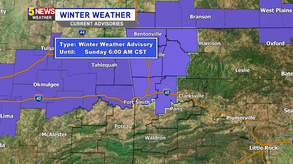
A Winter Weather Advisory remains in effect for location north of I40 across the Ozark Plateau and into NW Arkansas. Temperatures continue to trend warmer with a farther south track of the system which will lead to snow accumulations around 1″ with an inch or less south of I40.
Travel is expected to be slick in spots Saturday evening into Sunday morning.

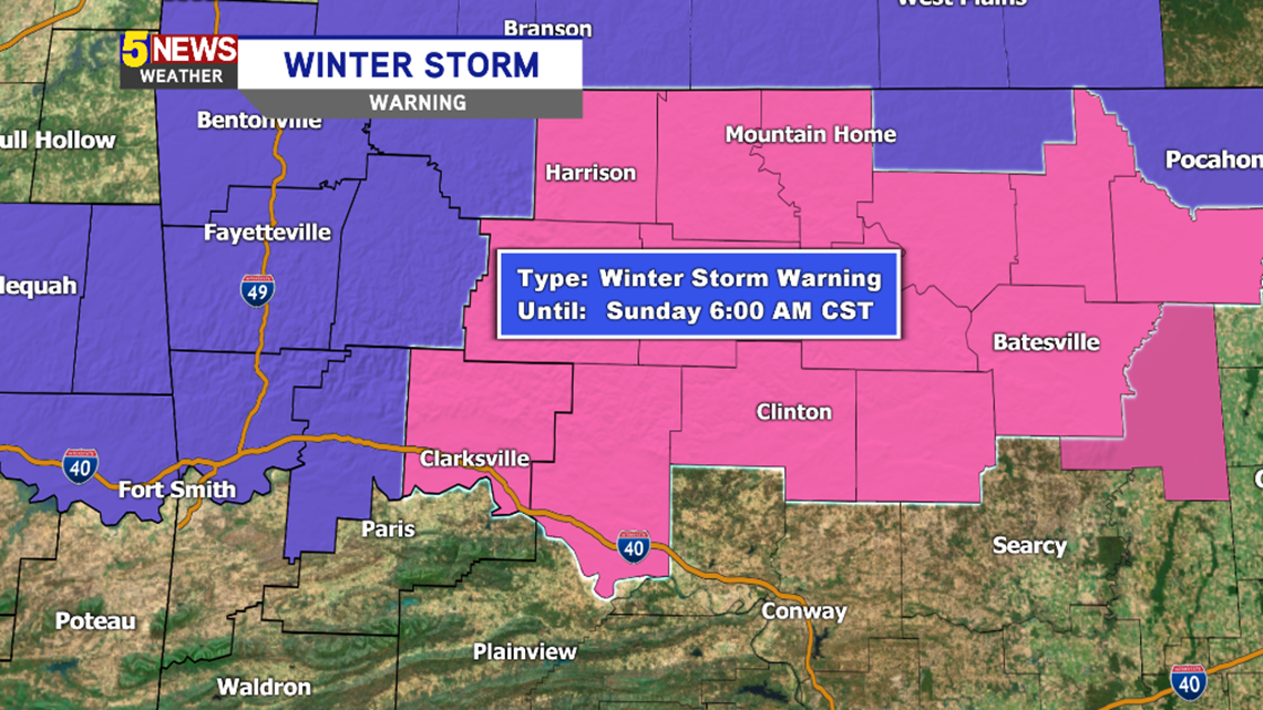
A Winter Storm Warning is in effect for the higher terrain of the Ozarks in North Central Arkansas.
Here’s an updated timeline based on the current data. This forecast has been challenging and additional changes to the placement of the true rain/snow line could occur.

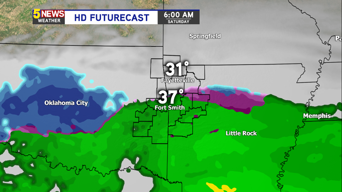
6AM SATURDAY: Rain will begin to spread north across Fort Smith and could initially mix with sleet before changing to all rain.

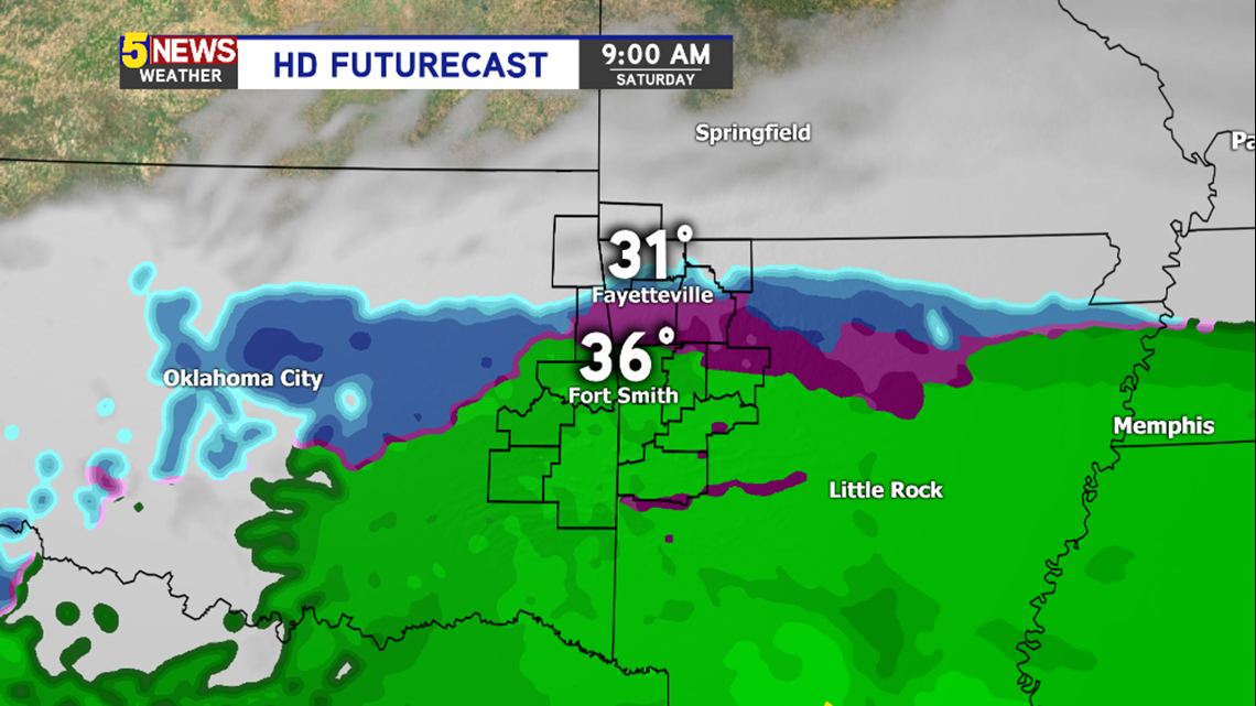
9AM SATURDAY: Snow and sleet will be possible across NW Arkansas with a few slick spots developing. Temperatures will be hovering near freezing. Temperatures will be above freezing in the River Valley.

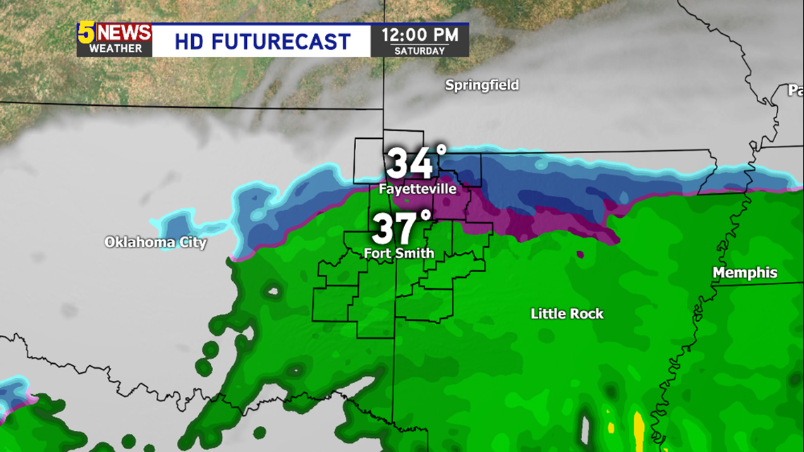
NOON SATURDAY: Rain will be likely in the River Valley with snow and sleet in NW Arkansas. Temperatures will be just above freezing; however, a few slick spots will remain possible.

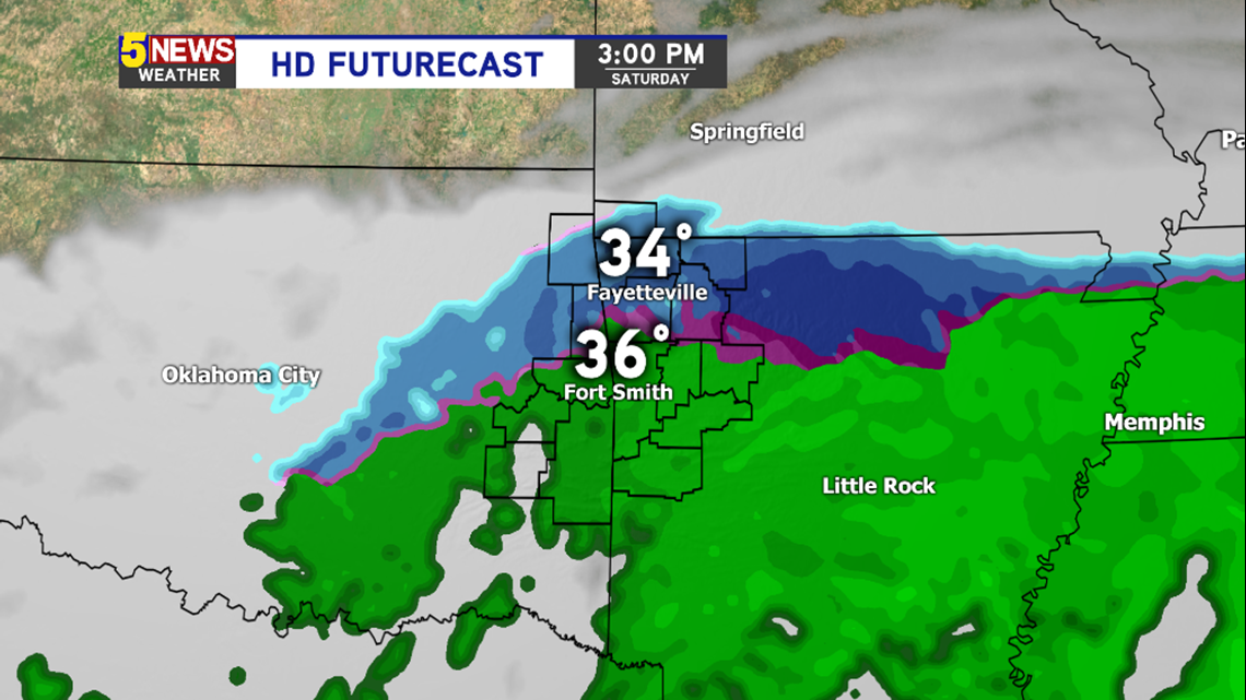
3PM SATURDAY: All snow is expected in the areas of blue with a mix in the pink transition zone to rain. A few slick spots will be possible on bridges and overpasses. Temperatures will be near or just above freezing.

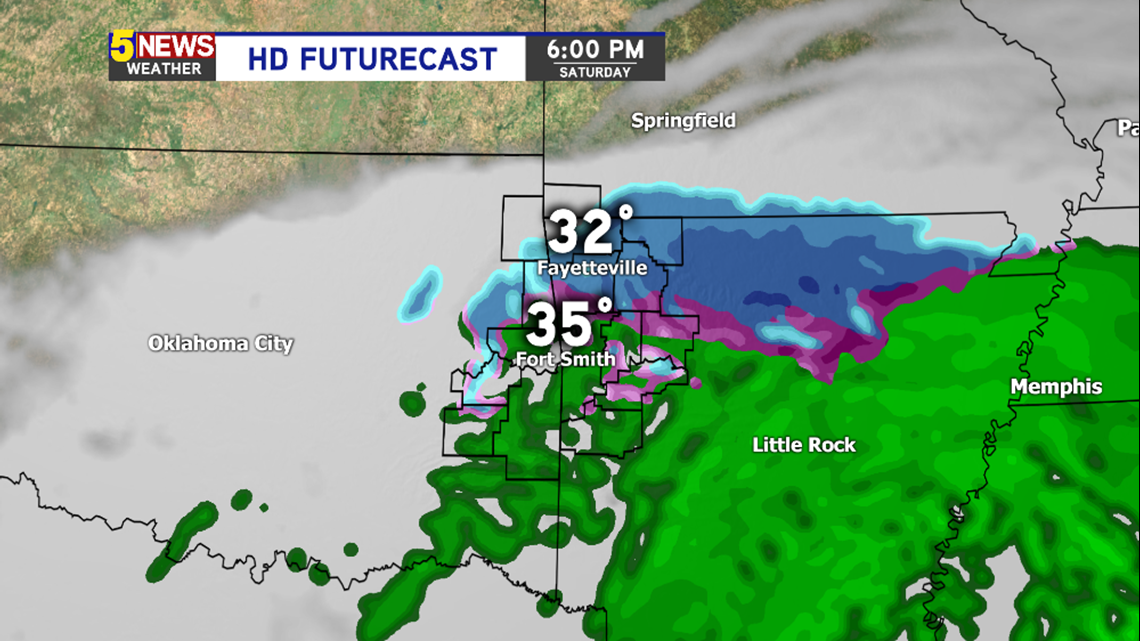
6PM SATURDAY: Temperatures start falling below freezing in NW Arkansas. Expect slick spots to develop in most locations that are blue. Rain could briefly mix with snow and sleet in the River Valley but temperatures will be above freezing.

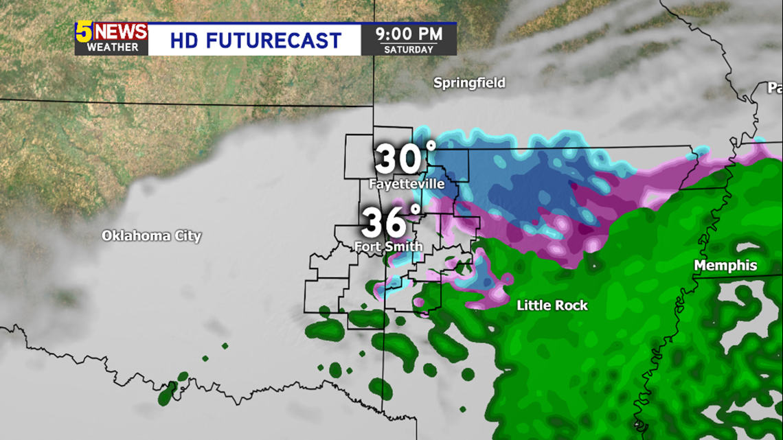
9PM SATURDAY: The winter system will be ending with snow possible in NW Arkansas and snow or sleet falling in the River Valley.
While some aspects of the forecast have been clarified, there’s still uncertainty as to how much will successfully accumulate on the ground with temperatures hovering near or above freezing.
Generally we would expect 0-1″ of snow in the NW Arkansas Metro locations probably closer to 1″, 0-2″ of snow in the higher terrain and increasing from there with elevation. In the River Valley we expect minimal amounts around 0-1″ likely closer to 0″.
-Garrett