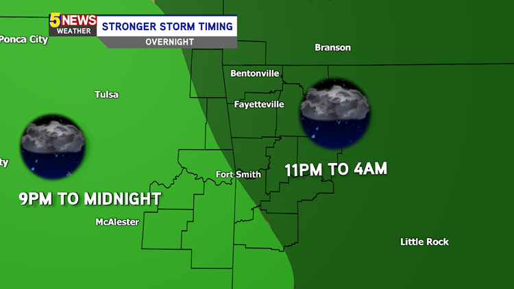
A strong system blows in heavy rain later tonight. The strongest storms for Northwest Arkansas and the River Valley will be after 9PM as a line moves through. Biggest threats are heavy rain and a few isolated strong wind gusts. Rain will clear out by early morning tomorrow.

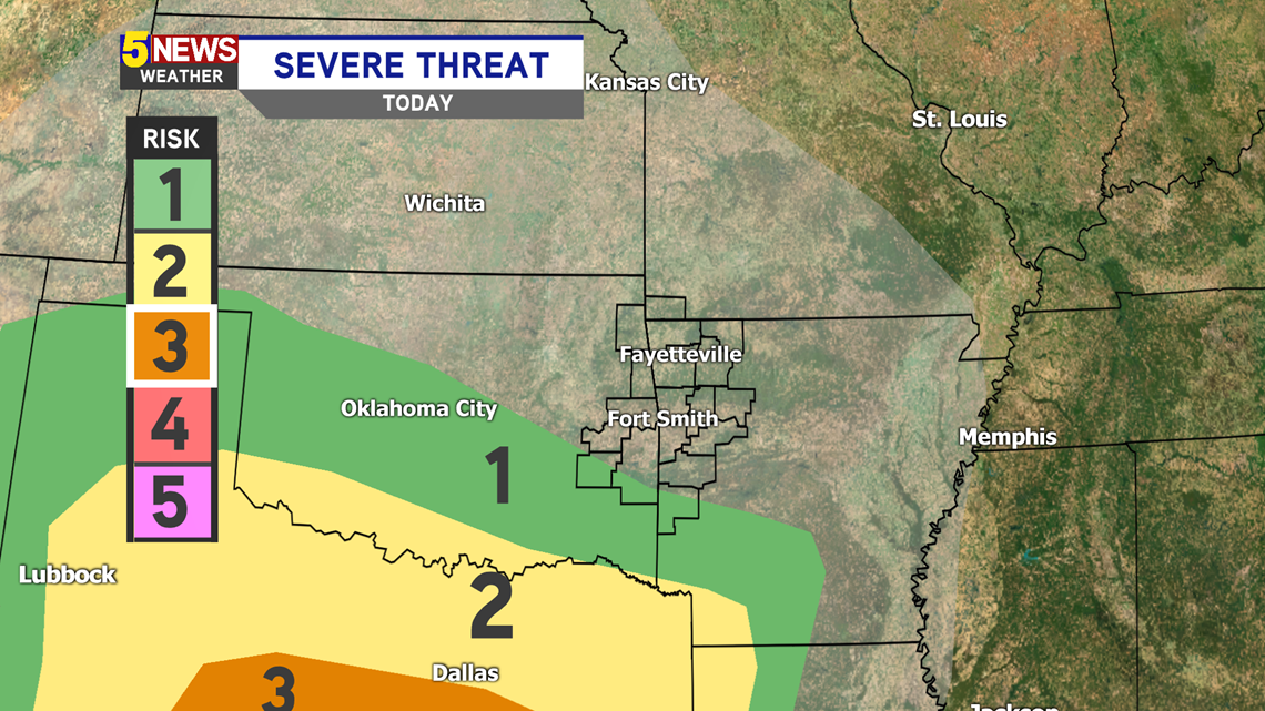
Severe storms will stay far to our south. The main severe threat will remain in Texas. We may have a few thunderstorms tonight, but none will be severe.

While rain will fall across the area after 6PM, the strongest storms will be after 9PM. Eastern Oklahoma can expect the heaviest rain and gusty winds from 9PM until midnight. Western Arkansas can expect those conditions from 11PM until 4AM.


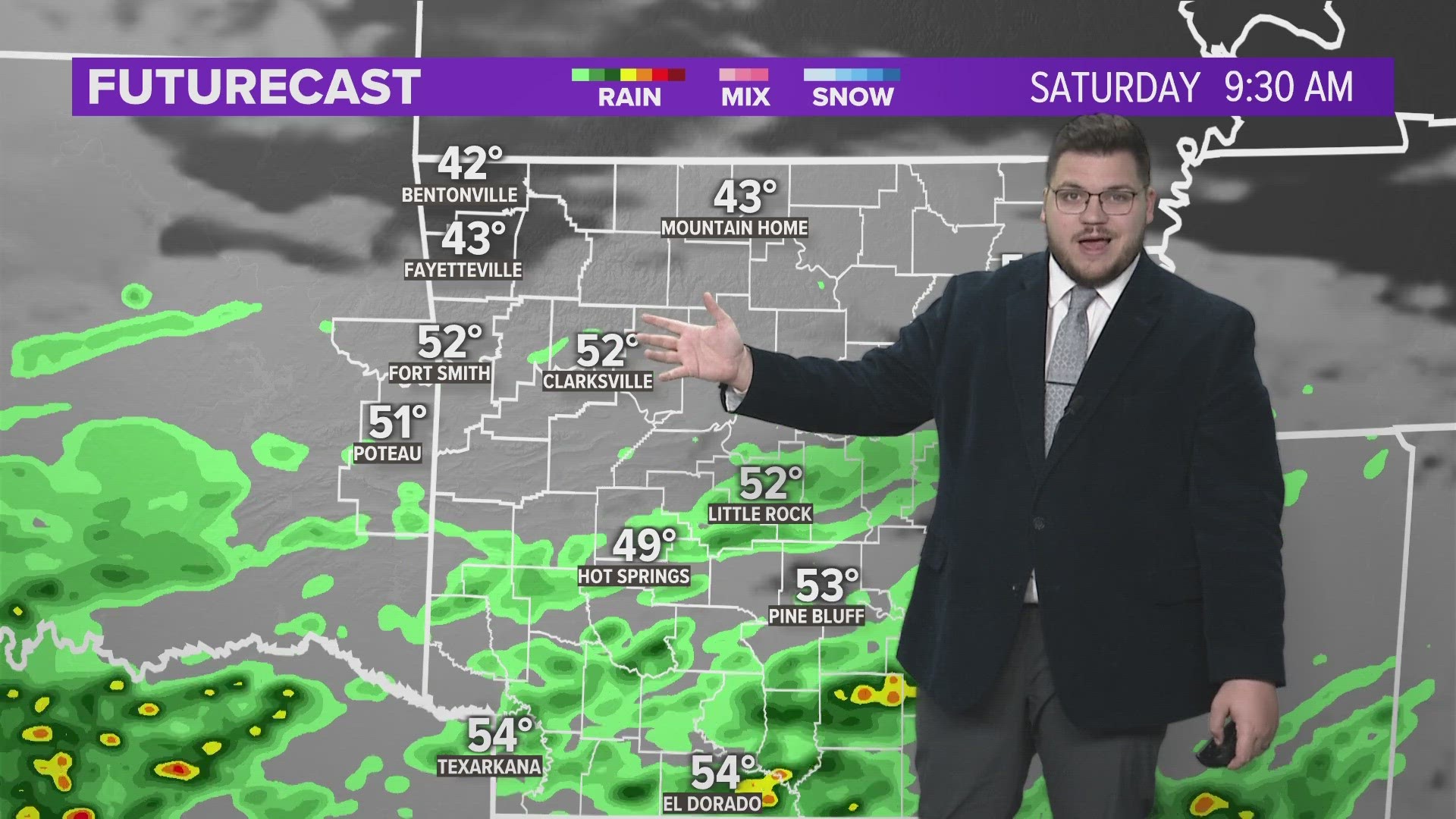
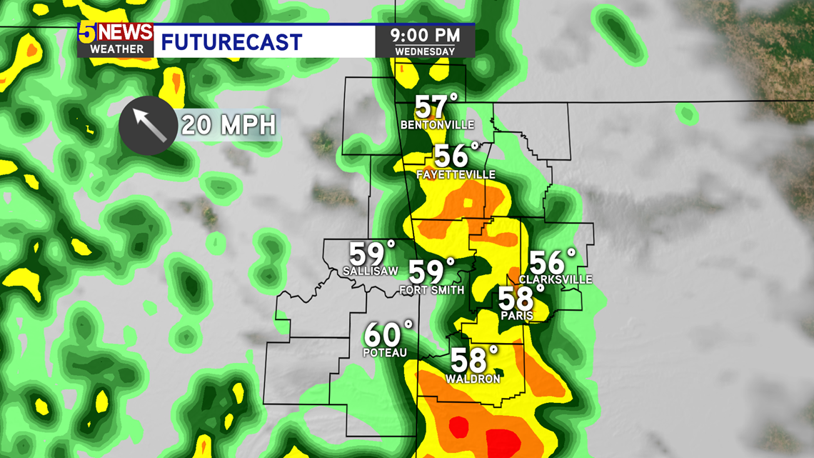
FUTURECAST 9PM - Storms will move across the area. Heavy rain is likely at this time.

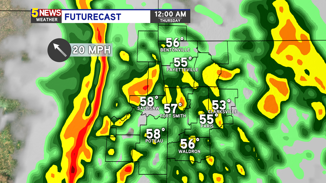
FUTURECAST 12AM - Rain coverage will likely increase. Showers and storms will push east. Heavy rain, along with a few thunderstorms, are possible. Thunder and lightning will occur, and the winds will be gusty (up to 35MPH).

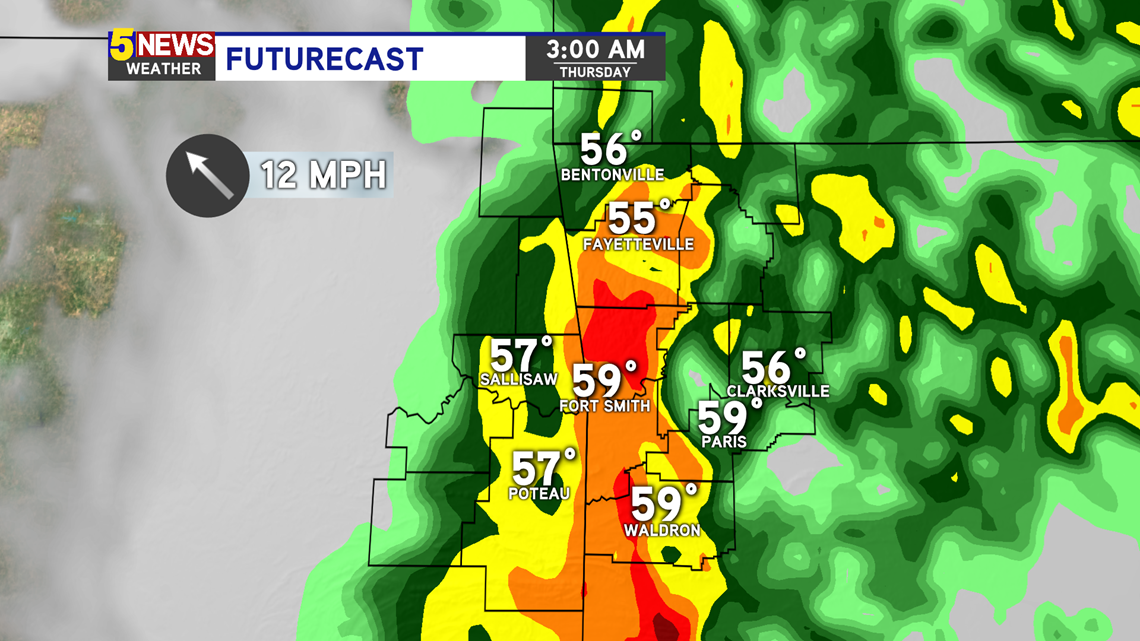
FUTURECAST 3AM - The showers and storms continue to push further east. Heavy rain continues. By 5AM, most of the rain will be east of everyone.

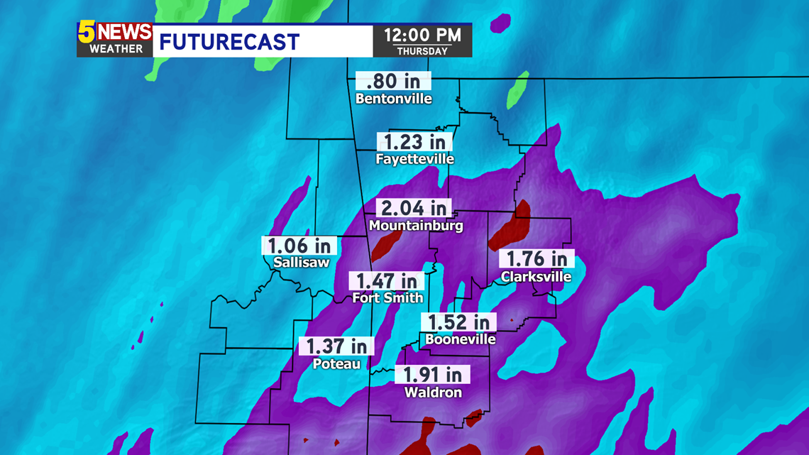
The showers and storms will drop around 1 to 2 inches of rainfall overnight. This is an estimate of how much you could see.

The main threat with the rain event will be the heavy rainfall. This can lead to localized flooding. The overall severe threat is low for our area.
-Sabrina