Several weather hazards affect our area over the next 12-hours with both severe thunderstorms and wintry weather possible. Additionally, dense fog and localized flooding will be possible.

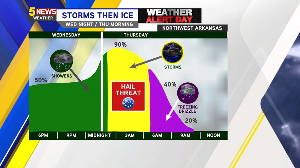
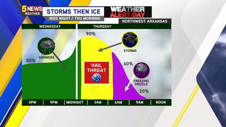
In Northwest Arkansas… Rain will be possible this evening with stronger storms moving in after midnight.
Rain will end as freezing rain towards the morning on Thursday. It appears freezing rain could affect the morning drive to work on Thursday. Winter Weather Advisories stay in effect until Noon on Thursday. Ice amounts will be light and likely less than 1/10th of an inch but could be enough for problems on bridges and overpasses.

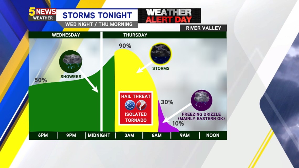
In the Greater Fort Smith area and south… Showers and thunderstorms, some strong with damaging wind and hail, will be possible after midnight thru 5am. Widespread freezing rain is unlikely but ice accumulation in Eastern Oklahoma will be possible.

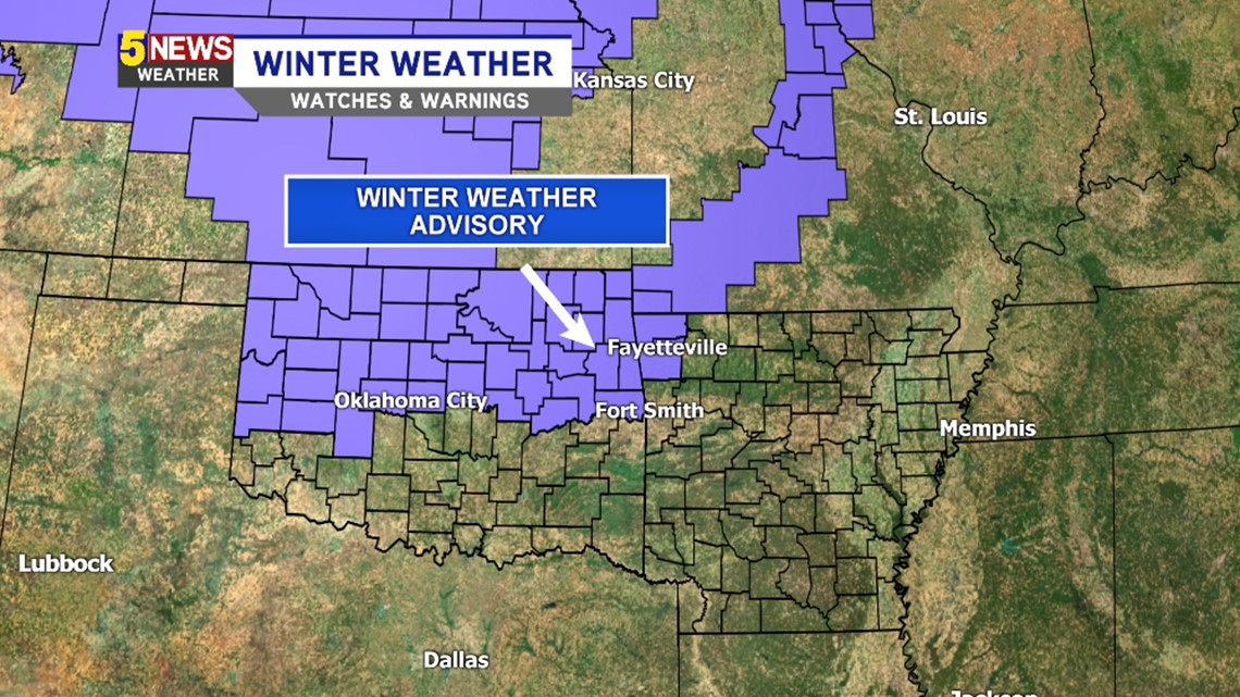
The Winter Weather Advisory includes Northwest Arkansas and Eastern Oklahoma.

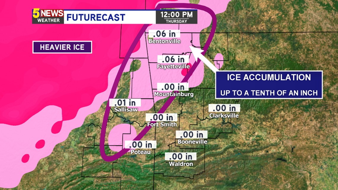
Forecast ice amounts will be light and could occur after sunrise Thursday to Noon. The impacts will be highest on bridges and overpasses.
Here’s a timeline of how temperatures and precipitation will play out late tonight into Thursday.

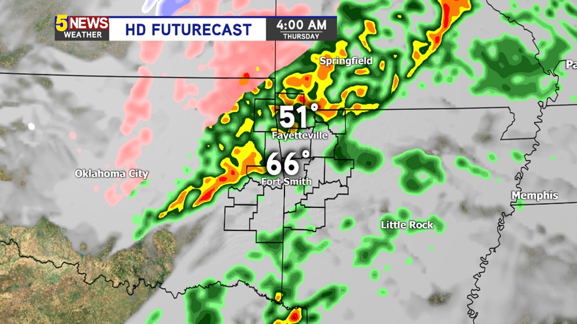
4AM THURSDAY: Scattered showers and thunderstorms will be possible area-wide. Some of these storms could be severe.

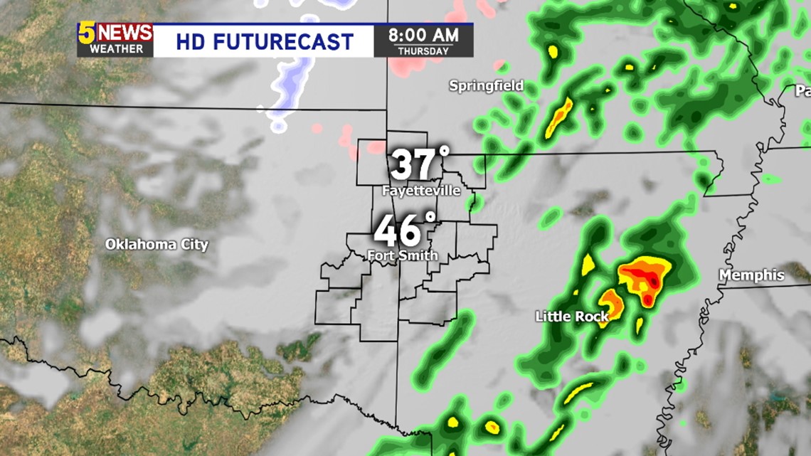
8AM THURSDAY: Most of the heavy rain will be out of the area but light freezing drizzle or freezing rain will begin to become possible in NW Arkansas.

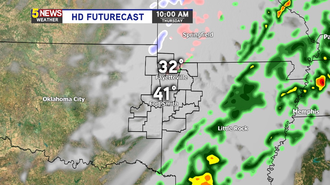
10AM THURSDAY: Freezing drizzle or freezing rain will be possible across NW Arkansas.

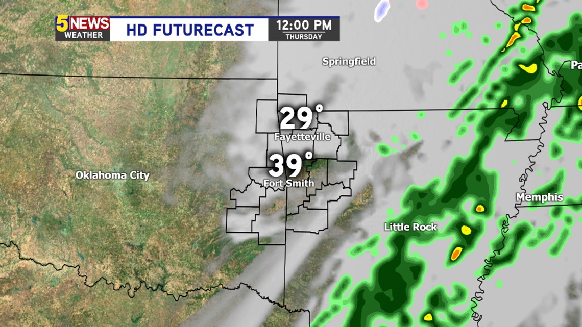
NOON THURSDAY: Temperatures will continue to fall into 20s the afternoon.

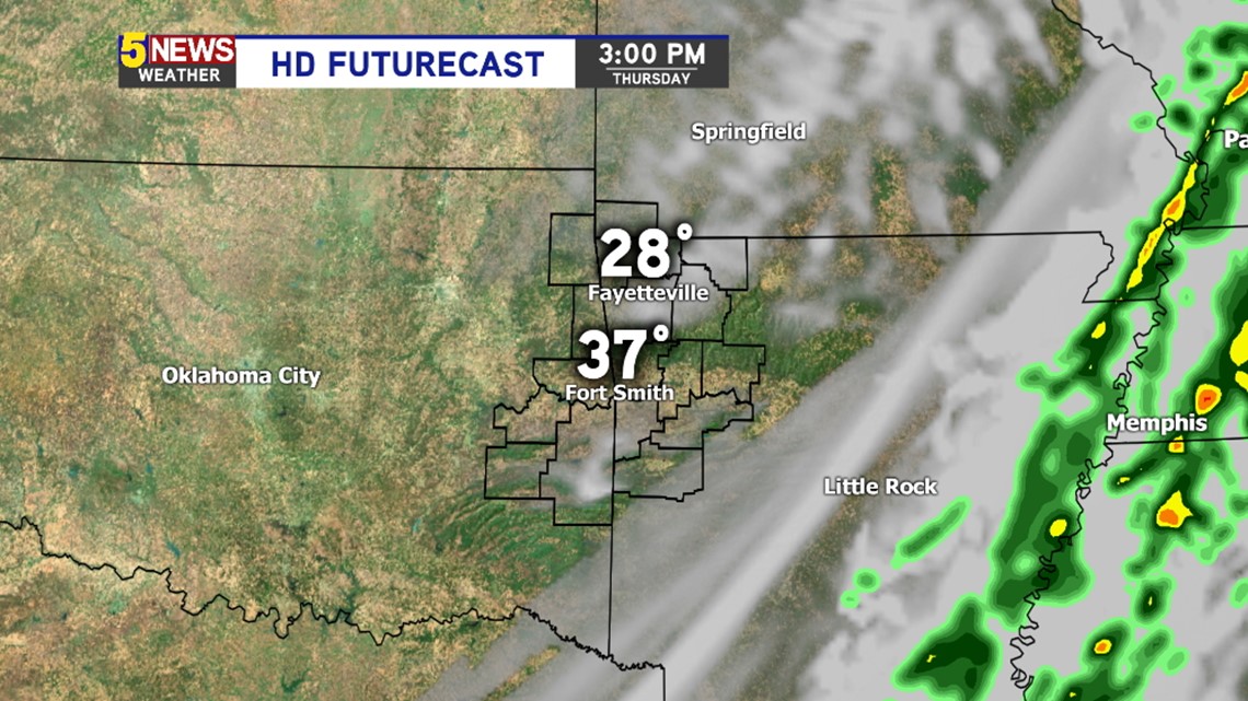
3PM THURSDAY: Temperatures will continue to fall but skies will clear out.
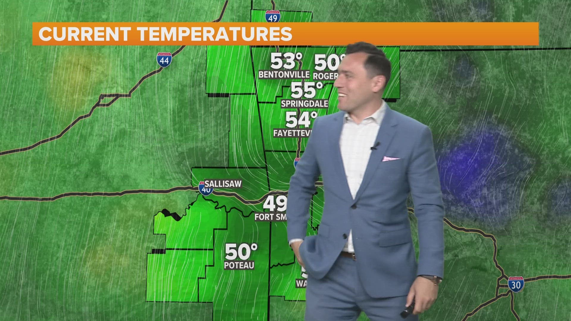
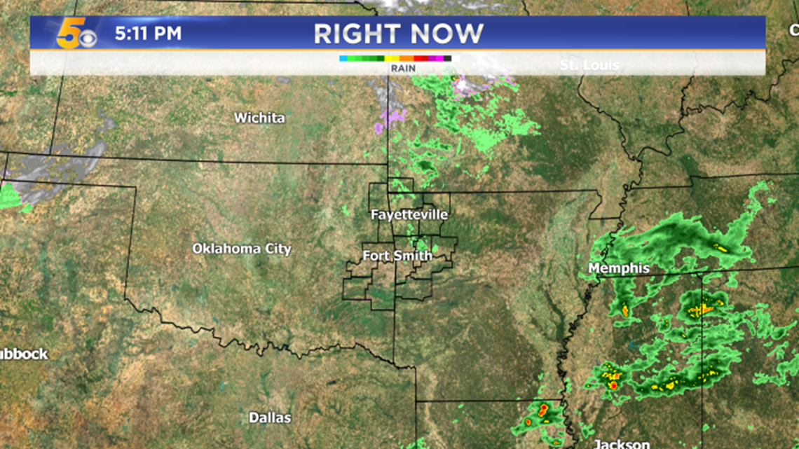
Here’s a current look at the satellite and radar for our area:

Stay tuned for updates on-air and online as the event unfolds.