
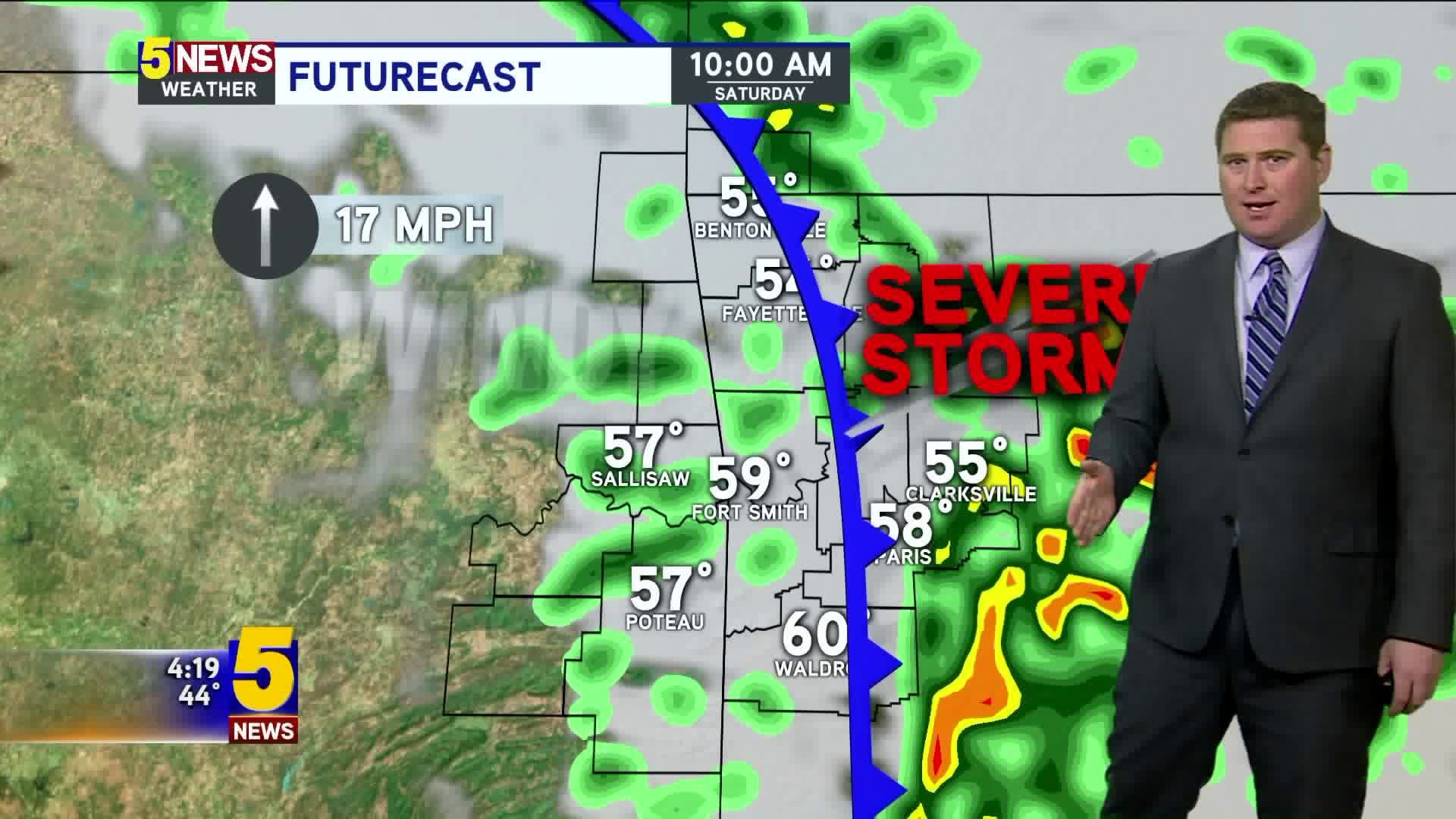

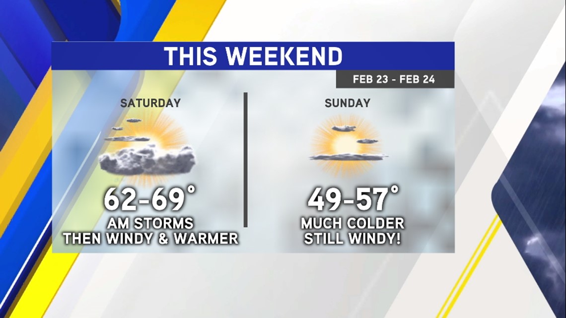
Active weather is expected for this upcoming weekend with a chance for showers and thunderstorms early Saturday and then a stronger cold front on Saturday night.

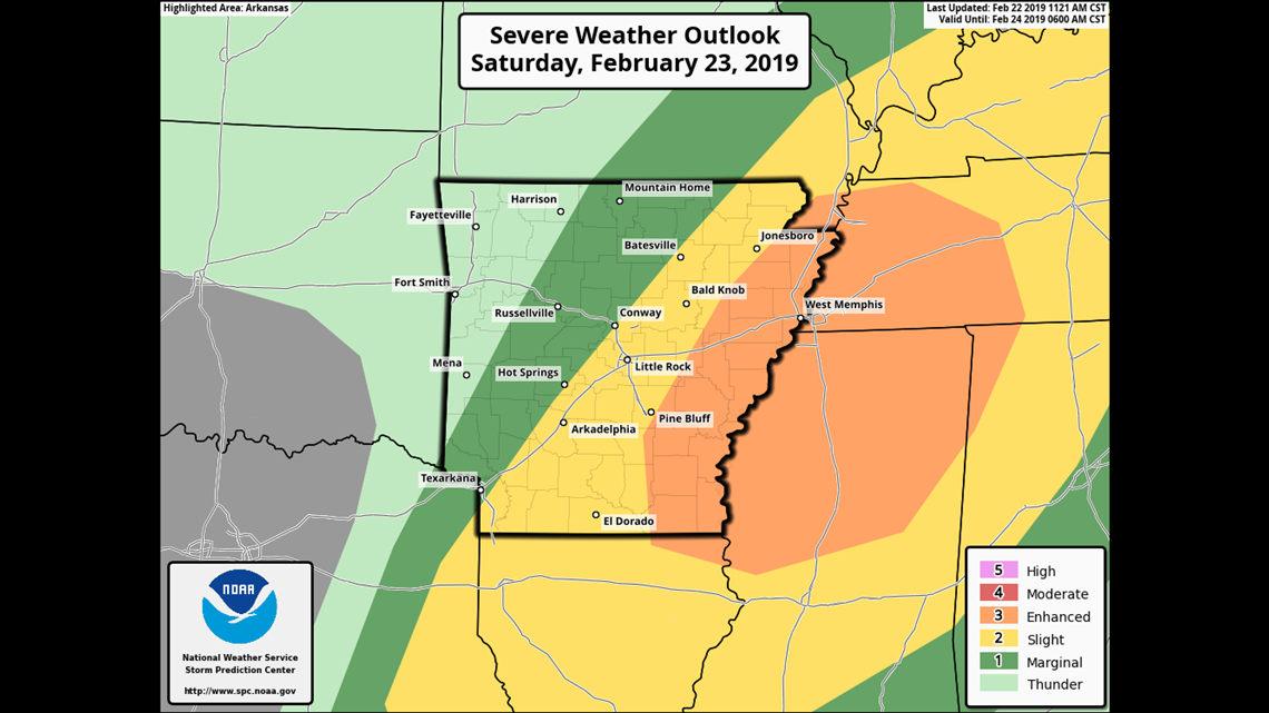
The highest risk of severe weather will be across the Mississippi River Valley. It appears that storms will begin across our area and then transition to our east where they're expected to intensify.

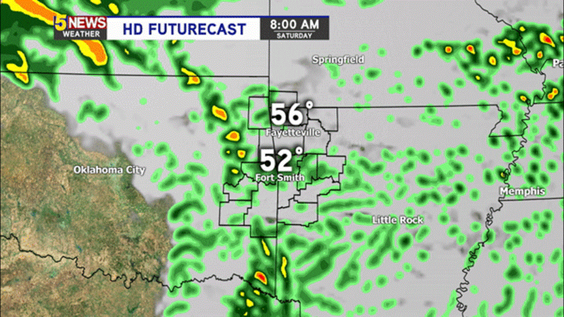
The highest chance for showers and storms locally will be during the first part of the day Saturday.
Saturday afternoon will be sunny, windy and warm.
Expect colder (but still windy) conditions on Sunday with highs in the upper 40s or low 50s.
-Garrett