The temperature trend for the next week or so will feature progressively colder temperatures with colder than normal temperatures expected for the start of March.
Winter weather will also be a possibility; first with freezing drizzle possible on Thursday followed but several days with either light freezing drizzle or snow possible heading into the weekend.

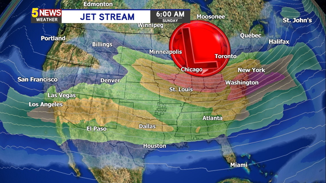
The jet stream once again phases south for the weekend with a large trough (aka “Polar Vortex”) spilling cold air across the central and eastern half of the United States.


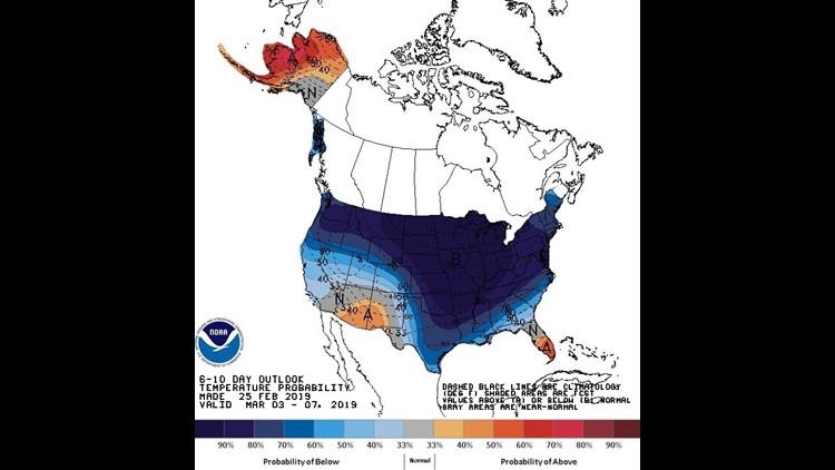
This is the 6-10 temperatures outlook for March 2nd to March 6th with bitter cold gripping most of the United States including all of our area.

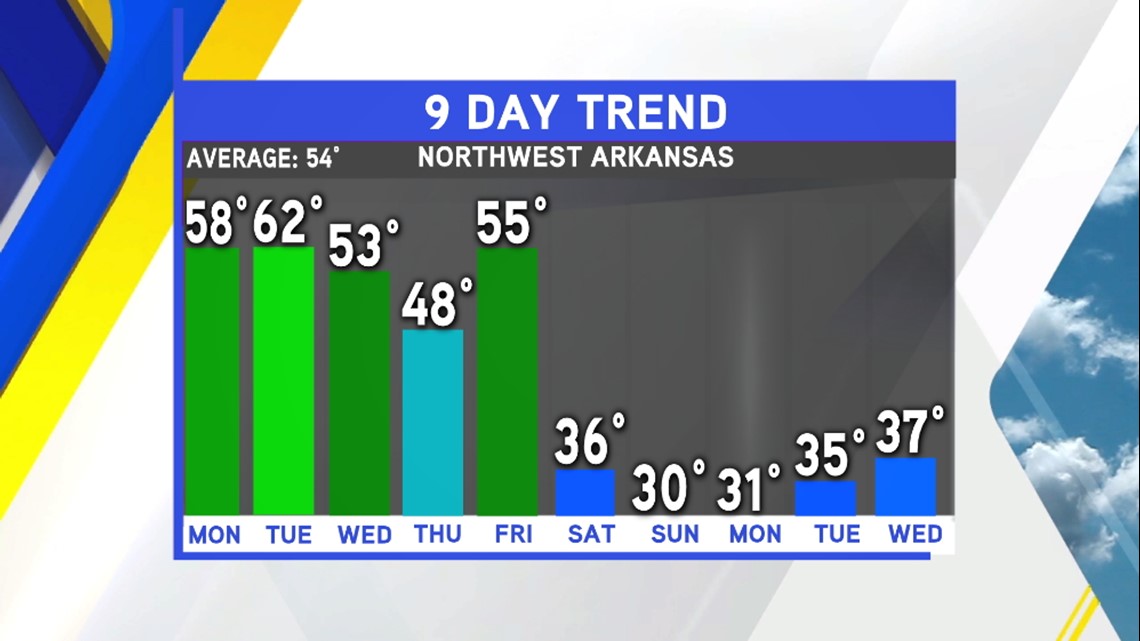
The current temperature trend shows the coldest air arriving on Saturday evening and continuing into next week.

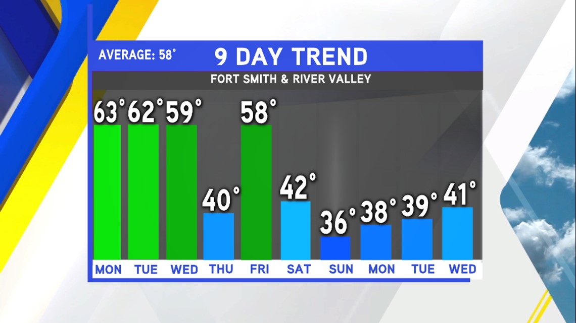
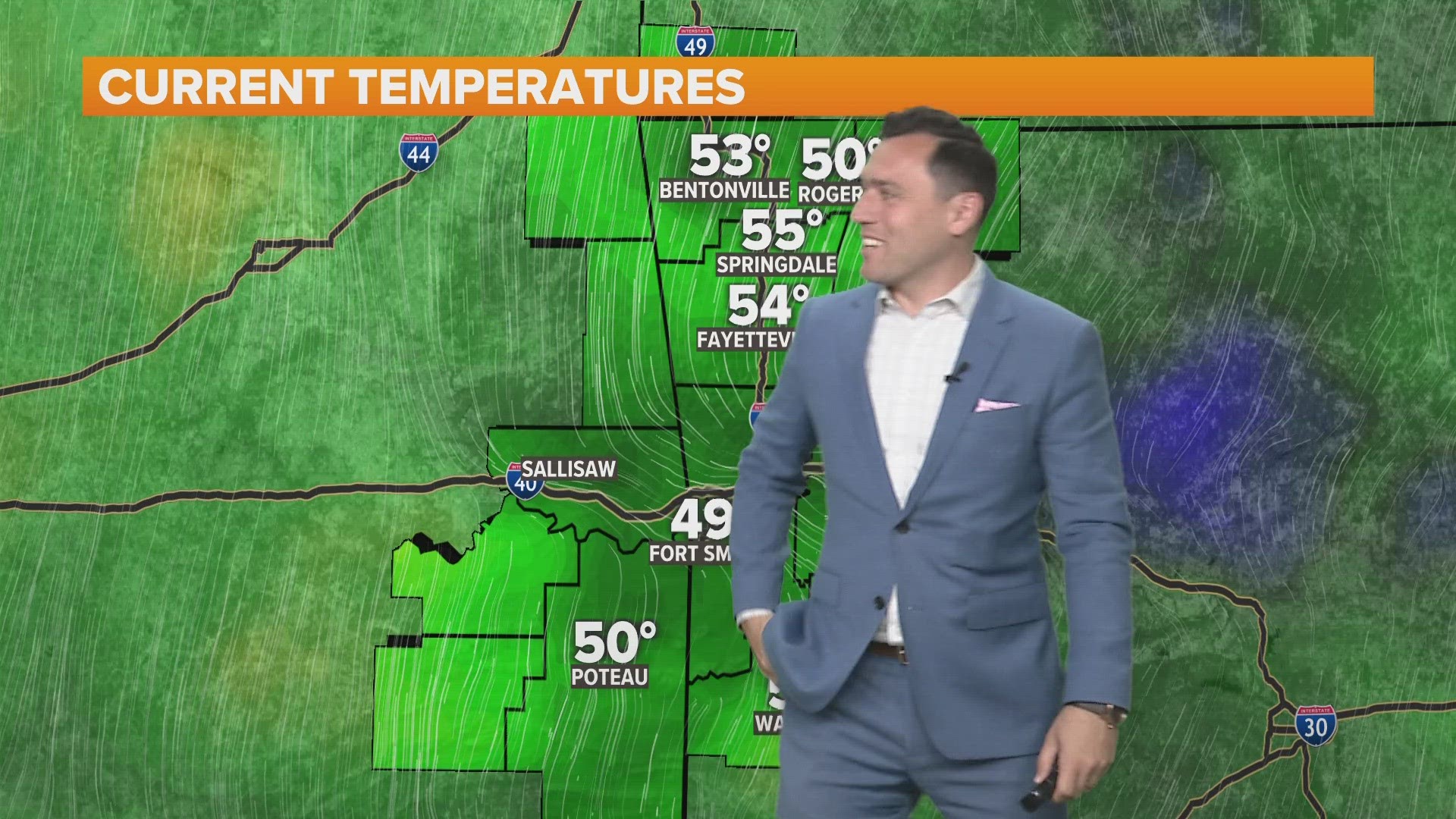
The same will also be true for the Greater Fort Smith area.
With the cold air in place, any moisture will result in mixed precipitation types and the risk of travel impacts.
-Garrett