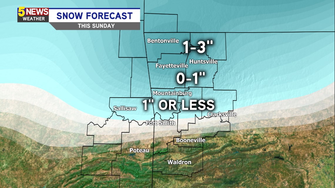
This is an early look at the snow potential coming up late Saturday night into Sunday morning.
As usual, these totals will change depending on the time of the rain to sleet to snow changeover and could end up being higher or lower than what it looks like three days before the event.
Regardless, it appears a transition from rain to snow will occur on Sunday with at least some light snow accumulation likely.
Here’s a current look at the timeline…

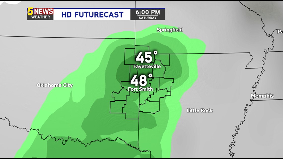
6PM SATURDAY EVENING: Expect a cold rain with temperatures above freezing.

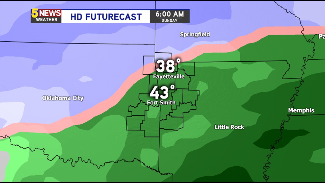
6AM SUNDAY MORNING: Rain will begin changing to snow across Northwest Arkansas.

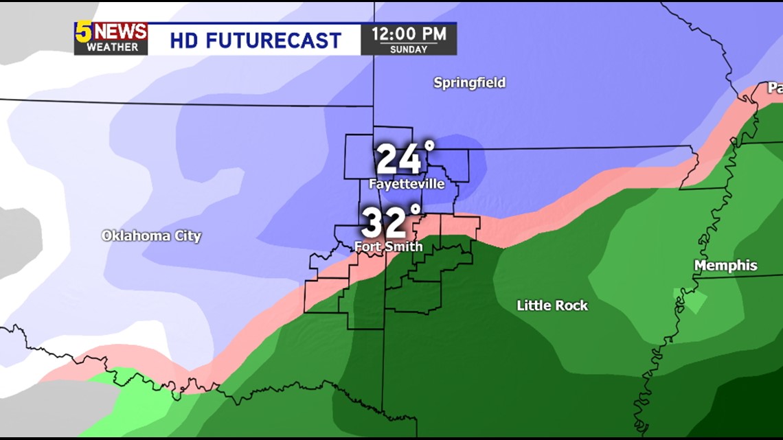
NOON SUNDAY: Snow is likely in Northwest Arkansas with hazardous travel expected. Rain will also begin to transition from freezing rain and sleet to snow in the River Valley by this time.

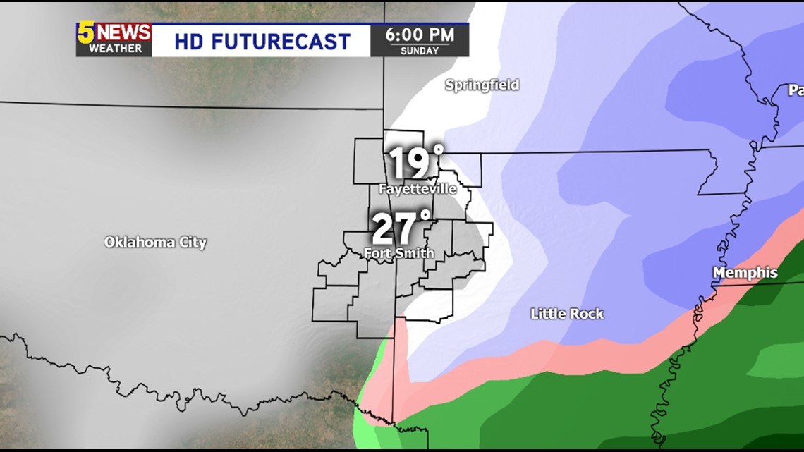
6PM SUNDAY: Light snow will be possible area-wide and hazardous travel conditions will continue into the night and likely into Monday morning as well. Temperatures are cold enough that school closings will be a possibility on Monday for any lingering snow that sticks on road surfaces.