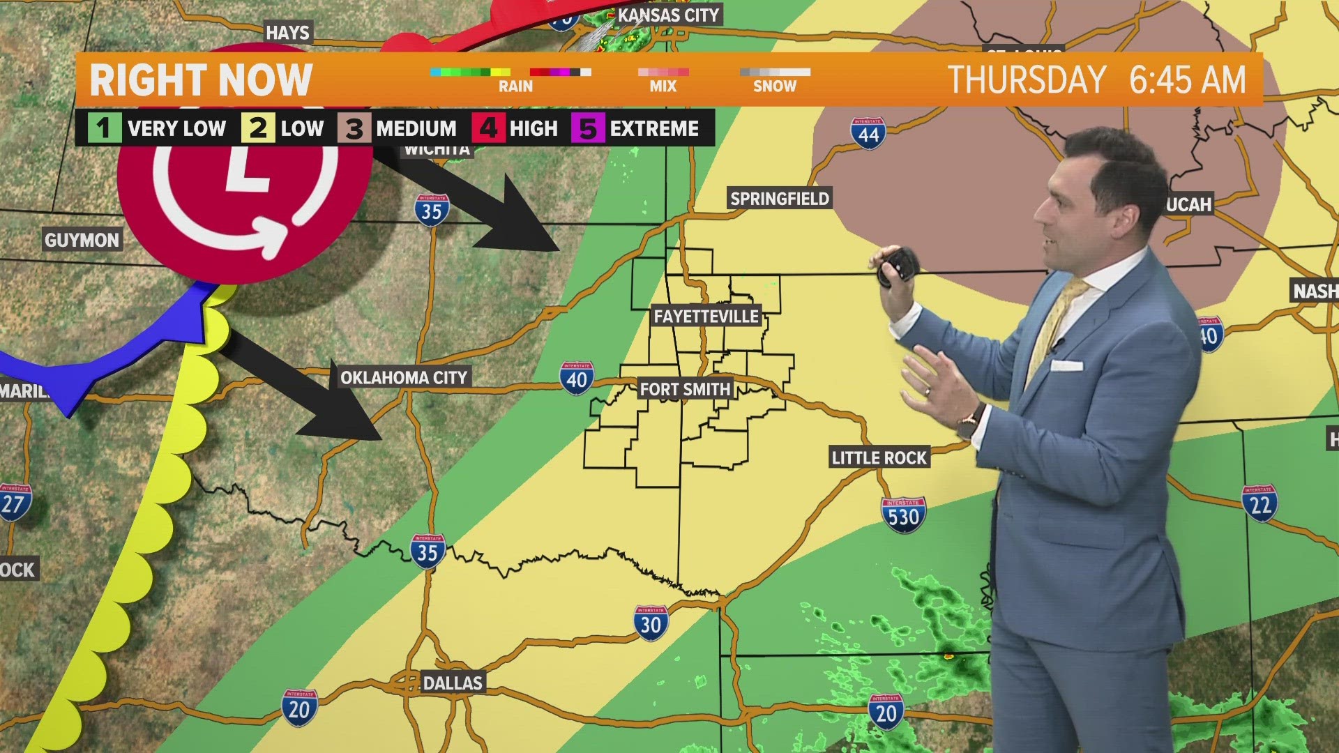
There’s a risk for strong to severe thunderstorms across our area over the next few hours this morning. The biggest threat will be south of I-40. After the line of storms moves east later this morning, the rest of Saturday will be warm, sunny, and windy.

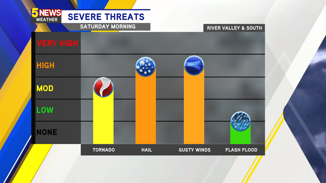
The risk for severe weather is a Level 2 (out of 5) for this morning. The strongest storms will be along and south of I-40.

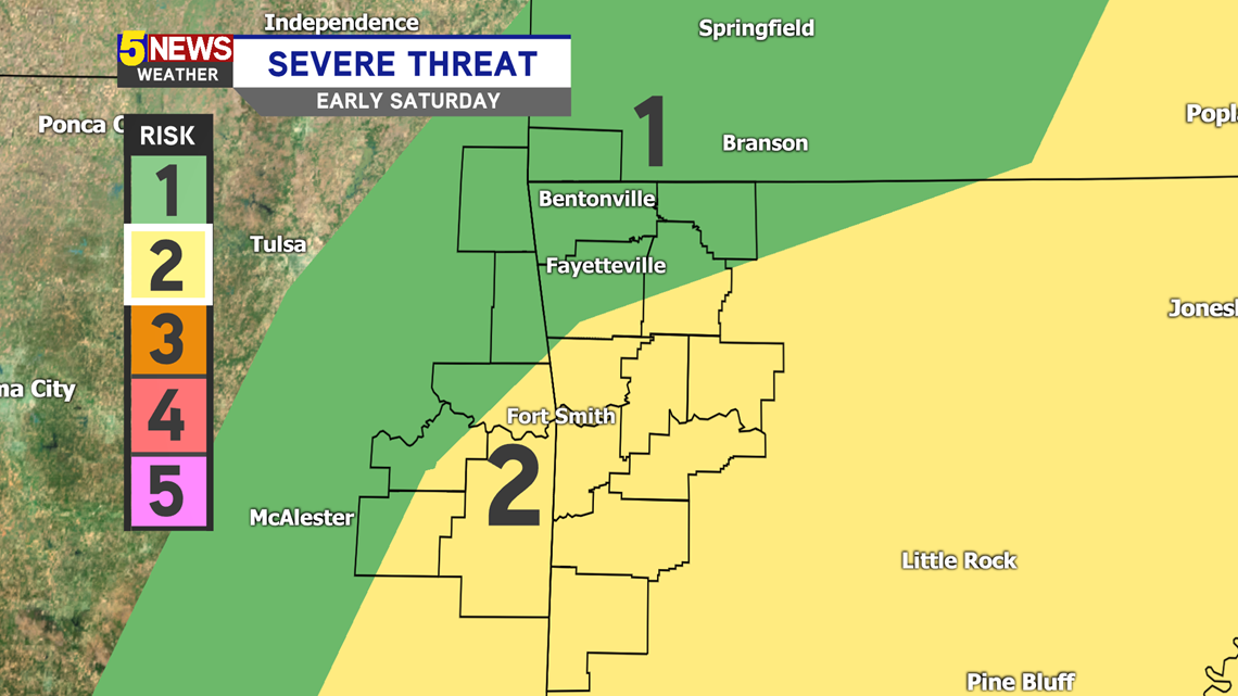
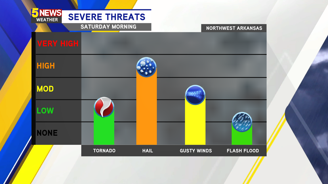
NORTHWEST ARKANSAS: The biggest threat for Northwest Arkansas is large hail this morning with a chance for some gusty winds with the thunderstorms.

River Valley: The threat for severe weather is higher in the River Valley and south, mainly along and south of I-40. The biggest risks are large hail and damaging winds. A tornado or two is also possible in the southern counties into southwest Arkansas and southeast Oklahoma.

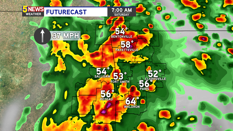
Futurecast 7AM - The strongest line of storms begin to move into the area just after sunrise. Expect a few storms to be severe, along with heavy rain and a lot of lightning.


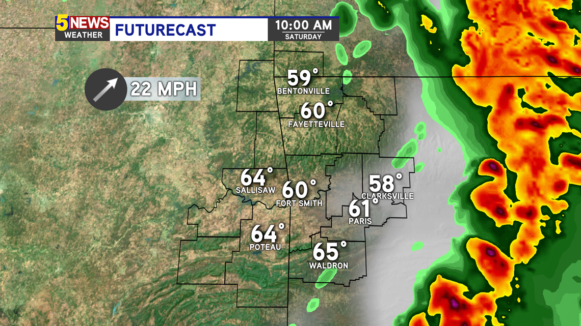
Futurecast 10AM - This strong line of thunderstorms will be east of our area by mid-morning, likely after 10AM.

-Sabrina