Tap HERE for our interactive radar. (Scroll down for more details)
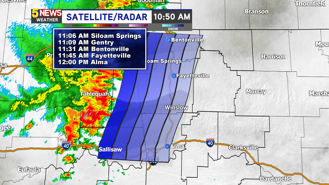
Radar image as of 10:50AM —

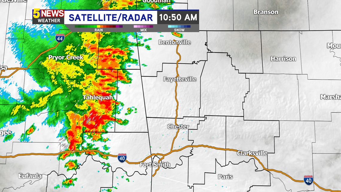
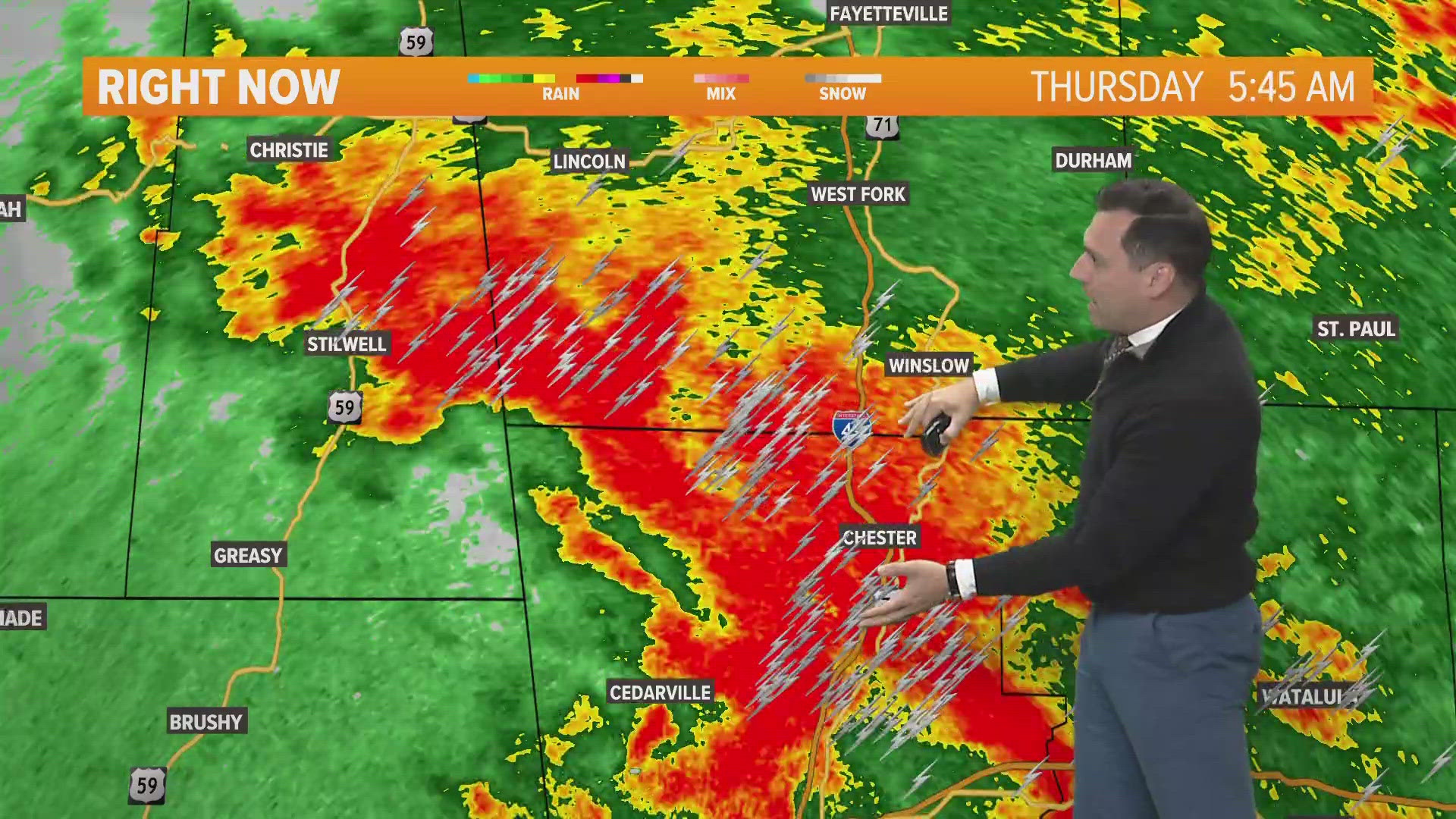
A complex of heavy rain and thunder is moving towards northwest Arkansas and for parts of the River Valley (mainly north of I-40). These will weaken as they approach the metro areas for Bentonville-Rogers-Springdale-Fayetteville. Most of the thunder will most likely stay in the mountainous areas. These storms are expected to stay BELOW severe criteria.
TIMING

-Matt