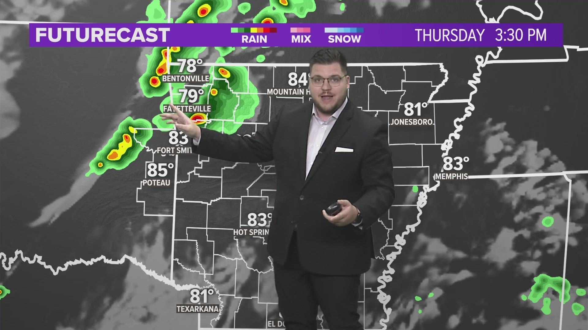
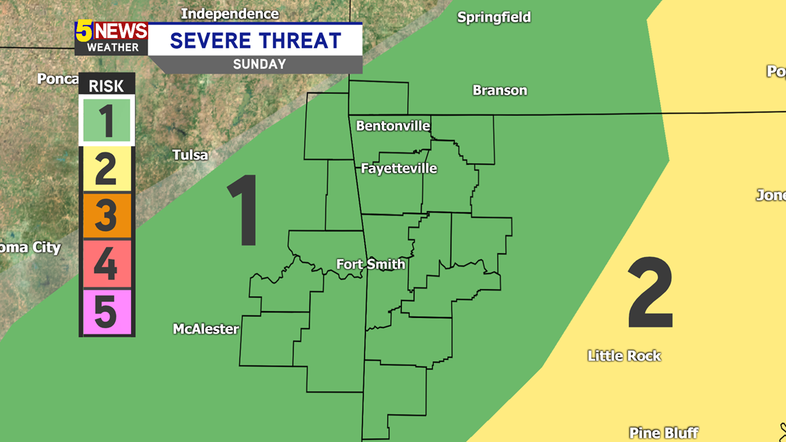
The latest weather pattern has been tricky, as the boundaries have taken a longer time to move through. Because of this, our severe chances were lowered yesterday and today. A cold front tracks in later today, which could spark some thunderstorms in the area.
The greater severe weather risk is not to our southeast. Our chance for severe storms has been lowered for today. We are now in a Level 1 (out of 5). Strong to severe storms are possible, but the chance for it to be severe is lower. Main threats would be some hail and gusty winds.

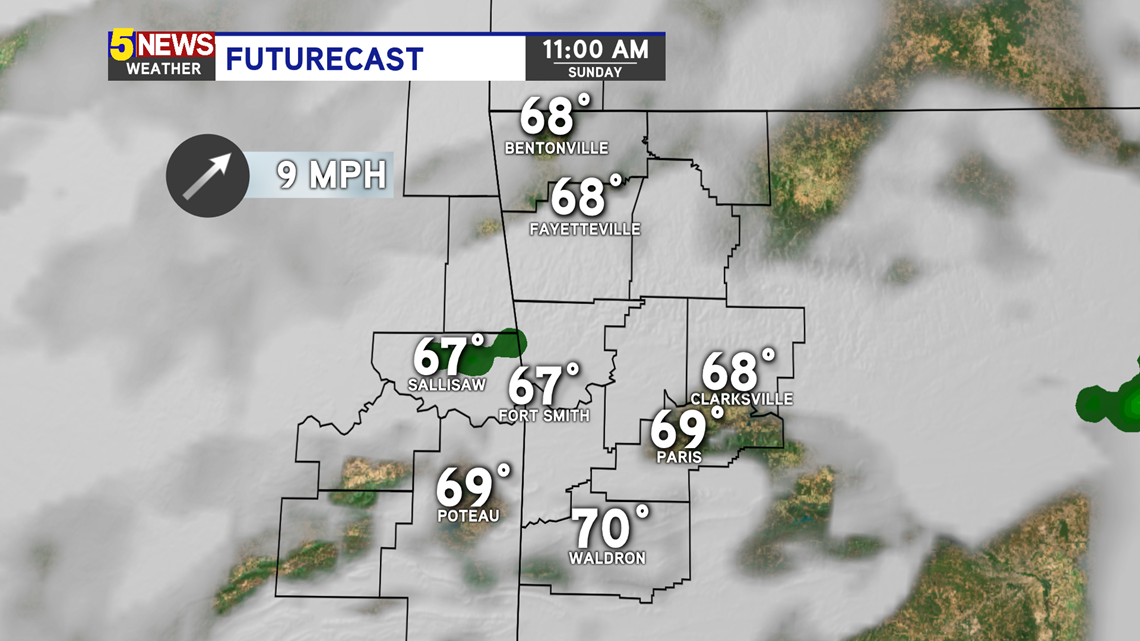
Futurecast 11AM - A few stray sprinkles are possible in the River Valley, but it's unlikely. We'll be mainly cloudy with southerly winds for most of the day.

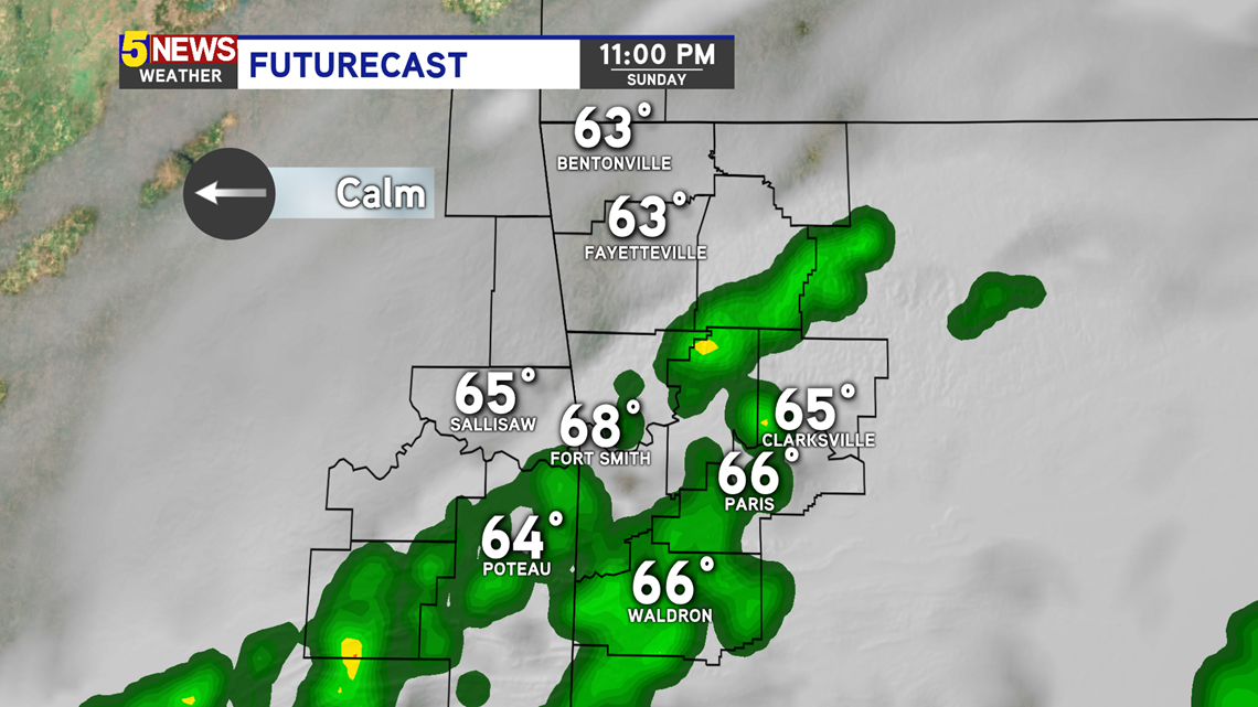
Futurecast 11PM - A cold front moves in late. Showers and thunderstorms could develop as it passes through. This would be after sunset and overnight.

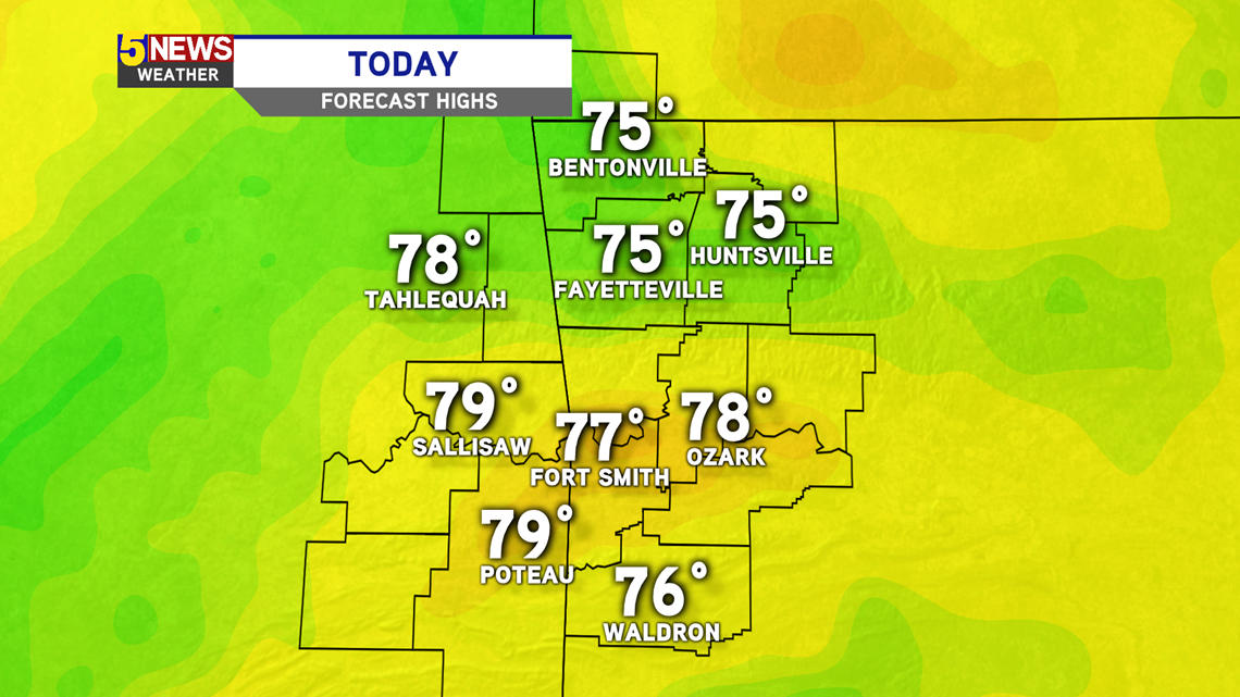
Overall, temperatures begin to trend warmer the next few days. Today's highs will almost reach 80 degrees.

-Sabrina