The sunshine on Friday is misleading with several rounds of active weather expected for both the weekend and next week.
This weekend, scattered storms are possible on both Saturday and Sunday. First in the morning, then again with daytime heating in the afternoon/evening.
The bigger system next week will stretch from Tuesday PM into Thursday.
Let’s look at the weekend first…
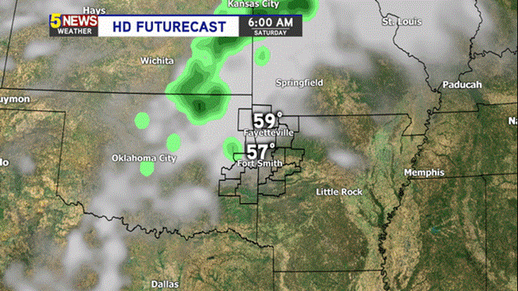
SATURDAY 10AM:

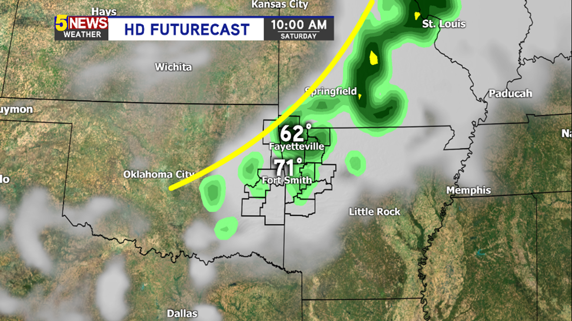
A boundary driven in by an active northwest flow will cause scattered showers and thunderstorms during the first part of the day on Saturday. This image is 10am. Most showers will be out of the area by Noon.
SATURDAY 5PM:

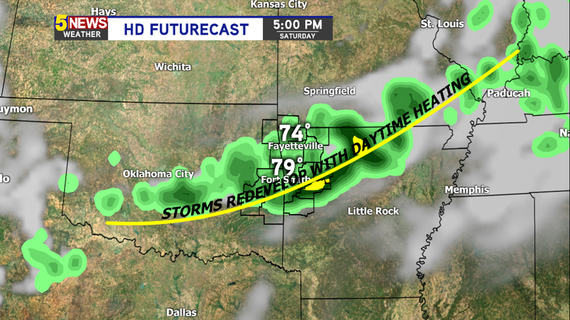
The boundary from the morning will restart thunderstorms with daytime heating. These storms could be severe. The exact placement of the storms on Saturday afternoon will depend on how far south the boundary goes in the morning. Right now, it appears it’ll be mostly south of I40.

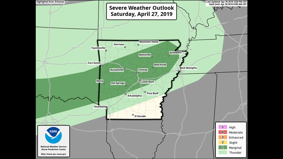
The Storm Prediction Center shows the “Marginal Level 1” risk in the darker green. This is current location that is most favored for an isolated severe storm with afternoon redevelopment.
SUNDAY 10AM

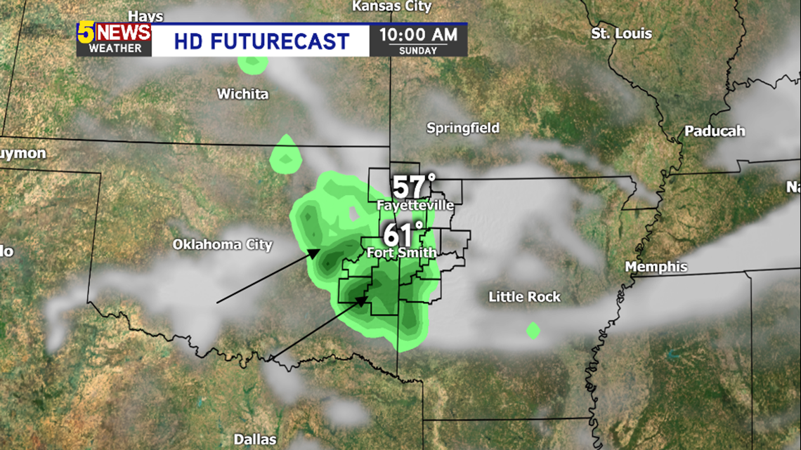
Scattered showers will be underway on Sunday morning with warm, moisture pushing northward into Oklahoma and Arkansas. This will be driven by the low level jet stream and likely be confined to the morning time before Noon. Scattered showers should fade as the day progresses on Sunday.
MONDAY 7AM

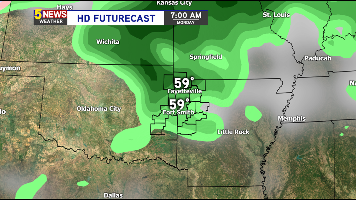
Much like Saturday and Sunday, the highest chance for rain on Monday will be during the first part of the day. This is also associated with deep moisture returning to the area. The highest rain chances on Monday will be before Noon.
TUESDAY PM THRU THURSDAY

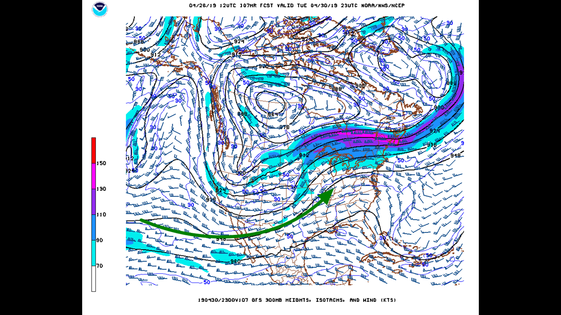
The prevailing pattern for the middle of next week features a strong southwest flow in the subtropical jet coupling with a trough embedded with the polar jet stream. The front will be parallel to the mean flow with winds aloft diverging or moving in separate directions.

This is a signal for a very heavy rain event with the potential for flash flooding. There will also be enough minor small systems embedded in the flow to cause a few rounds of severe thunderstorms; although, the timing is still yet to be determined this far out.
Plan on active weather this weekend and especially next week.
Given the time of year, tornadoes, large hail, damaging winds, and flash flooding are all certainly a possibility.
-Garrett