
Tap HERE for live coverage of storms where you live.
Tap HERE for our interactive radar.
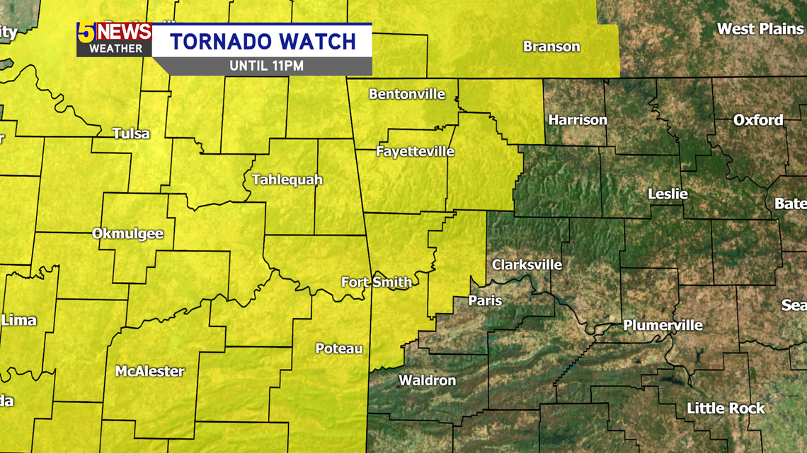
Tornado Watch

TIMING
- 12PM-5PM: Scattered storms
- 5PM-Overnight: A line of strong storms will swing through the region.
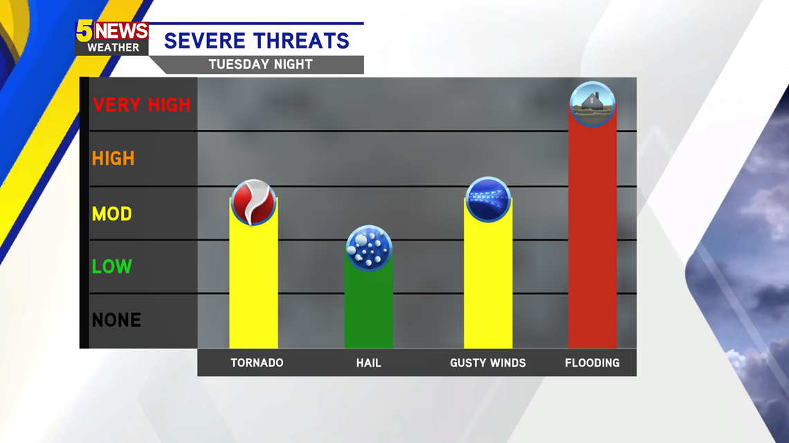
The environment is ripe for storms to form and rotate, which means a few tornadoes are possible Tuesday afternoon and evening. In addition, several lightning strikes, hail, and gusty winds are likely. Several rounds of rain and severe weather are possible, which is posing a flooding risk the next few days.

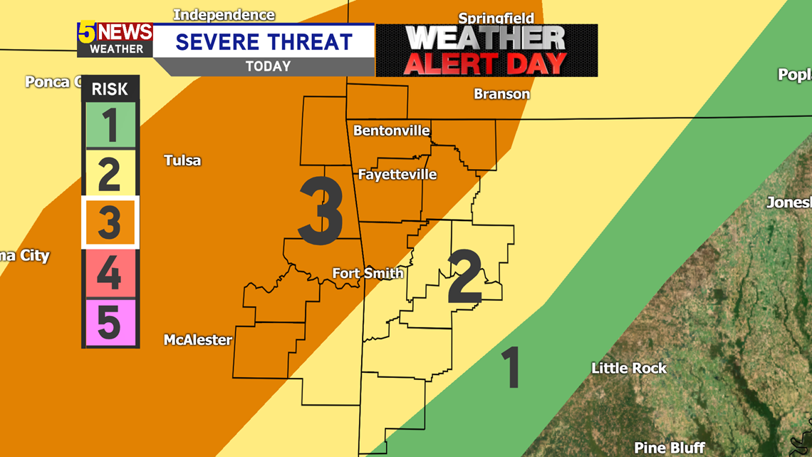
Storm Risk Map: The highest threats will be in NWA and eastern Oklahoma.

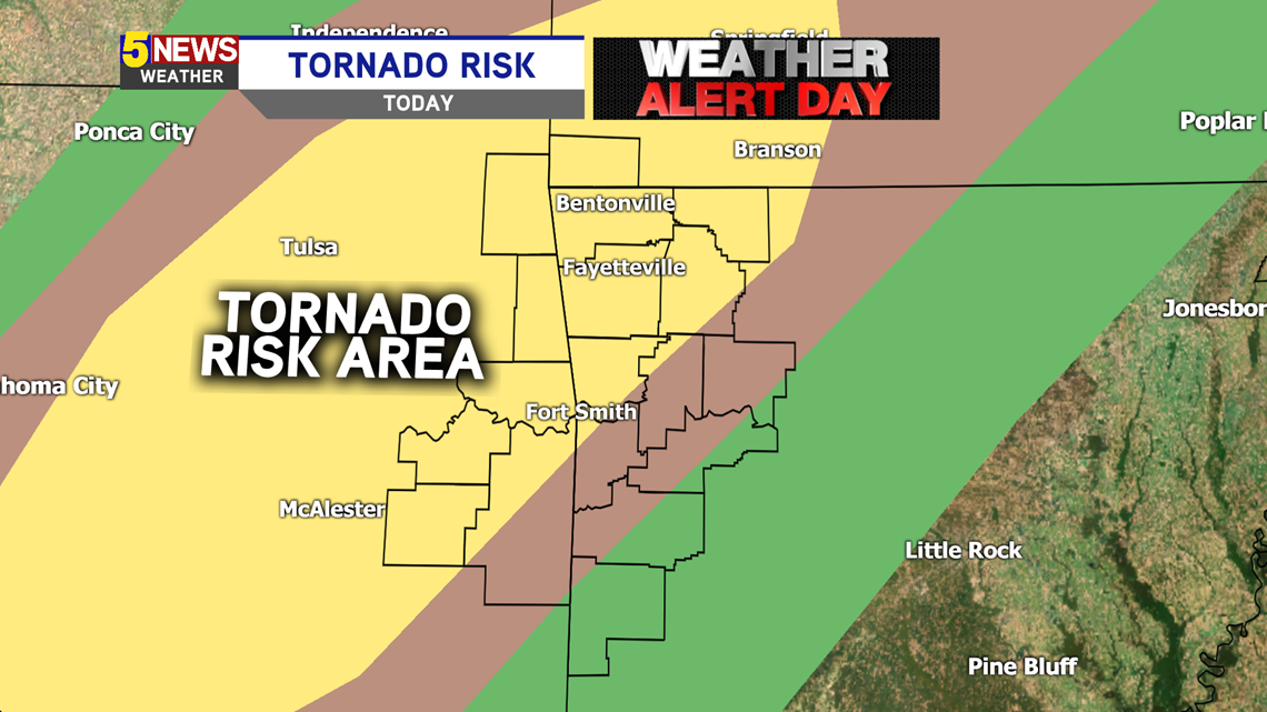
The highest tornado risk also lies in NWA and eastern Oklahoma.

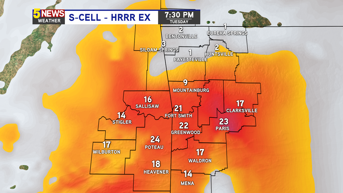
This is a look at the threat for supercells to form. Because of unstable and humid air towards the south, storms will have plenty of energy to form. However, the risk is being capped a bit by thick cloud cover. This will not be a tornado outbreak, but tornadoes are still possible.

-5NEWS Weather