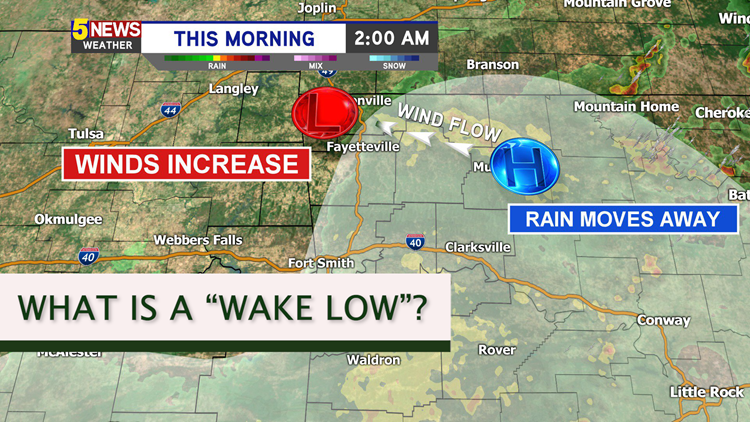
Unusually high winds struck parts of Northwest Arkansas overnight, but it wasn’t because of thunderstorms. It was caused by a “wake low”.
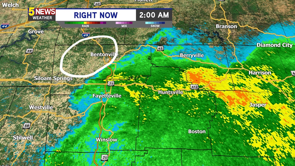
Strong winds stretched from Fayetteville to Siloam Springs. Local airports reported that the highest winds gusted between 50 to 60 mph. This caused tree damage and power outages, even though the rain was wrapping up.

“Wake Low” Breakdown
This weather phenomena is defined as a mesoscale low that develops behind the high pressure created by the rain. These events are considered to be fairly rare.

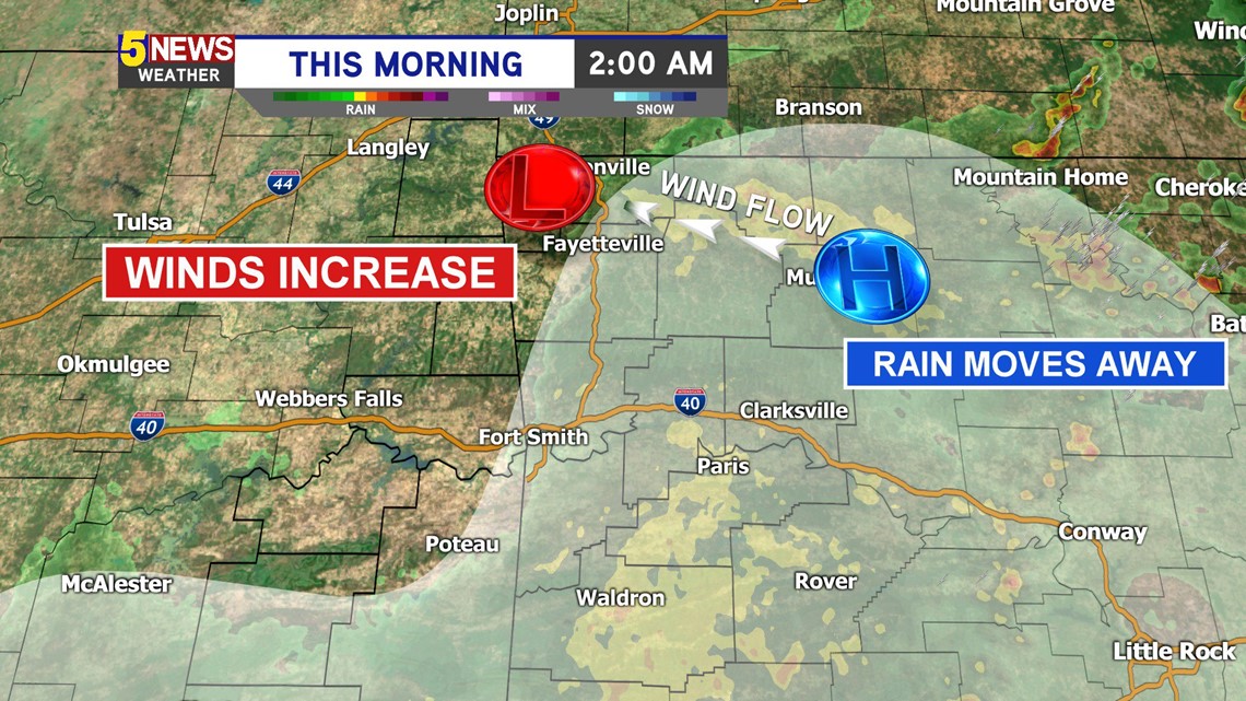
Wind is caused by differences in atmospheric pressure. The squall line of thunderstorms has a small area of high pressure (mesoscale high). Atmospheric winds flow from high to low pressure. As the dissipating storms move off to the east, an area of lower pressure begins to form behind the rain. Rapid pressure falls over a short amount of time cause the winds to increase in the “wake low” area.
Typically, there is little to no rain and clearing skies associated with this phenomena.
Strongest Wind Gusts Across The Area


The “wake low” developed in the early morning hours after midnight. The winds were fairly calm before the speeds rapidly increased within 5 minutes. The strongest gusts occurred from around 1am to 2am, and the winds subsided after that. Winds are considered severe by the National Weather Service when they reach 60 mph. The NWS considered the high winds “non-thunderstorm wind gusts”.

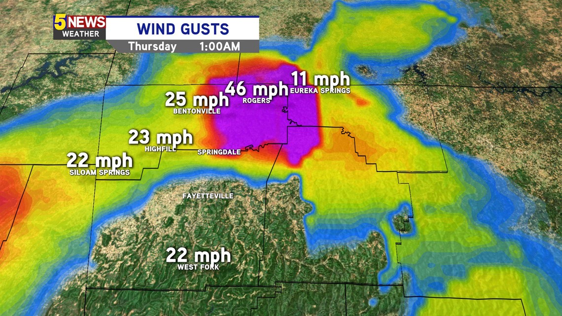

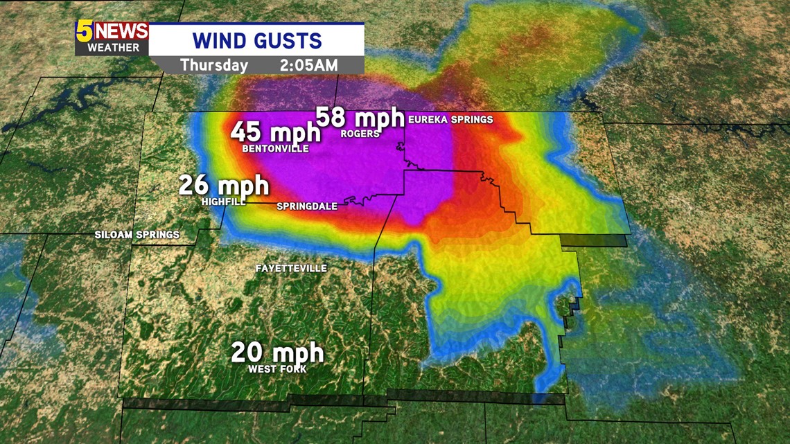
South of the hill, wind speeds ranged from 10 to 20 mph. The winds didn’t affect the River Valley since it was still raining there, and the “wake low” was too far away.
-Sabrina