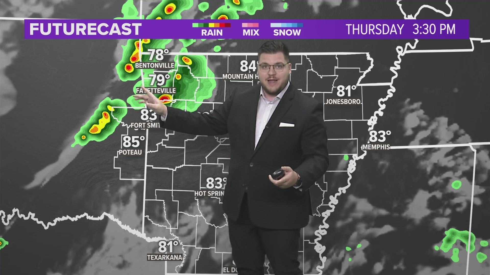
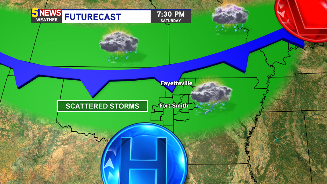
Overall a nice weekend is shaping up for western Arkansas and eastern Oklahoma. Most of the time we’ll enjoy partly cloudy skies with south winds keeping temperatures in the 80s. However there is a stray thunderstorm chance with a low-end severe threat.
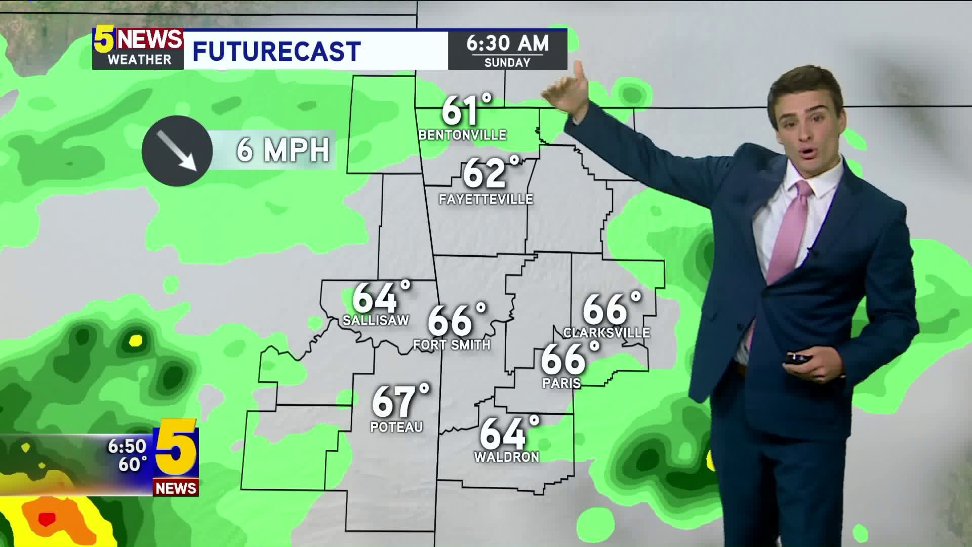
A cold front will be diving south, approaching Arkansas. This will help spark isolated storms, mainly north of I-40. The best chance for storm would be Saturday afternoon and Saturday night. More storm chances flare up Sunday afternoon with daytime heating.

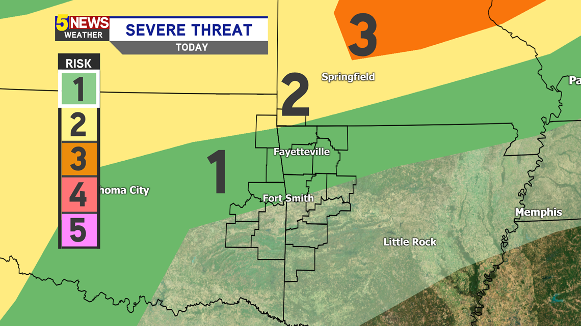
The best chance for a storm will be in Northwest Arkansas and even farther north into Missouri. Hail and gusty winds would be the main threat. The overnight threat may be larger than the afternoon threat.

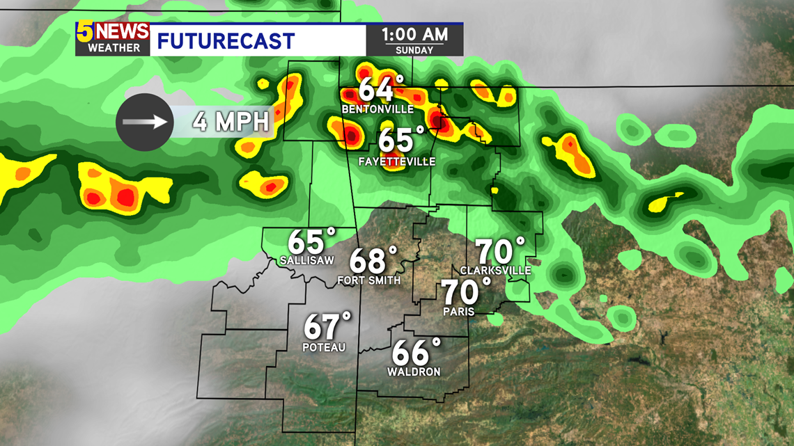
There is also high pressure centered over the Red River Basin. The cold front and the high pressure will compete so the storm chances will stay mainly isolated and could fall apart quickly upon arrival into Arkansas.

South and southwesterly winds will help us stay in the 80s throughout the afternoon.


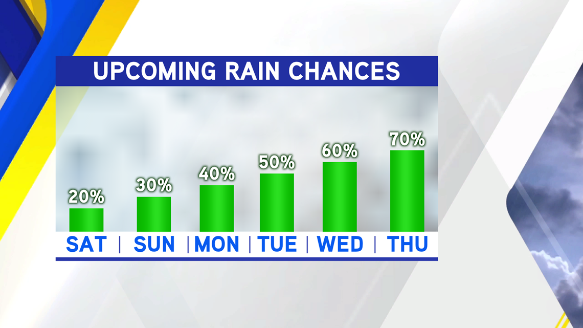
An upper level low pressure system will slowly approach the Natural State by the end of the week, helping to increase rain chances this upcoming week.

-Matt