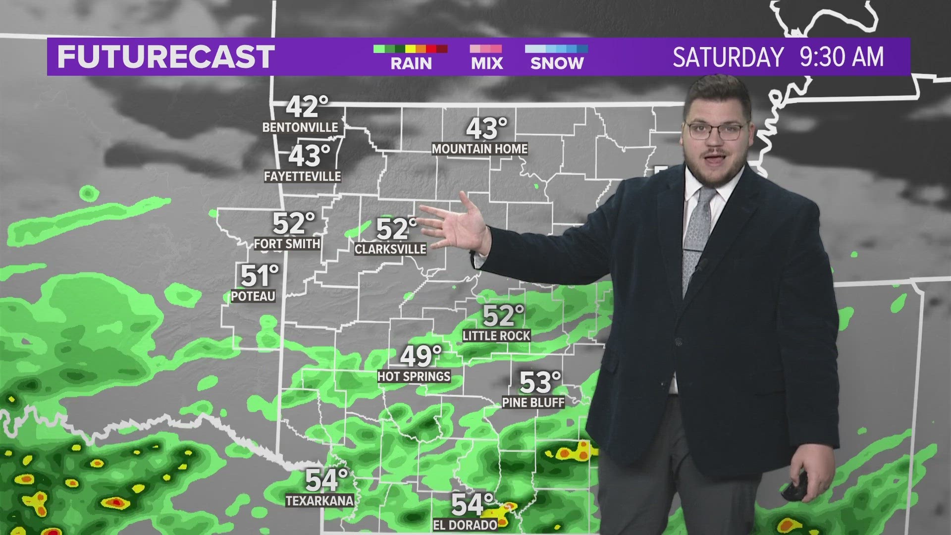
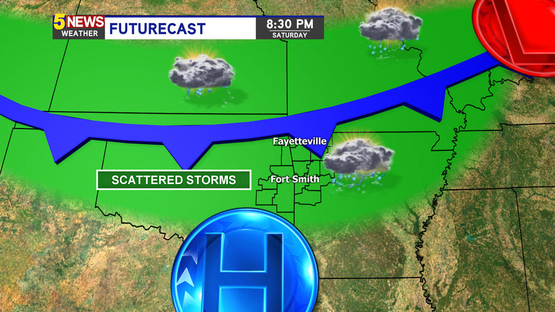
A cold front will stall out near the Arkansas state line the next few days. The timing is difficult to pinpoint because of the extreme scattered nature of the thunderstorms. They will pop up and die out all relatively quickly.
TIMING
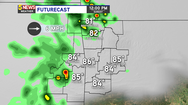
The most likely time to have storm swing by your neighborhood throughout the weekend will be Saturday night and then Sunday midday through the evening.

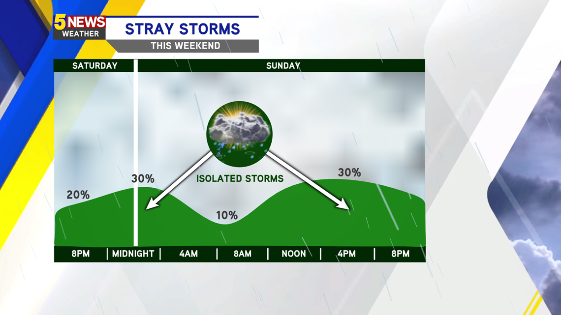
Scattered storms could develop Saturday night and once again around noon on Sunday. The overall threat looks low, with hail being the largest contender.


This cold front will park towards our north and provide a breeding ground for storms the next several days. By Wednesday and Thursday and strong low pressure system will intensify storm threats and then clear us out for next weekend.

-Matt