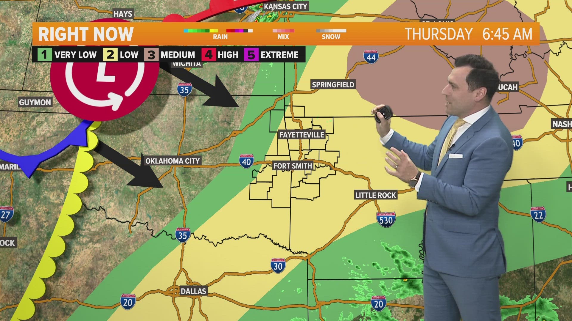
The weather pattern continues to bring us hot and humid weather. However, that’s helping to fuel the atmosphere before a low-pressure system moves closer later today. Strong to severe storms are possible on Saturday, but the risk ramps up for Sunday.

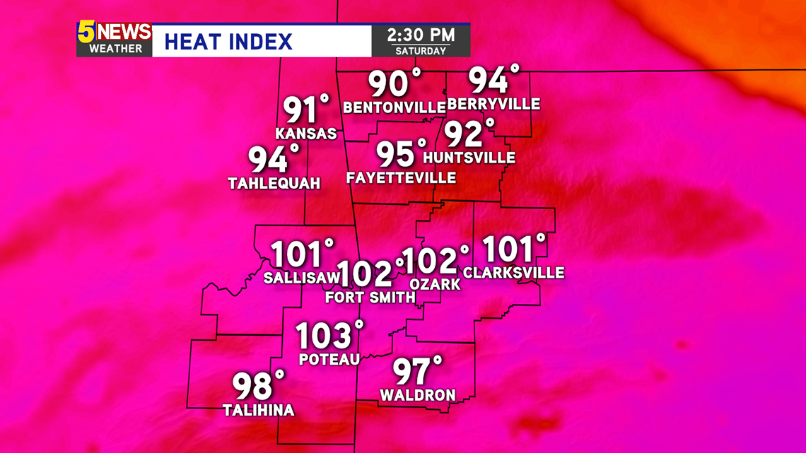
Feel-like temperatures this afternoon will be in the 90s in Northwest Arkansas, and will be in the low 100s in the River Valley. Humidity will be high.

STORM CHANCES
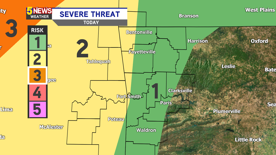
Saturday severe risk: Almost everyone is in a Level 1 out of 5 risk. Any storms that develop today could be strong to severe.

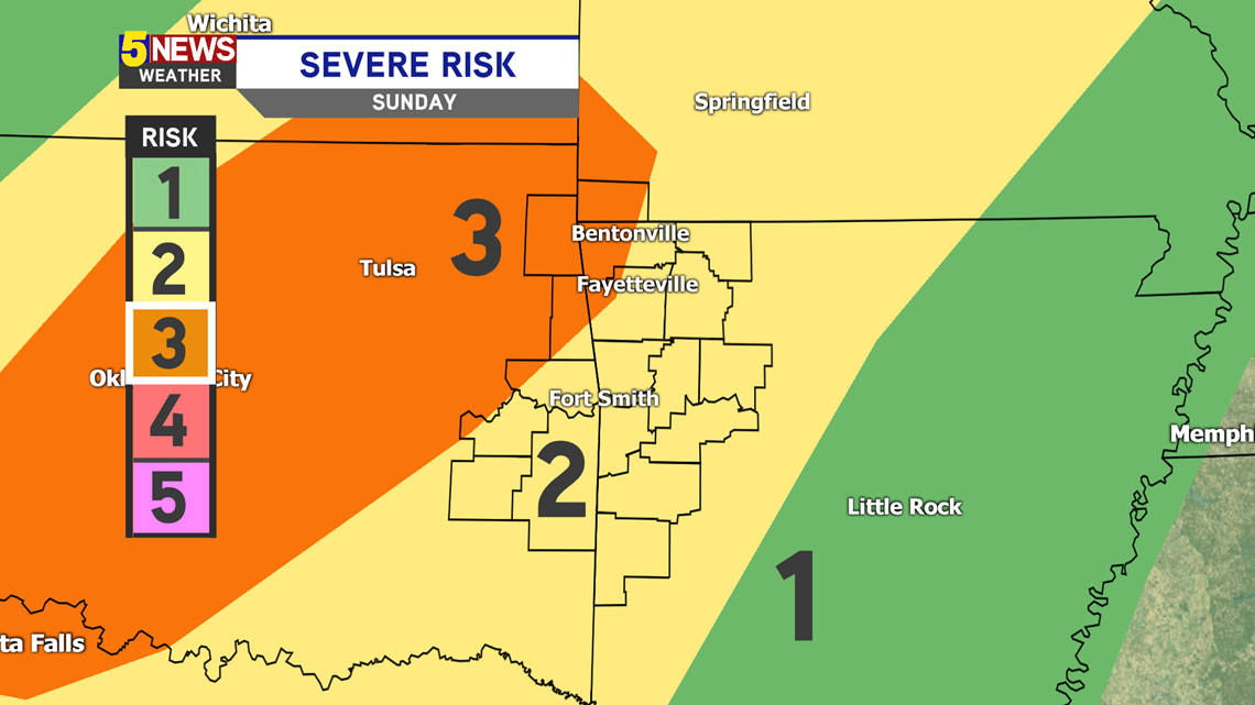
Sunday severe risk: Everyone is under a Level 2 (out of 5), with parts of western NW Arkansas under a Level 3. All modes of severe weather are possible, but a higher risk for damaging winds.

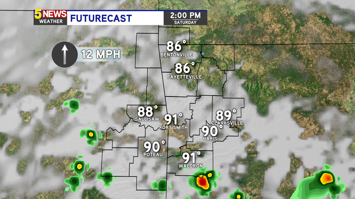
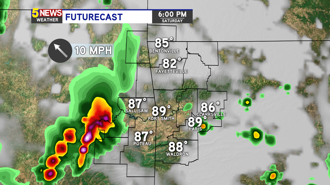
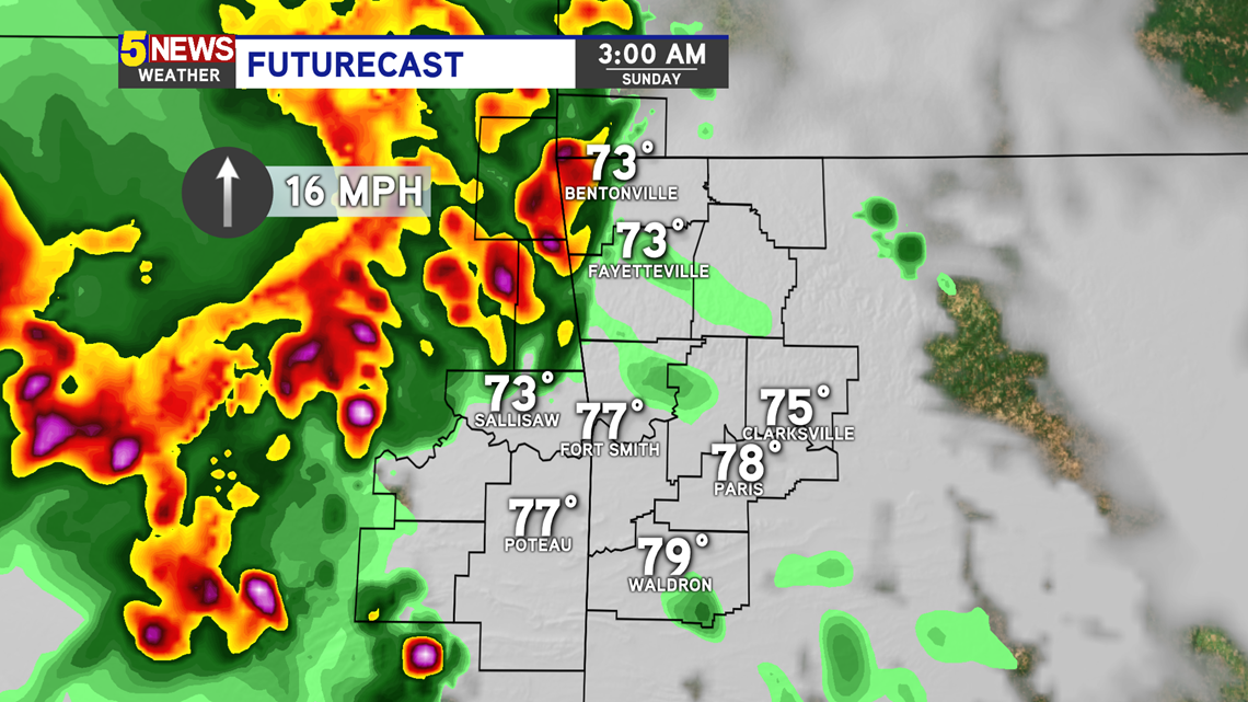
TIMELINE
2PM: Isolated storms may develop in the River Valley and south. These will track north, further into the area. These storms could become severe.

6PM: The greater chance for storms and heavy rain will be in eastern Oklahoma this evening.

3AM: If this complex holds together, a line of strong to severe storms will push through overnight and early tomorrow morning. If the boundary from this sits over us during the day, more storms will develop tomorrow afternoon.

-Sabrina