Several rounds of showers and storms are likely for the remainder of the weekend. There are two key players at work.
- A small low-pressure system (an MCV) developed in North Texas and is moving north towards Arkansas. This will help continue the chance for scattered storms for Saturday evening and overnight. Some could turn severe. We will watch for some pockets of rotation as this nears the area.
- A cold front will be swinging through Sunday night, sparking showers and storms throughout the second half of the weekend as well. On top of that the low-level jet will help sustain overnight storms too.
TIMING
The timing of storms will be tricky with their scattered nature. Storms now affect storm environments later on.

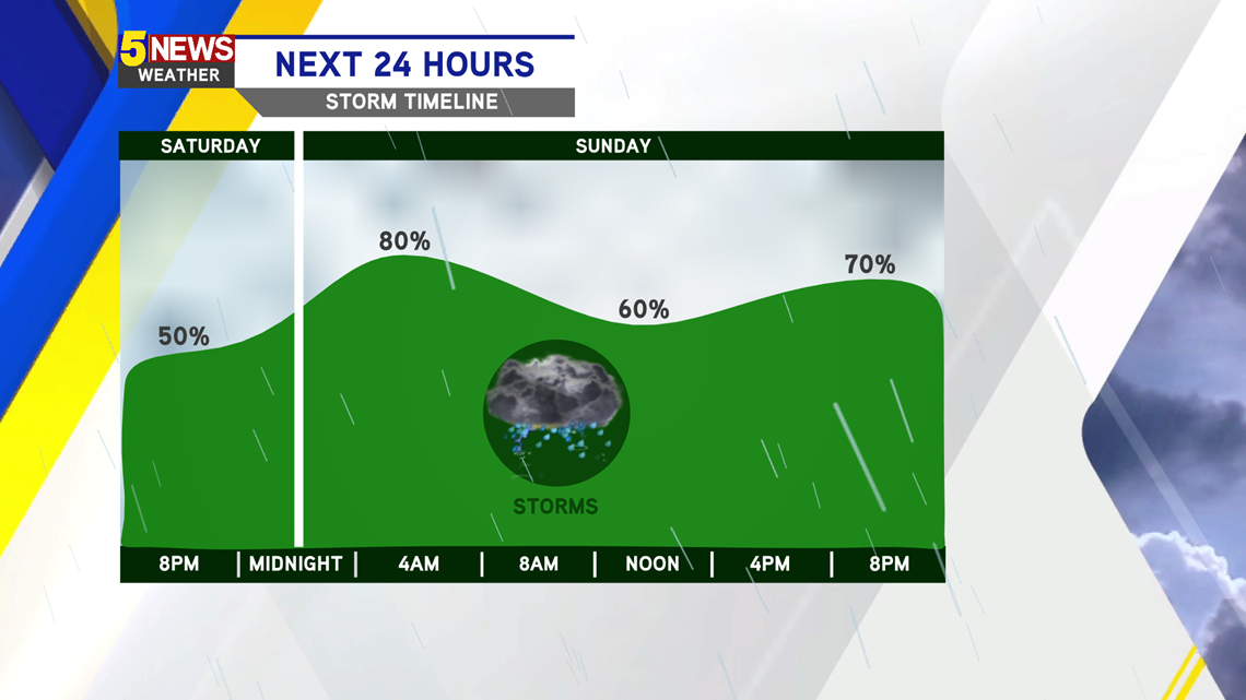
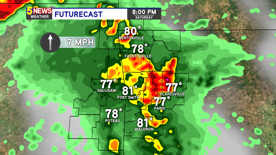
-Saturday Evening: Scattered storms, one or two severe
-Saturday Night: Strong storms with gusty winds and hail are possible
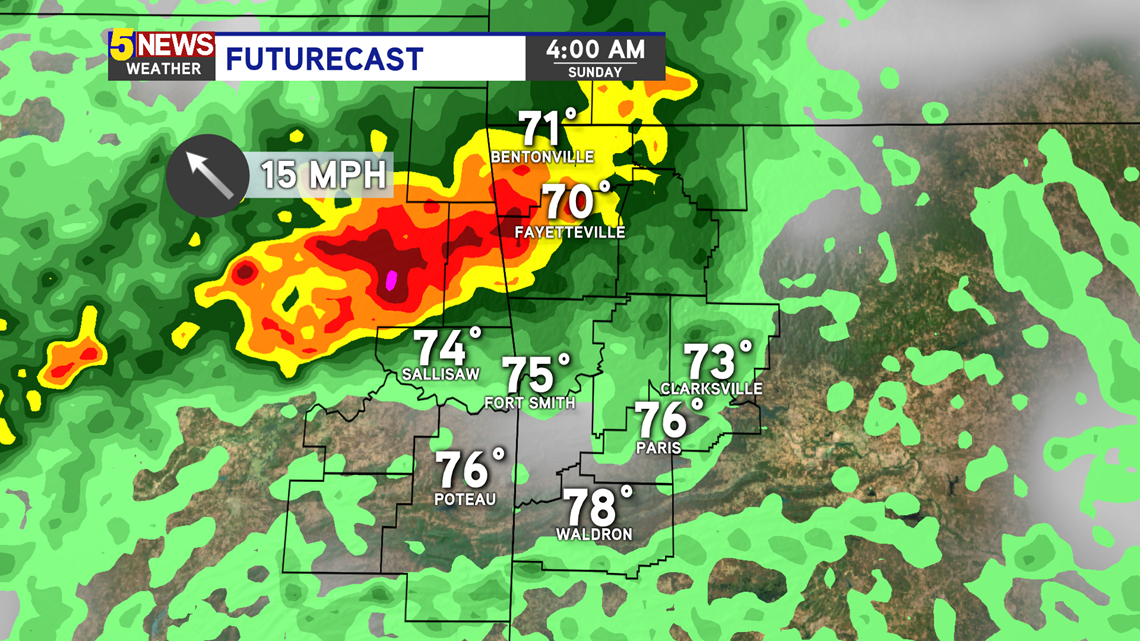
-Sunday Morning: Leftover storms still possible
-Sunday Afternoon: Isolated strong storms
-Sunday Evening/Night: Heavy rain with pockets of gusty winds and hail are possible
LOCATION
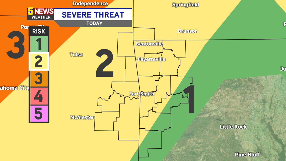
Saturday Evening: Level 2 for most

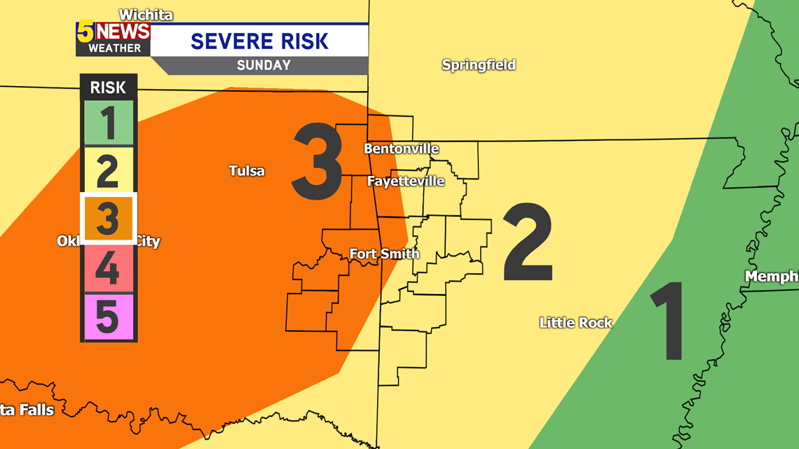
Sunday: Severe threat increases to Level 3

THREATS
Flash flooding, hail, and gusty winds are the primary threat. However a few storms could rotate, so tornado chances are not zero.

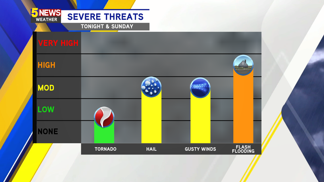
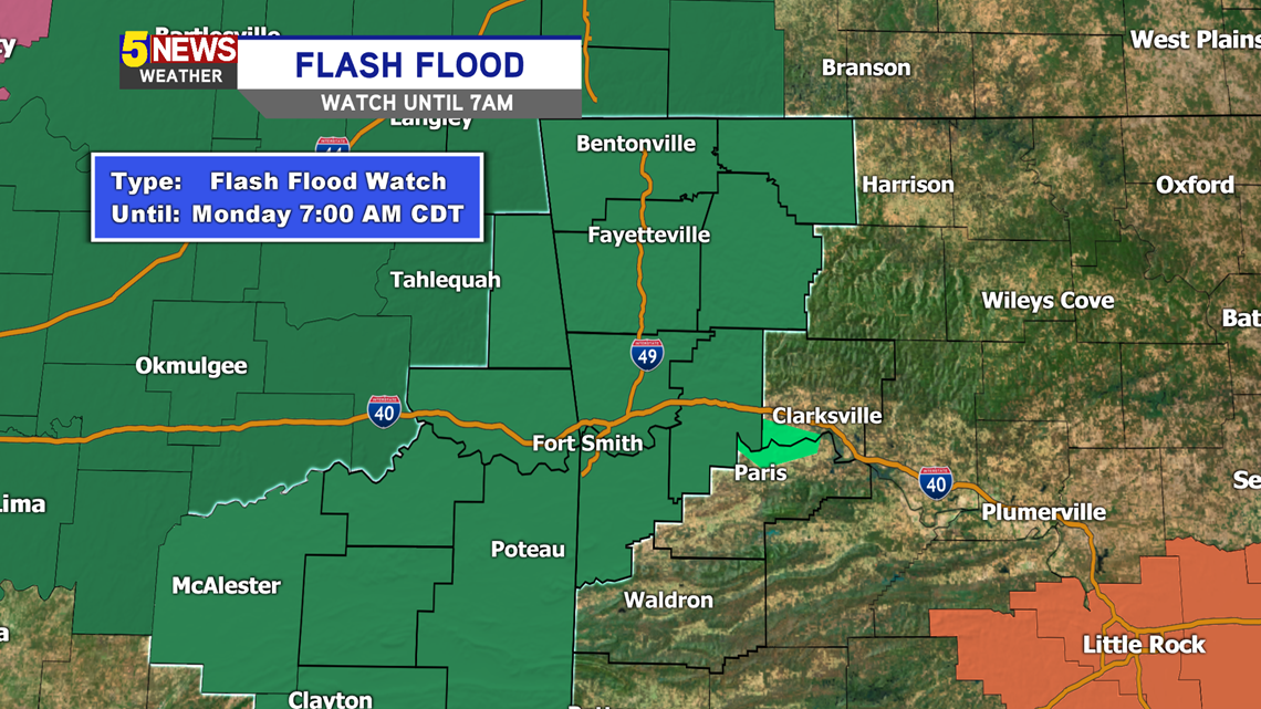
A flash flood watch is in effect until 7AM Monday. Some storms could train over the same locations for hours on end, producing the chance for waters to rise quickly in low-lying and urban areas. Rainfall projects are over 2 inches.

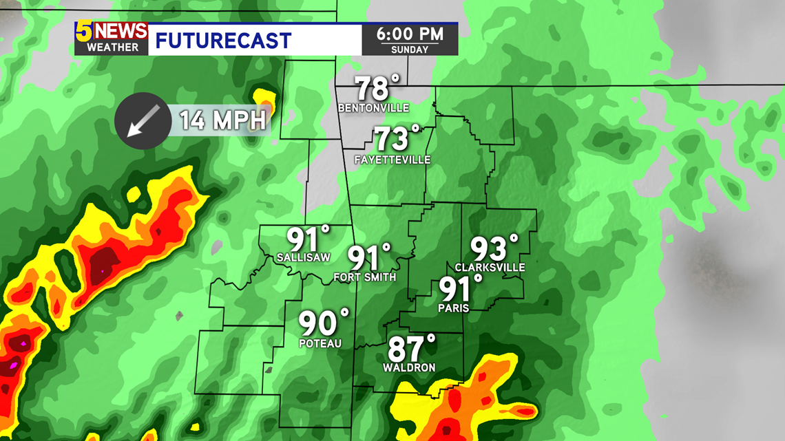
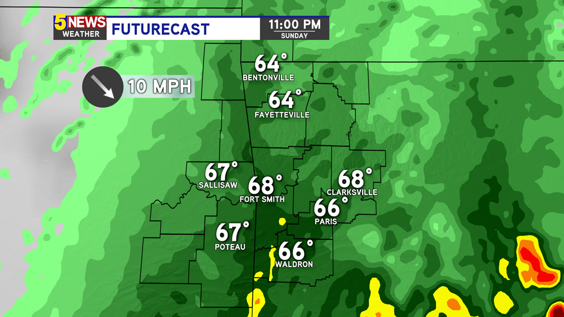
FUTURECAST
Saturday 8PM

Sunday 4AM

Sunday 6PM

Sunday 11PM

-Matt