A ridge of high pressure has been building heat across Arkansas and Oklahoma, and will continue to do so for the next few days. However, relief from that heat may come sooner than later.
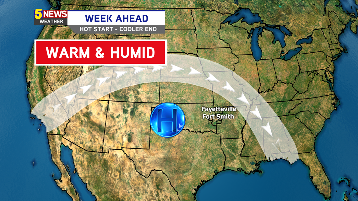
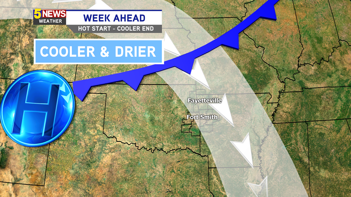
Next week will start hot and humid (Monday-Wednesday). However a weak cold front will swing through Wednesday night and cool us down a bit (Thursday-Friday), an also bring in a bit drier air.
VIDEO FORECAST

WEATHER SET UP
The ridge of high pressure will be centered over the Ozarks the first half of the week, keeping things hot and humid. However, by the second half of the week, the ridge will slowly retrograde westward. That will allow a cold front to push through the NW Flow, which will allow slightly cooler and drier air to filter south throughout Arkansas.
MONDAY-WEDNESDAY

THURSDAY-FRIDAY

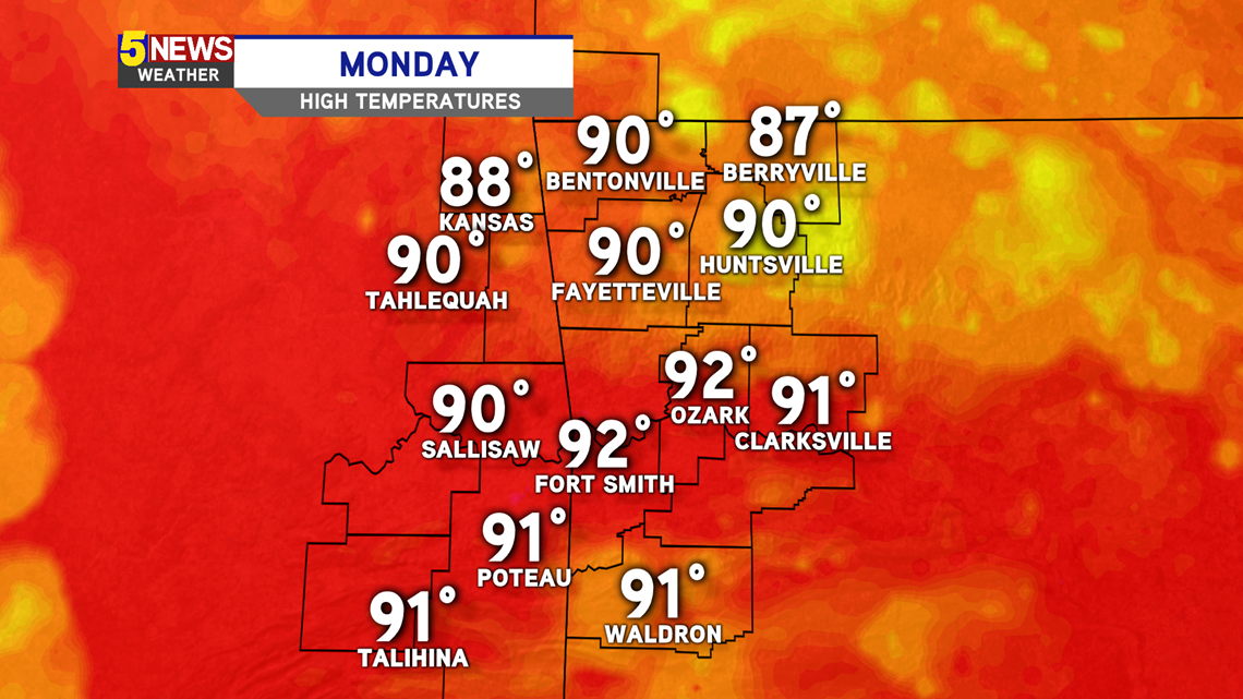
MONDAY FORECAST
An isolated shower is possible as highs reach the 90s.

LOOKING AHEAD
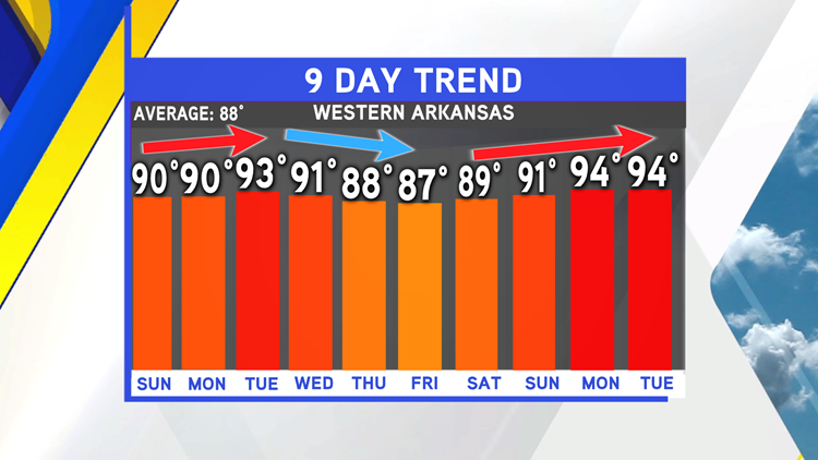
The temporary reduction in temperature will take place by Thursday, but by the following week, the heat will build back in.


-Matt