Hurricane Barry made landfall as a Category 1 storm near Intracoastal City, Louisiana at 1PM CDT Saturday, July 13th. Moments later Barry was downgraded to Tropical Storm status as winds dropped to 70 MPH (74+ needed for hurricane). The rain, wind, and cooler air will be moving north towards Arkansas and Oklahoma. What can we expect?
TROPICAL CYCLONE BARRY

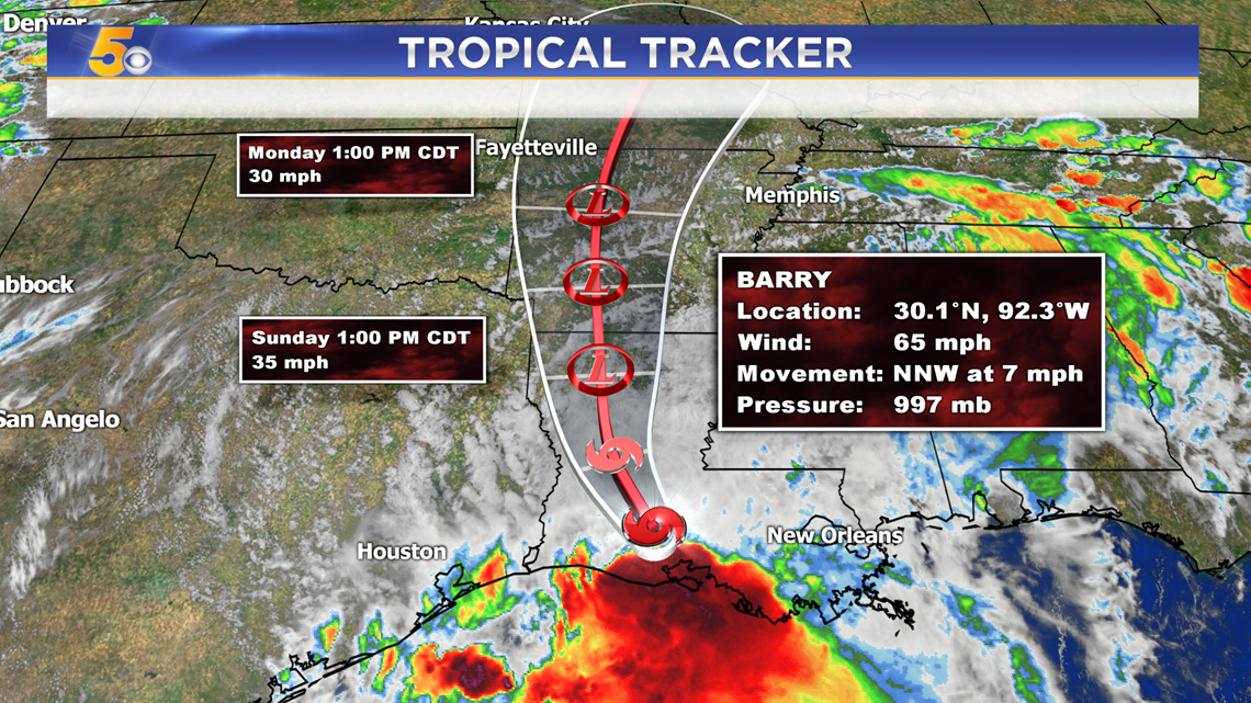
The center of lowest pressure, or the center of Tropical Storm Barry is expected to move through Arkansas. By the time it reaches our area, it will be a tropical depression with sustained winds closer to 30 MPH.
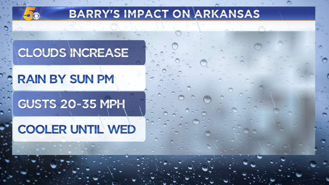
ARKANSAS AND OKLAHOMA IMPACTS
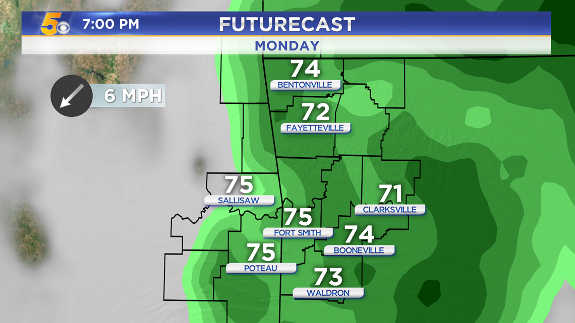
For the rest of the weekend, expected more scattered showers as clouds start to increase from south to north. The heaviest rain will not arrive until late Sunday. Winds will be around 20-30 MPH with winds closer to 35MPH in the mountains. Thanks to the additional rain and clouds, cooler temperatures will be in the forecast at least until Wednesday. Highs Monday and Tuesday will be in the 70s and 80s.

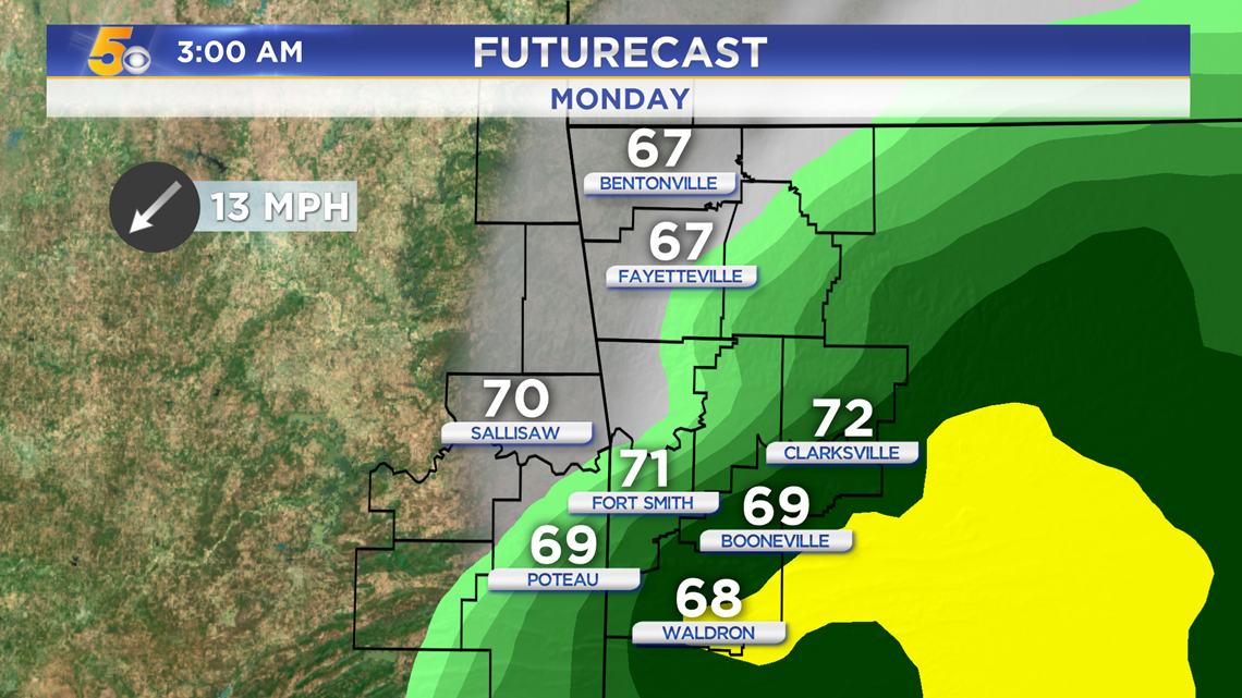
FUTURECAST — 3AM Monday

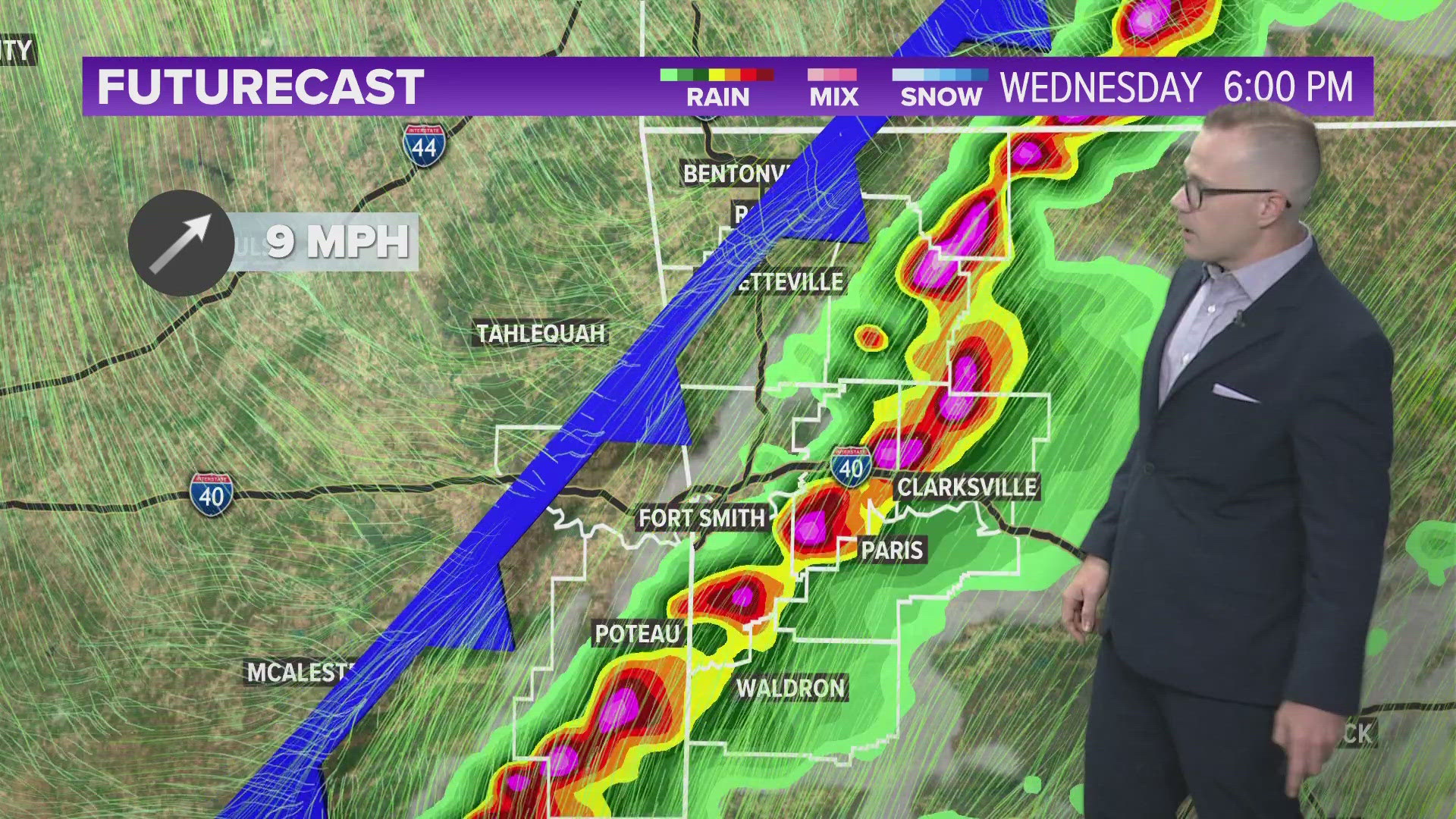
FUTURECAST — 7PM Monday

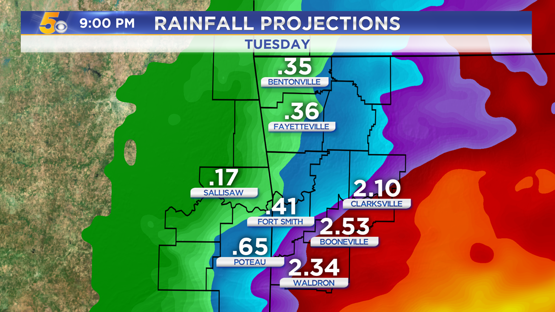
RAINFALL PROJECTIONS
Exact rainfall totals may greatly change as the system could change trajectory. Even a 15 mile shift east or west will cause rainfall totals to

-Matt