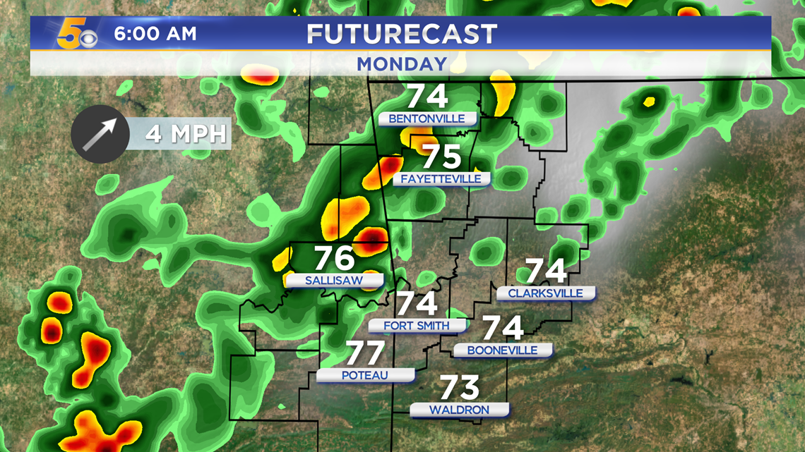
A weak cold front is on the way to Arkansas and Oklahoma. Showers and a few thunderstorms will arrive alongside it early Monday, however a few isolated showers have popped up today during the heat of the day. This will diminish once the sun sets.
Tap HERE for our interactive radar.
RAIN OUTLOOK
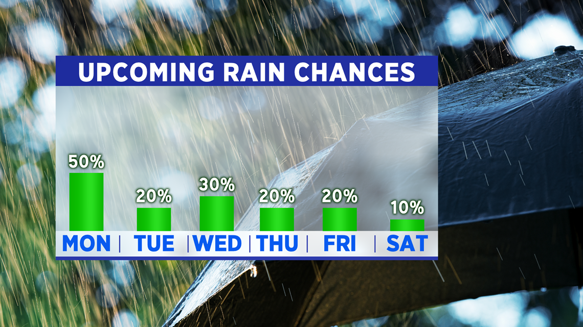
SUNDAY: Isolated Shower 10%-20%
MONDAY: Morning Showers 60%, Afternoon Isolated Storm 30%

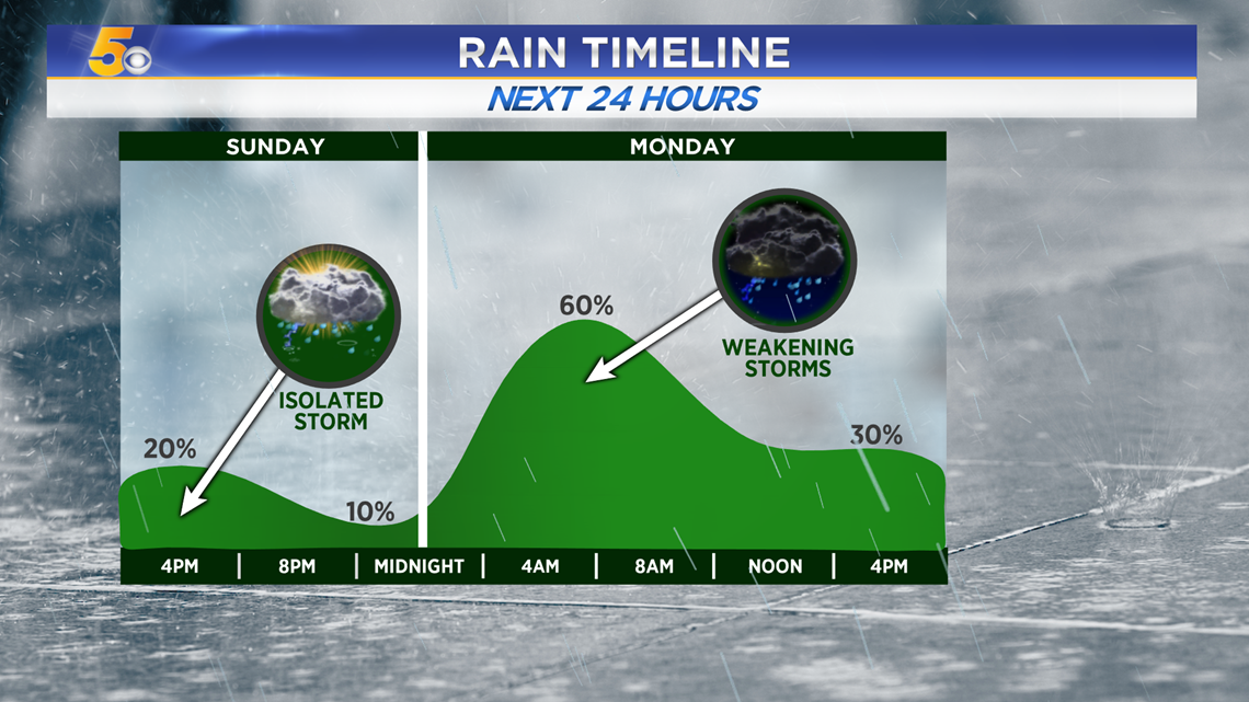
With daytime heating and some cooler air in the upper levels of the atmosphere (20,000 FT and up) an isolated shower or storm is possible, but the majority of us will stay dry.

A line of showers with one or two embedded thunderstorms is possible throughout morning rush hour, starting in the north and spreading south throughout the morning.

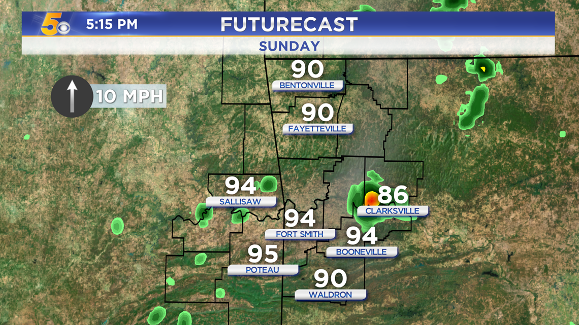
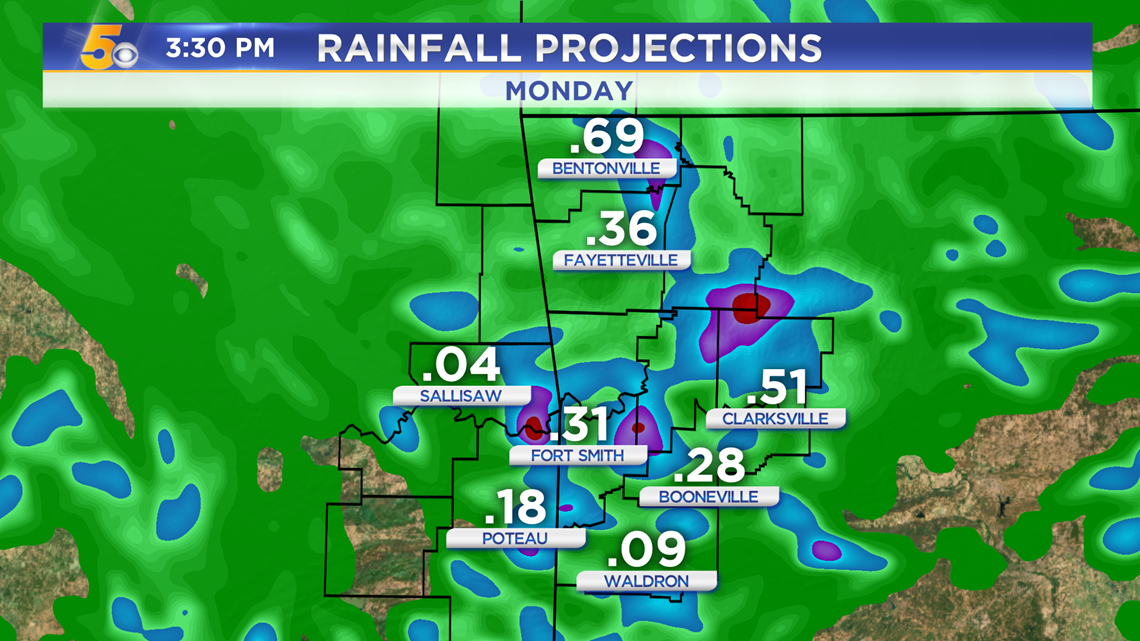
Rainfall totals should be less than a half inch for most locations.

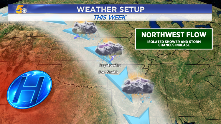
WEATHER SETUP
As high pressure slides west, Northwest Flow is taking it’s place. That means winds high up in the atmosphere are flowing from the northwest towards the southeast. This favors storm development with cooler air aloft, making the air more buoyant and thus easier for thunderstorms to pop up. Little storm systems can also track easily alone the flow, right through Arkansas, giving us more rain chances this next week.


There is a slight chance for a stray shower every day this upcoming week. However, there will still be plenty of sunshine between those times. You can expect more cumulus cloud development day after day after Monday’s front. The extra clouds will keep us a bit cooler too.

-Matt