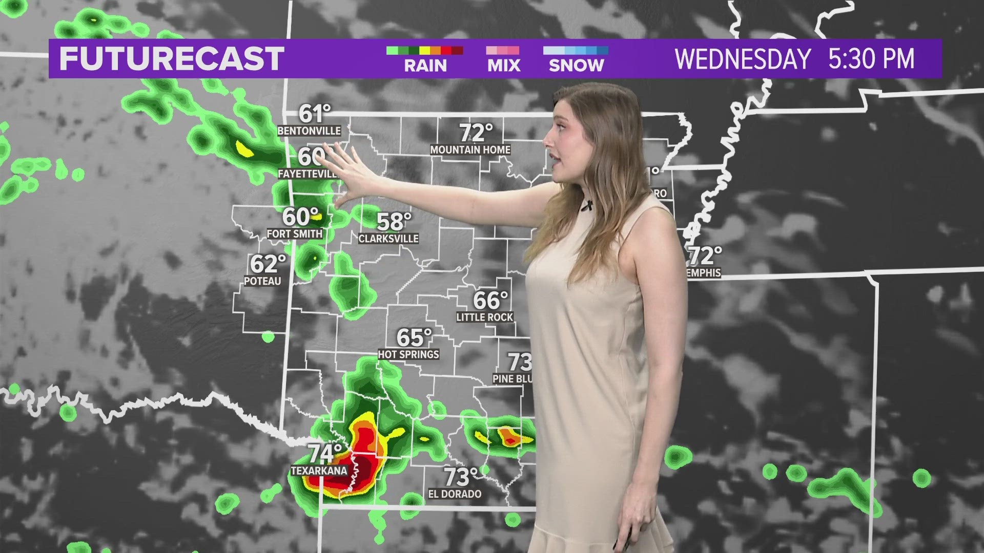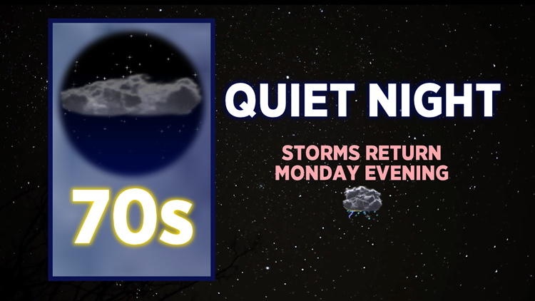
Isolated showers will continue to fade away Sunday evening, leading to a calm and quiet night. Monday will be dry until the evening when storms return to Northwest Arkansas and the River Valley. (see details below)
VIDEO FORECAST
SUNDAY NIGHT CONDITIONS
Lows tonight should dip into the upper 60s and low 70s with clouds continuing to break. No rain is expected after 8PM.
MONDAY OUTLOOK
AM: Mostly sunny with highs quickly warming up into the 70s/80s.
PM: Lots of sunshine with clouds bubbling up, highs in the upper 80s and low 90s, humidity will be high

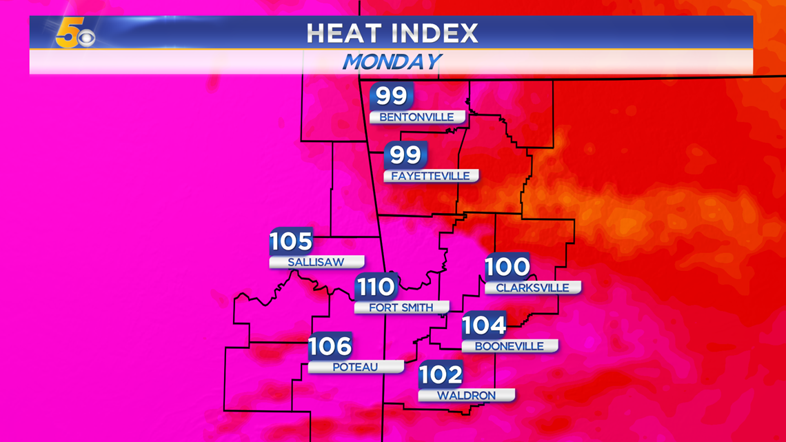
Heat index values by noon will be 90-100 degrees but by 3-4PM they will reach near or above 100 degrees.
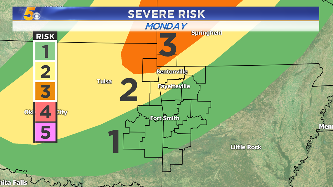
MONDAY STORM THREAT
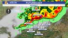
A line of storms will drop south from the Central Plains, reinvigorated by the warm and humid conditions leftover from the Monday afternoon heat. There are colder temperatures in the upper levels of the atmosphere that will lead to greater instability for storms to hold together. The timing for storms will be mainly after sunset Monday.

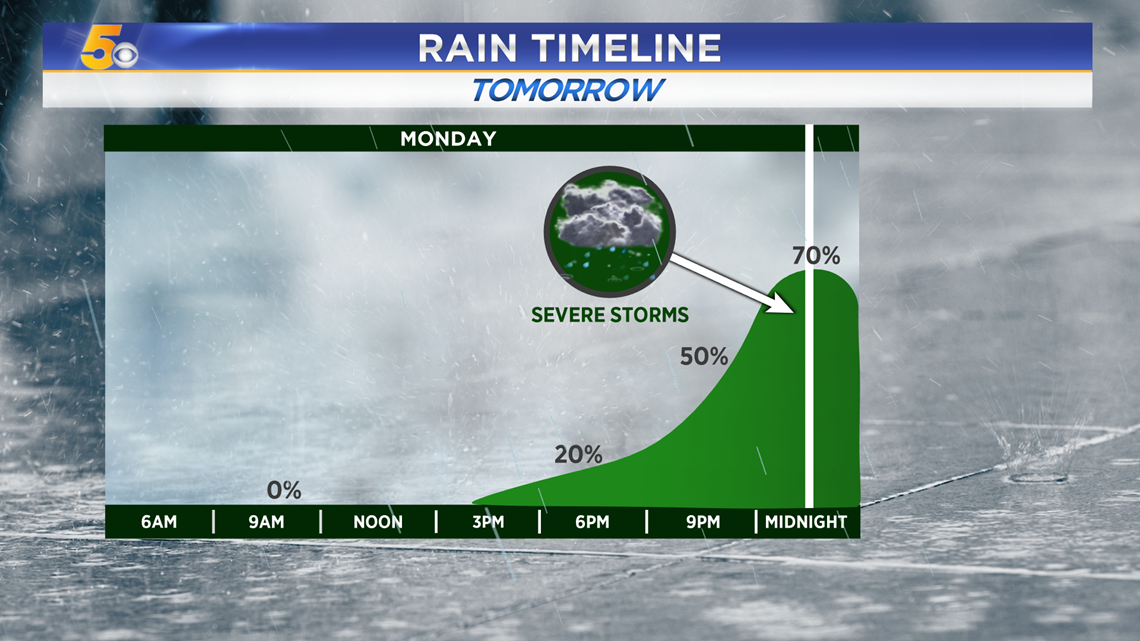
The strongest storms are expected to arrive:
NORTHWEST ARKANSAS: 9PM-12AM
RIVER VALLEY: 11PM-2AM

Severe risks range from a Level 1 (Marginal) to a Level 3 (Enhanced). The strongest storms will impact Northwest Arkansas before slowly weakening over time as they reach the River Valley.

-Matt