Rain and a few storms are possible as we head into the second part of the weekend. This will also cause our temperatures to be slightly cooler.
VIDEO FORECAST

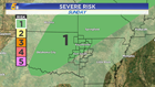
STORM CHANCES
The severe risk is only a Level 1, so it's low-end. Gusty winds and heavy downpours are possible. The line of storms will weaken as it pushes further south.

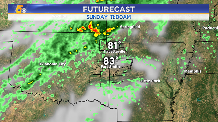
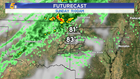
RAIN TIMELINE
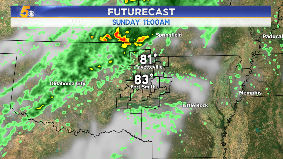
11AM - The heavy area of rain will stay to our northwest for most of the day along a weak cold front. However, if it inches any closer to us, a few scattered showers are possible in Northwest Arkansas earlier in the day.
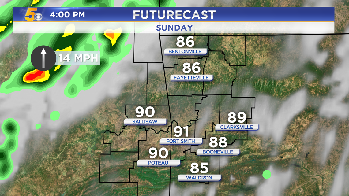
4PM - The main line of storms will be on our doorstep late afternoon.
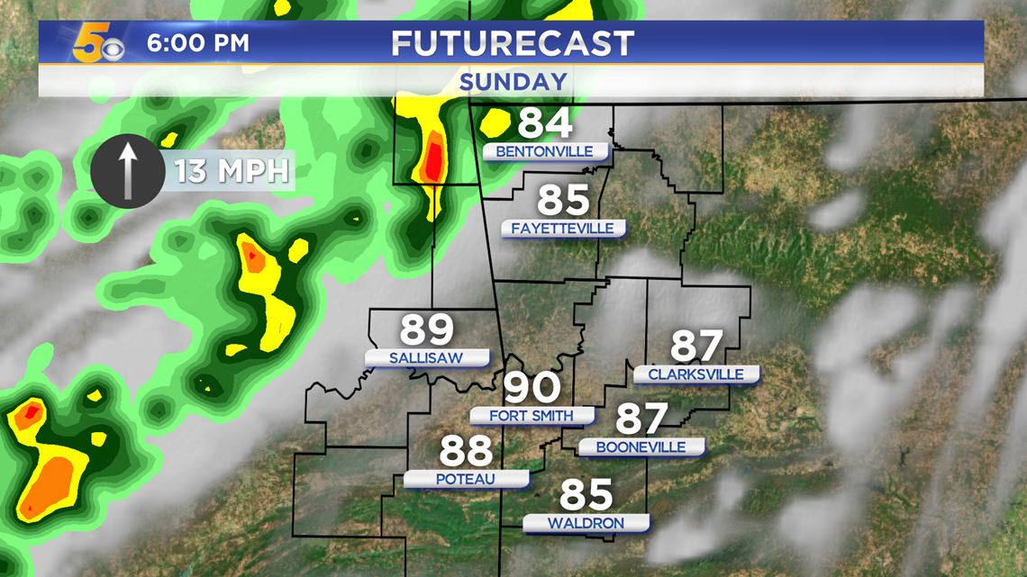
6PM - The rain will push in around dinnertime into Northwest Arkansas. This is when the winds would be highest.
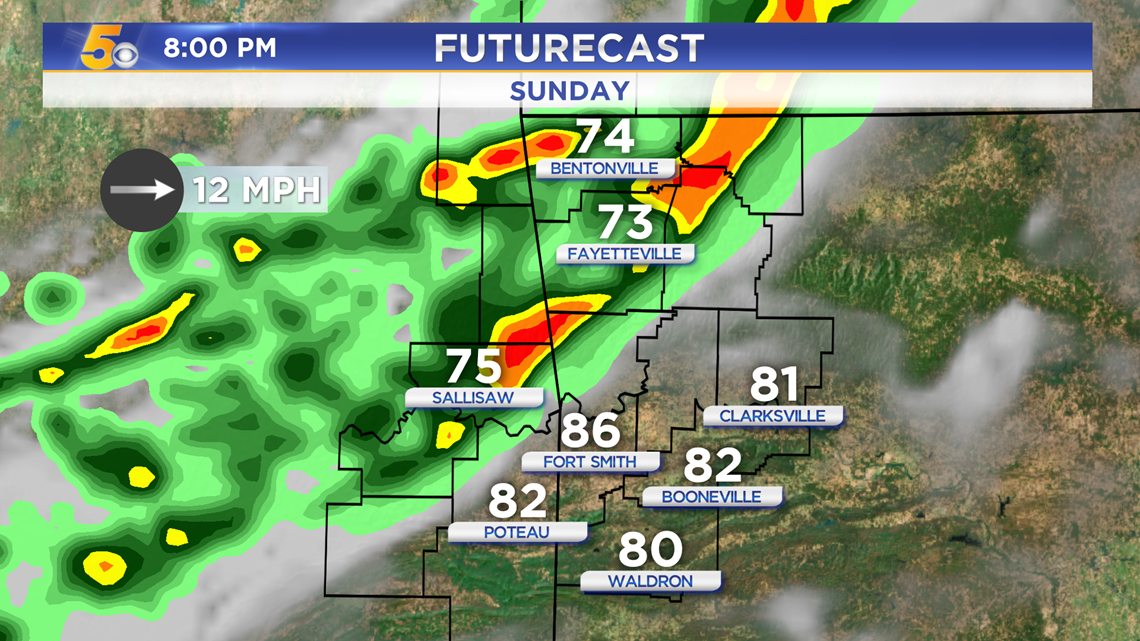
8PM - As the cold front pushes through, the rain will advance further south into the River Valley.

11PM - The rain finally weakens and reaches the River Valley after sunset. Rain will likely continue overnight and into the early morning, but the severe threat will be much lower.

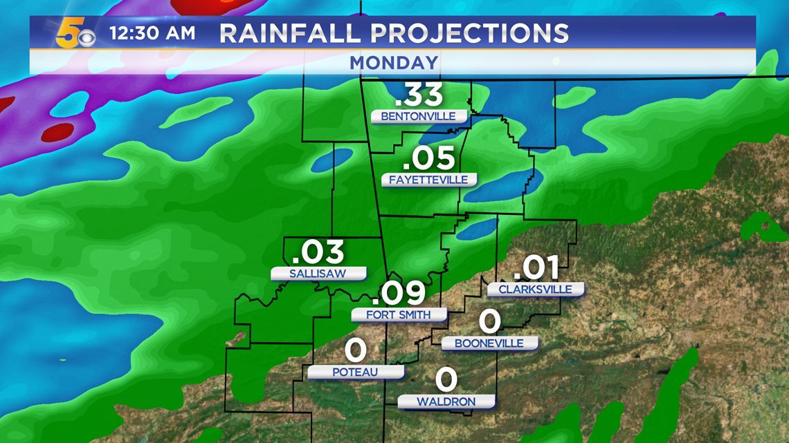
Rainfall totals are low with this system. We may receive up to half an inch. More rain, though, is expected throughout the week.
-Sabrina