September is wrapping up on a warm and muggy note as highs reach the 80s and 90s. Heat index values are expected to reach the mid 90s area wide. The high pressure system holding this heat wave will start to break down after a series of cold fronts the next 7 days.
VIDEO FORECAST
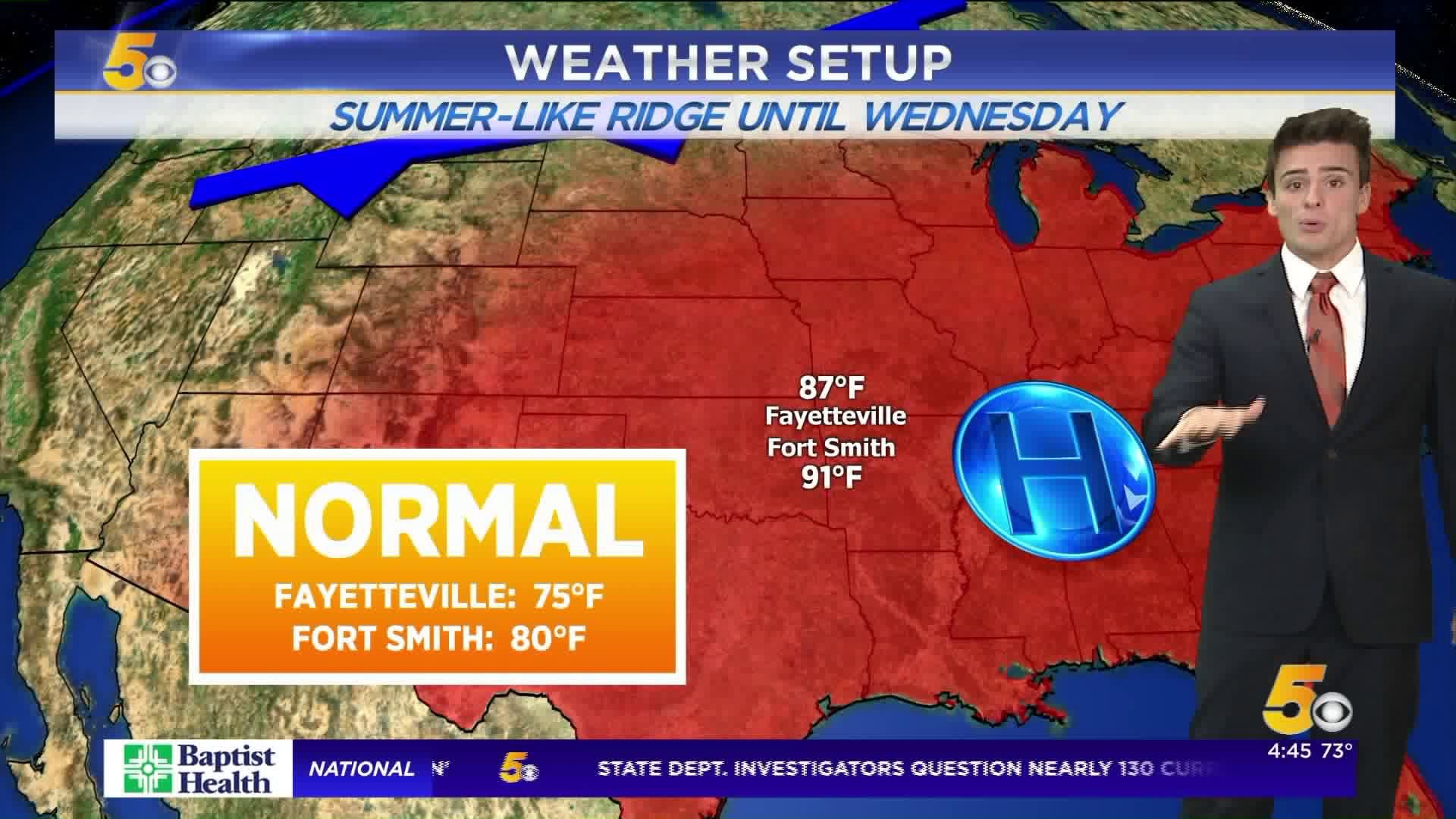
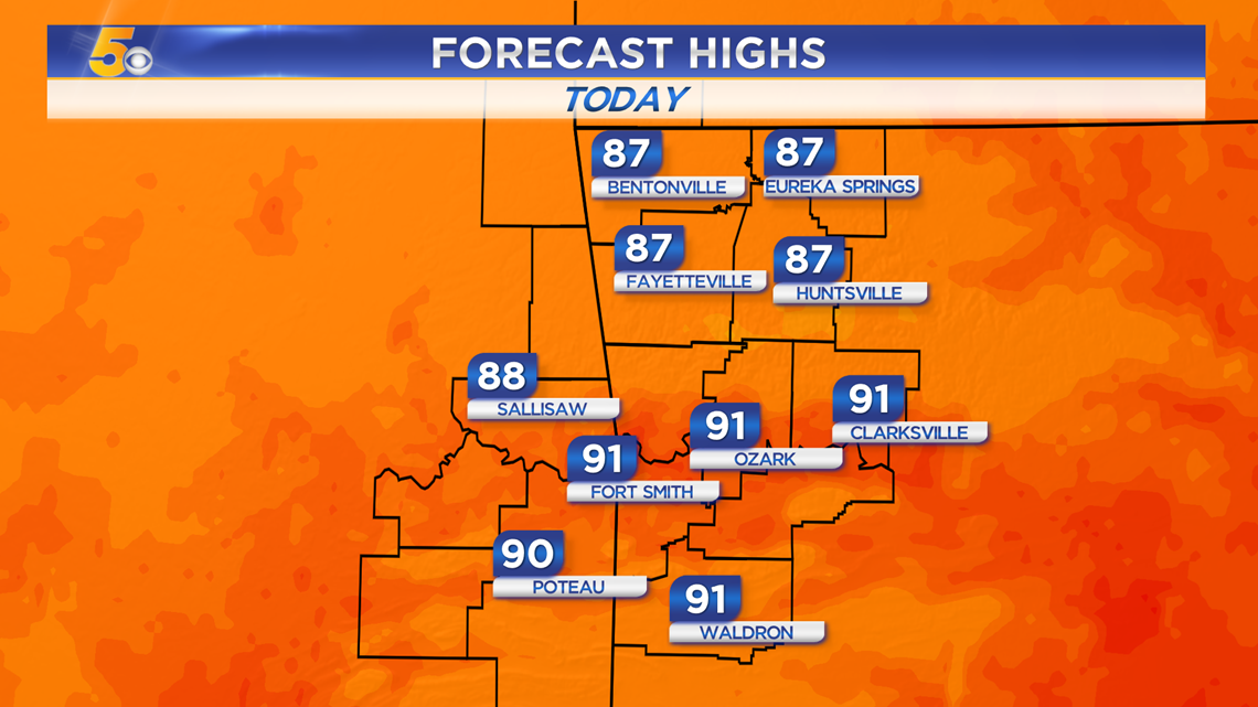
HEAT WAVE CONTINUES THREE DAYS
Monday, Tuesday, and Wednesday will continue to be warm with highs 10-15 degrees above normal.

Monday Highs: (South winds 10-15 MPH, gusts 20+ MPH helping sustain heat)
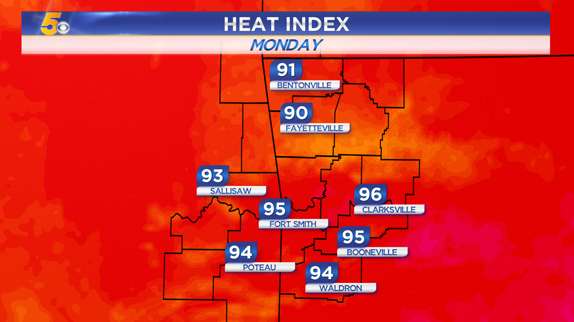
Monday Max Heat Index Forecast:
LOOKING AHEAD
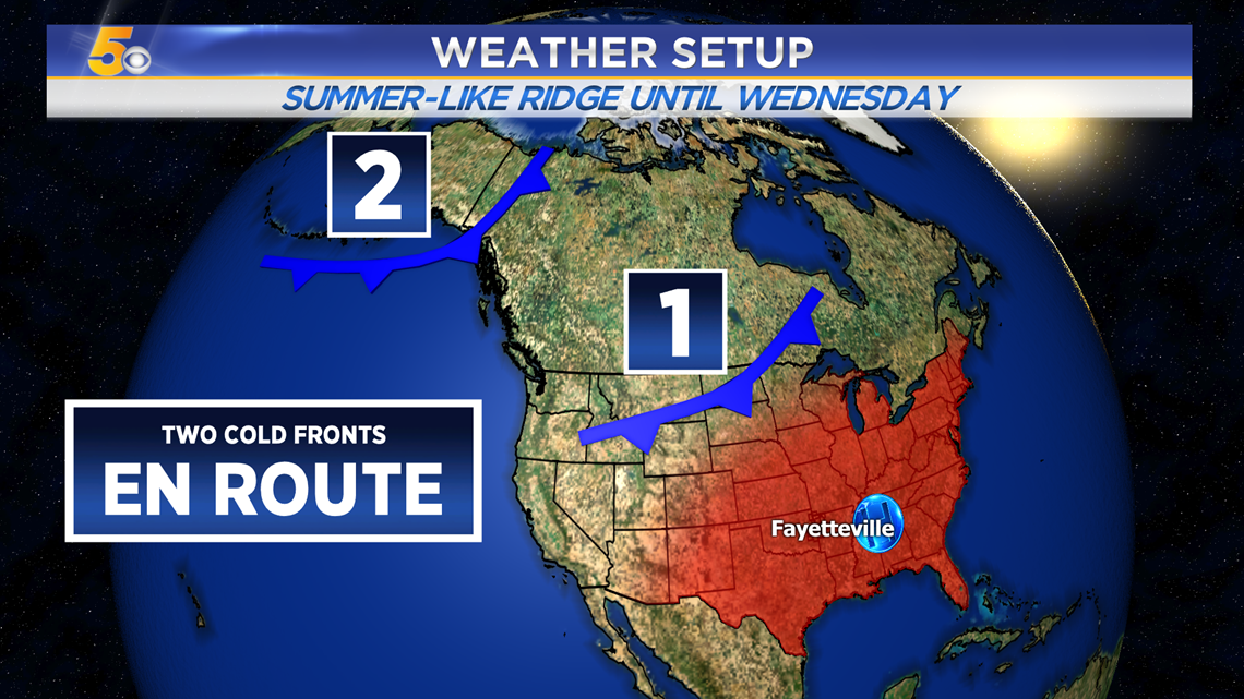
No rain expected the next couple of days as high pressure holds on. Two cold fronts will come in with rain chances and cooler weather, the first one arrive Thursday morning, and the second arriving at the end of the coming weekend.

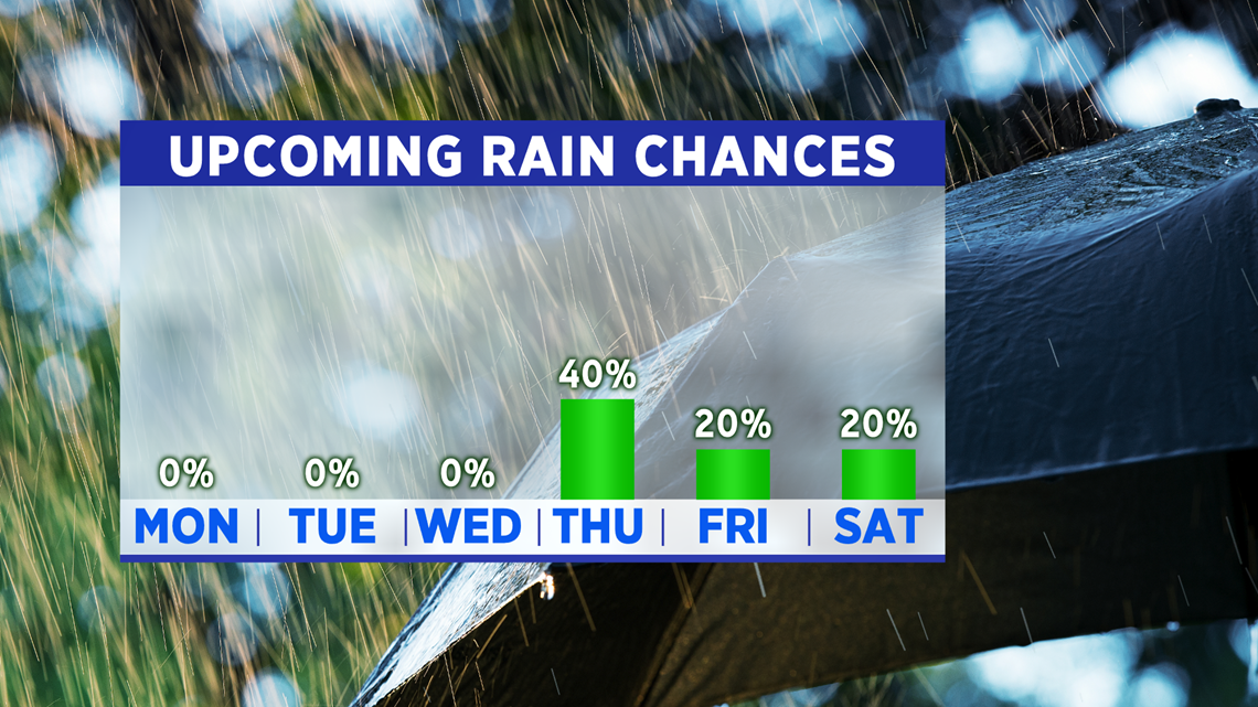
TWO COLD FRONTS EN ROUTE

-Matt