
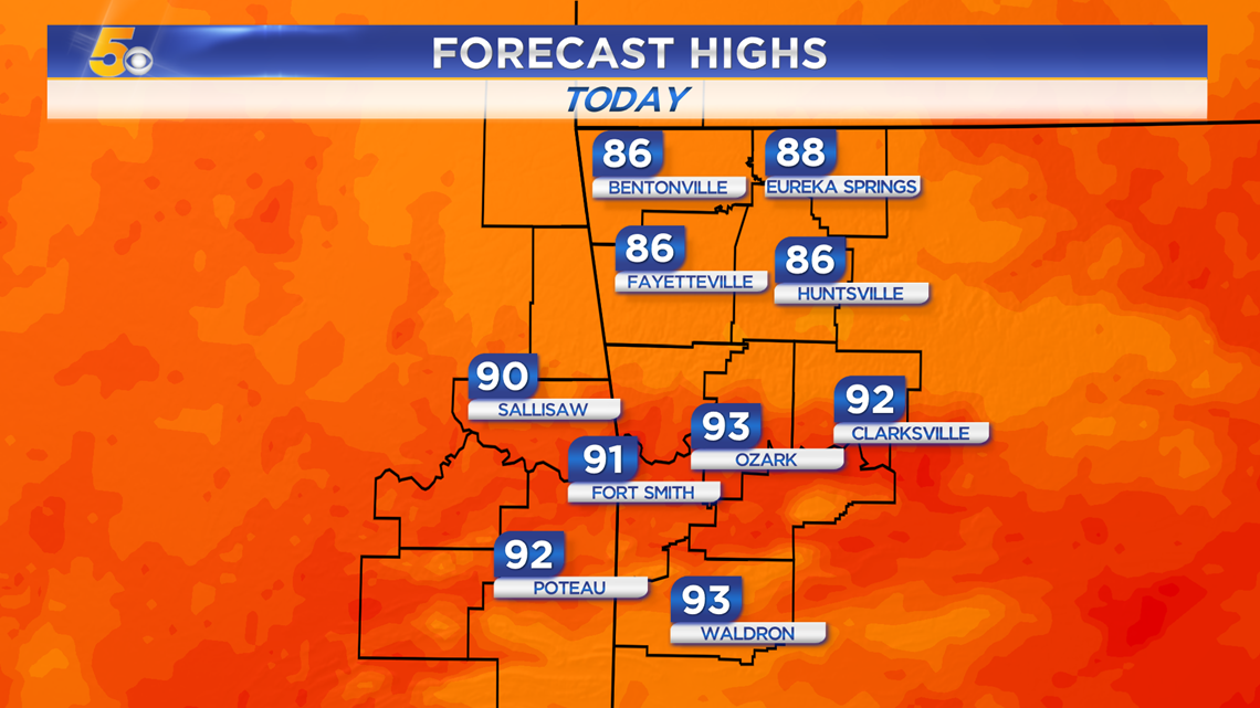
Wednesday will be the last day of solid heat thanks to southerly winds holding from 5-15 MPH under mostly sunny skies. Our first front from a series of fronts will arrive by Thursday afternoon, starting to drop temperatures heading into the weekend.
VIDEO FORECAST

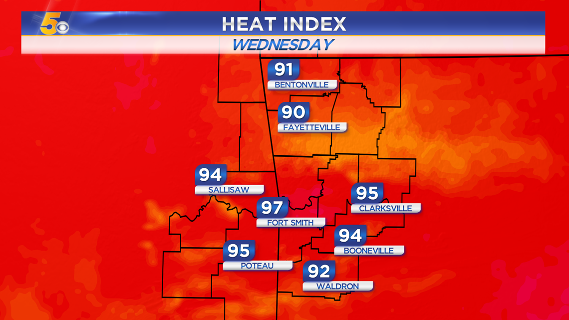
HEAT LINGERS WEDNESDAY
Northwest Arkansas: Mid 80s (Heat index low 90s)
River Valley: Low 90s (Heat index mid 90s)
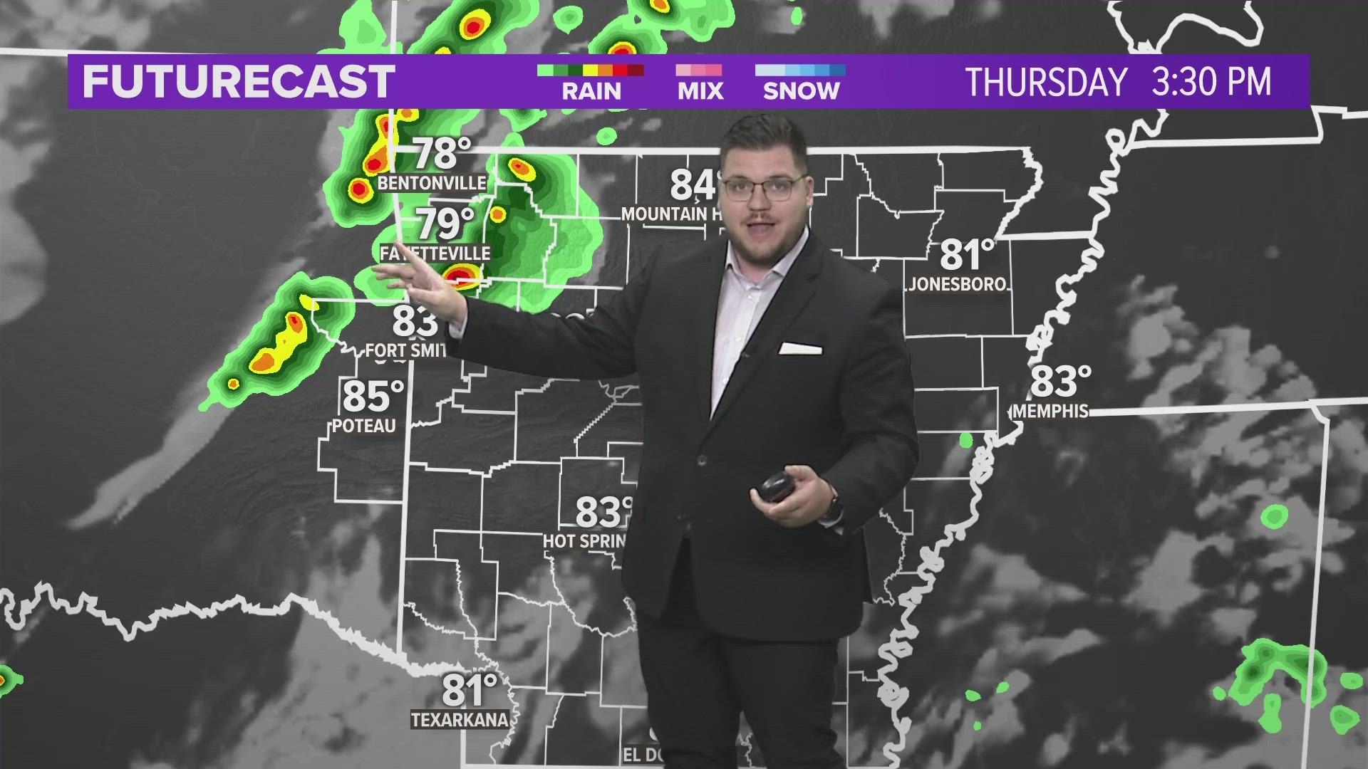
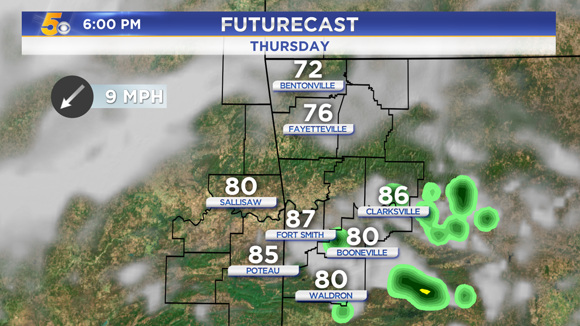
Cooler air along with showers will stay north of Arkansas and eastern Oklahoma today but will start to arrive Thursday.
Maximum Heat Index Wednesday Afternoon
SERIES OF COLD FRONTS
Front #1 - Arrives Thursday afternoon with most of the affects felt by Friday. Highs will drop into the upper 70s and low 80s.
Front #2 - Arrives Sunday night into Monday with much cooler air as highs will drip into the upper 60s and low 70s.

As the front dives south on Thursday, a stray shower will be possible.

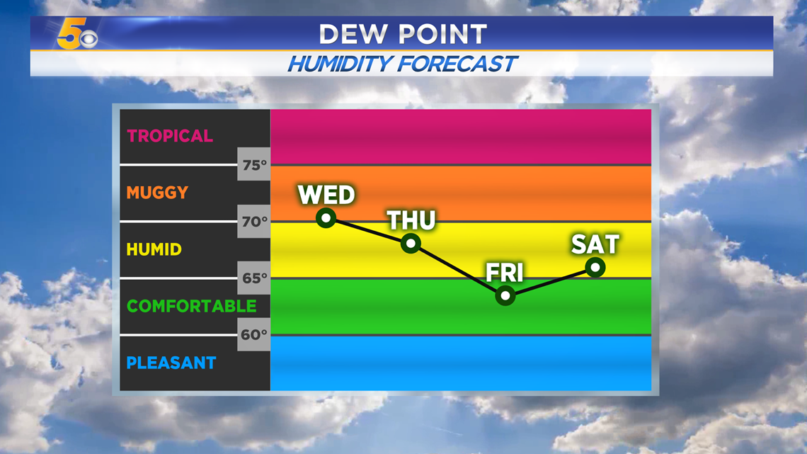
The humidity will drop as the fronts slide through because northerly winds will cut us off from Gulf moisture.

-Matt