An active end to the week is underway. Our next cold front is approaching bringing chances for showers and storms with much colder air behind it.

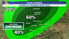
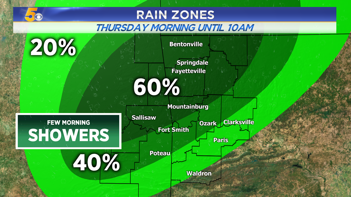
-Thursday Morning: Few downpours and some lightning until 10AM
-Thursday Evening: Strong-to-severe storms
-Thursday Night: Leftover showers and becoming windy
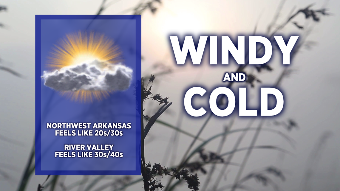
-Friday: Cold and windy
VIDEO FORECAST
THURSDAY MORNING SCATTERED DOWNPOURS
A complex of showers and storms in eastern Oklahoma will move north and east into the northern River Valley (mainly north of the Arkansas River) and eventually into the mountains and Northwest Arkansas. Dry conditions will return by 10AM.
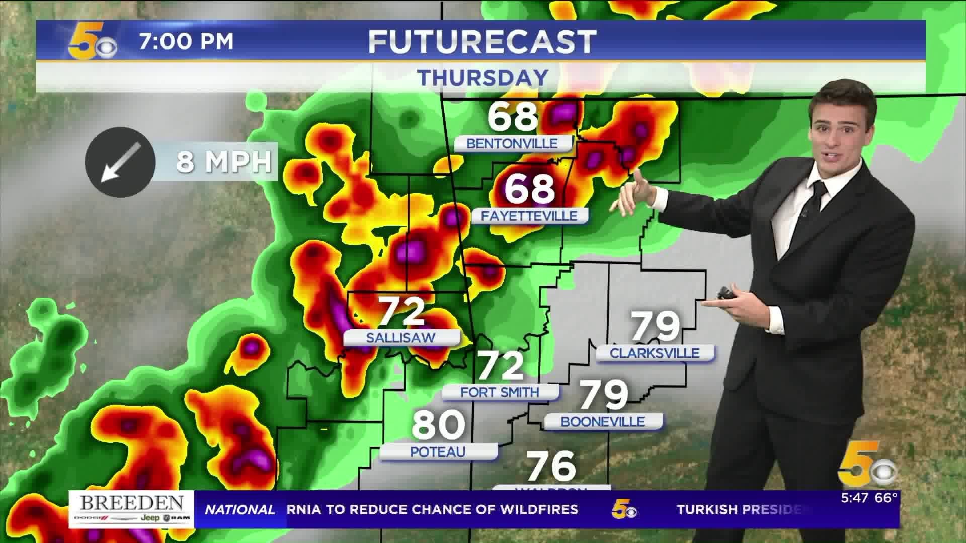
THURSDAY LATE AFTERNOON / EVENING
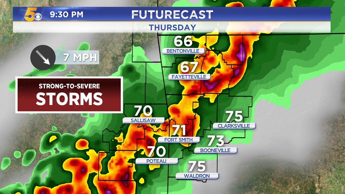
A powerful cold front will swing through later on Thursday, sparking strong storms (some could turn severe) in eastern Oklahoma and then marching into western Arkansas. Hail and gusty winds are the main threat, as well as frequent lightning. If storms linger over the NWA metros, flash flooding could be a concern because the ground is still saturated.
Main Timing For Downpours And Lightning
Northwest Arkansas: 3PM-10PM
River Valley: 6PM - 2AM

The strongest storms will roll through from 7PM-11PM.
COLD AIR BEHIND THE FRONT
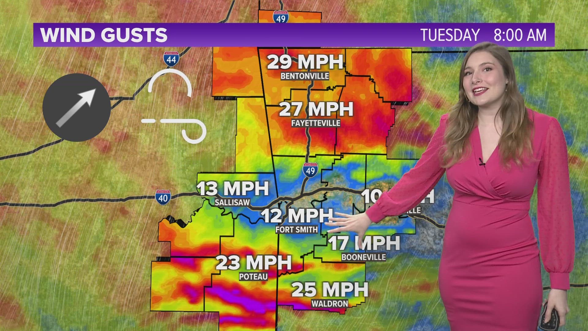
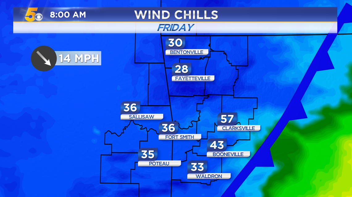
Winds will intensify from the north Thursday night and throughout Friday, bringing in much colder air. We will most likely get our first official wind chill of the season.

Expected Wind Chills Friday Morning
-Matt