A nice Sunday will allow for an environment conducive for severe weather overnight. Strong to severe storms are possible after midnight.
VIDEO FORECAST
SUNDAY FORECAST
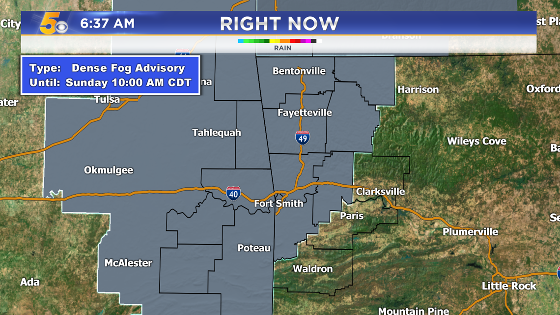
A dense fog advisory has been issued for most of our area. Fog will continue to thicken this morning, before it begins to fade mid-morning.

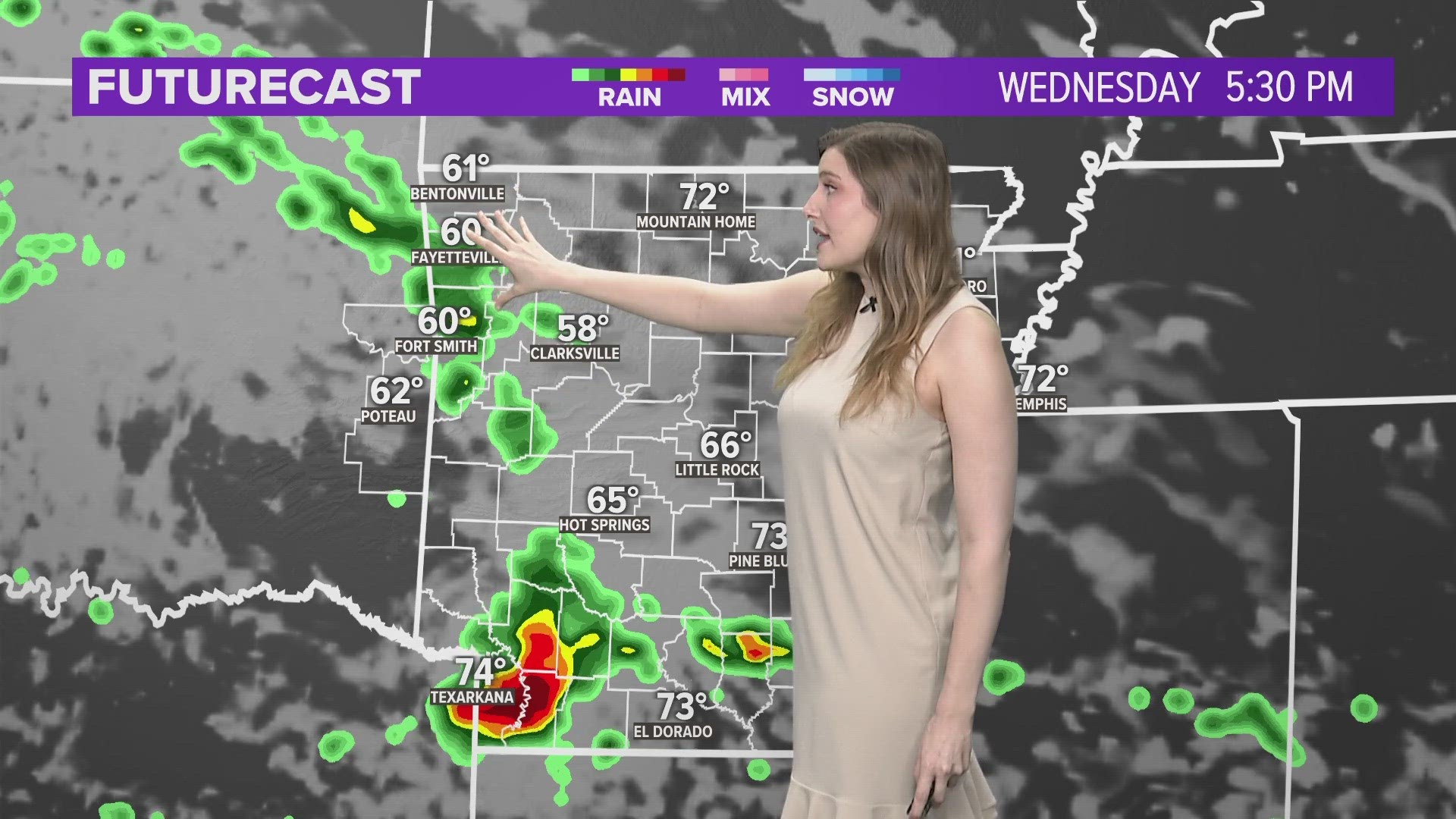
Temperatures warm into the 70s and near 80 degrees today with southerly winds.


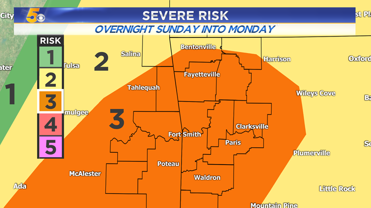
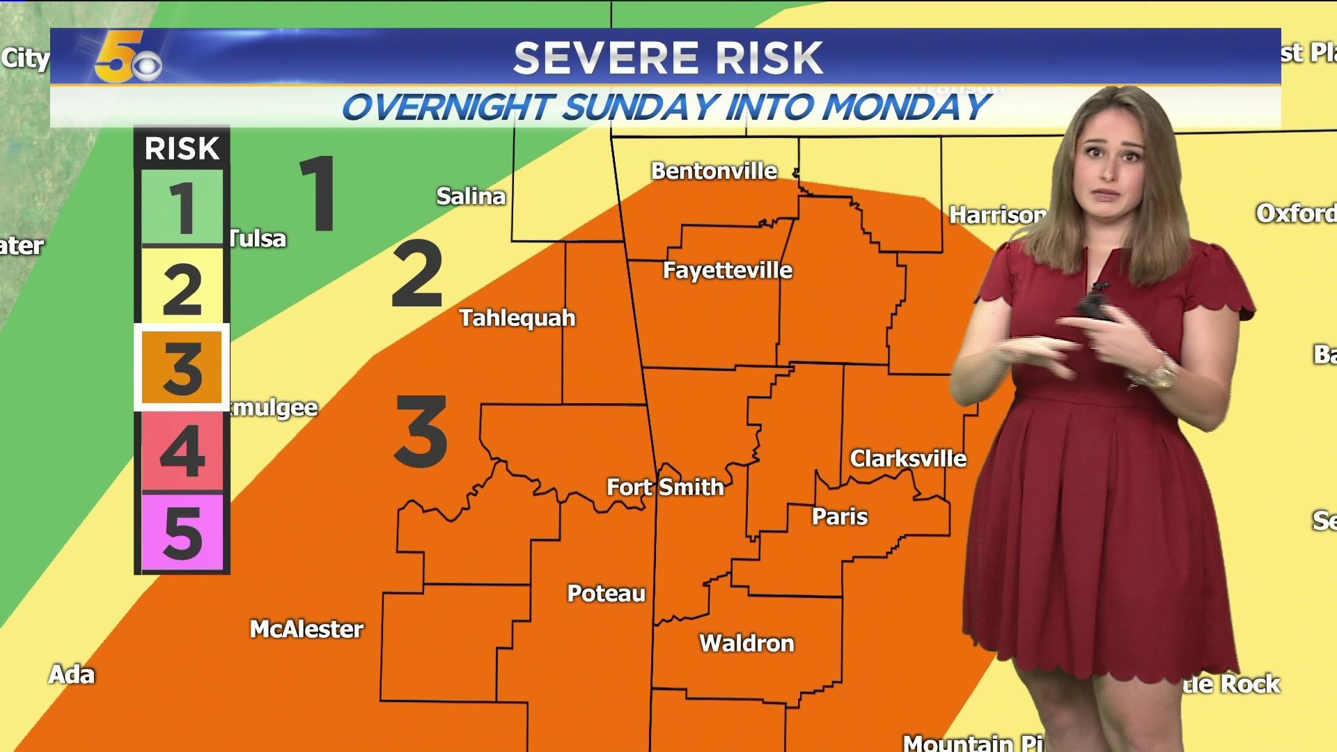
SEVERE THREAT
There's a level 3 out of 5 risk for overnight. Highest threats are damaging winds, large hail, and possible tornadoes.


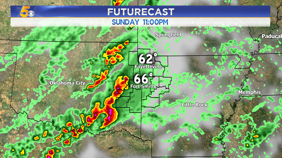
11PM: Isolated supercells could develop in Eastern Oklahoma and develop into a line as it reaches us.

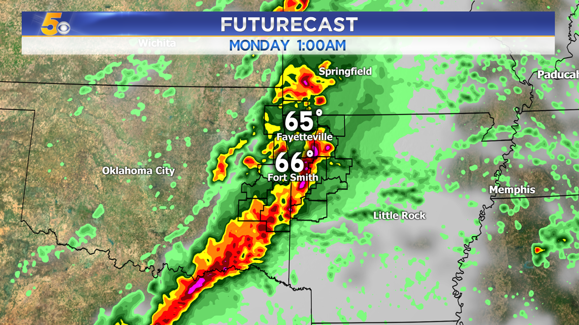
1AM: The strong line of storms will move through around midnight and 1AM. The leading edge will pack the most punch.

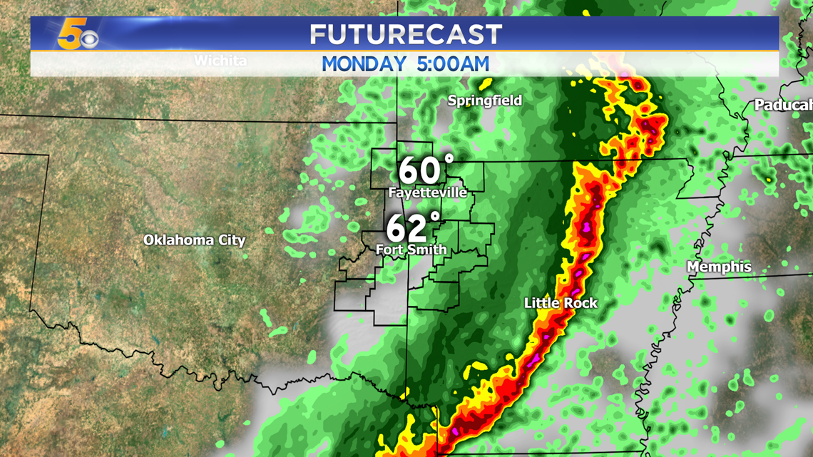
5AM: Strong storms will be east of us, but some rain behind the line is possible for the early part of the morning commute.

-Sabrina