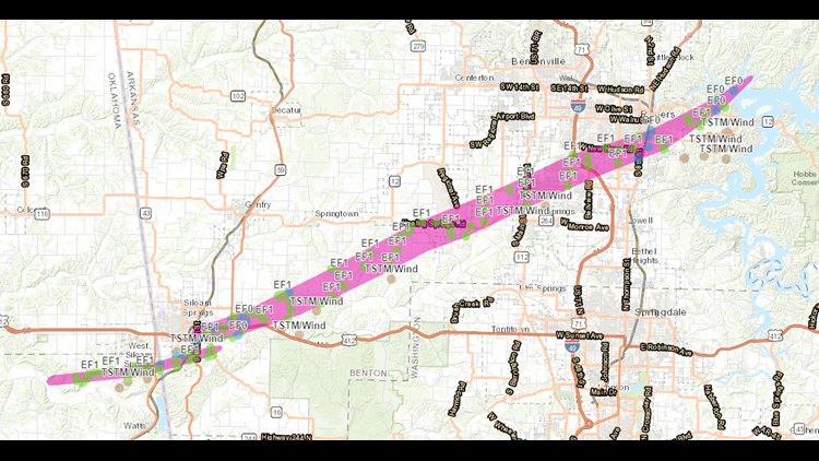

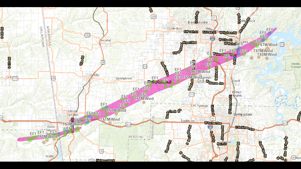
The National Weather Service has released a detailed track of the two tornadoes that hit Benton County early on October 21st. The width of the second tornado was 1.5miles wide; the second widest in state history.
The EF2 damage was documented in NE Siloam Springs while the remainder of the track across Highfill, Cave Springs, & Rogers was EF1.
Each dot represents a surveyed location and what the NWS found at that location.
-Garrett