
A powerful Arctic cold front will move across all of NW Arkansas and the River Valley during the day Monday with temperatures free-falling during the daytime hours.
Rain will be likely for the morning drive but temperatures will continue to be above freezing early in the day.
By the late-morning or early afternoon, rain will start to change over to snow with a transition to all snow by the afternoon.
Accumulations are likely in NW Arkansas but warmer ground temperatures will limit traffic issues to bridges and overpasses.
All precipitation will be out of the area by evening.
Wind chill values on Tuesday morning will be in the single digits with blustery northwest winds up to 35mph and air temperatures in the teens and low 20s.
Here's how it plays out hour-by-hour...
MONDAY 8AM: Scattered showers will continue to be underway for the morning drive. Temperatures will be above freezing initially.
MONDAY NOON: Rain will be mixing with snow in NW Arkansas with temperatures near freezing.
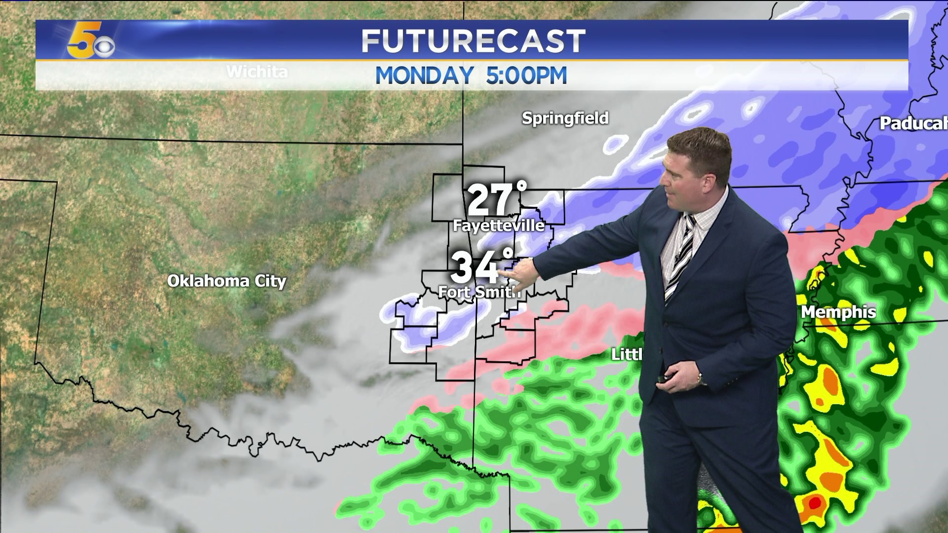
MONDAY 3PM: Snow will be likely across Northwest Arkansas with rain mixing with snow farther south in the River Valley. A few slick spots could develop on bridges and overpasses.
MONDAY 6PM: Rain and snow will all shift east out of our area into the evening with bitterly cold temperatures filtering in for the overnight into Tuesday.
Expect updates throughout the day as the weather situation unfolds.
-Garrett