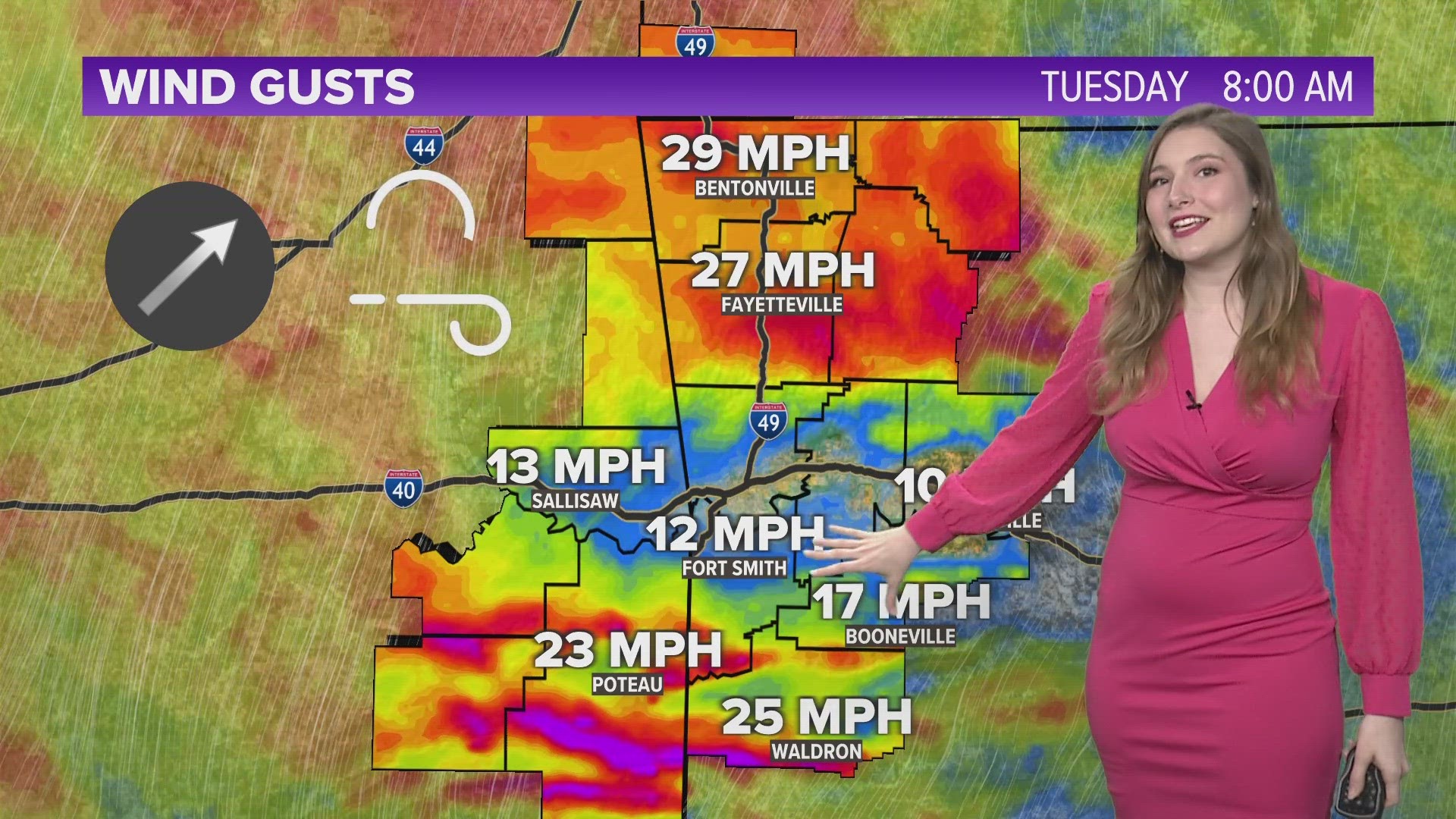
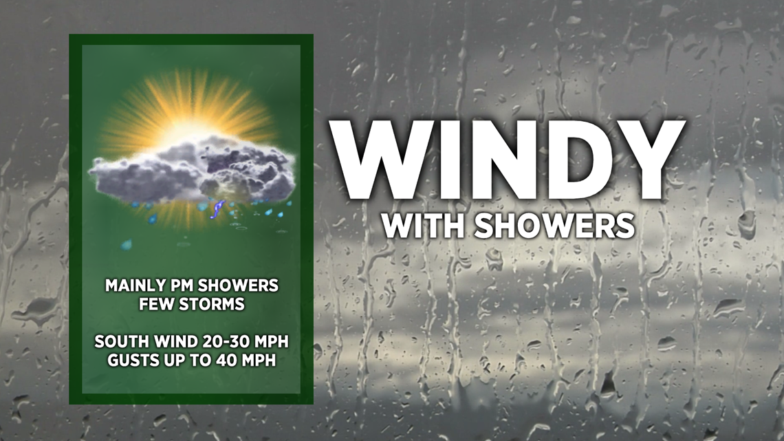
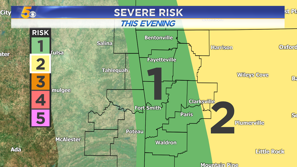
A strong low pressure system is intensifying towards our north. We’re in the “warm sector” which means we’ll have gusty southerly winds and shower chances today. As the cold front approaches, we may get a few rumbles of thunder with the heavier batches of rain. A Level 1 Severe Risk is in effect for most of us this afternoon and evening.

VIDEO FORECAST

SEVERE CHANCES
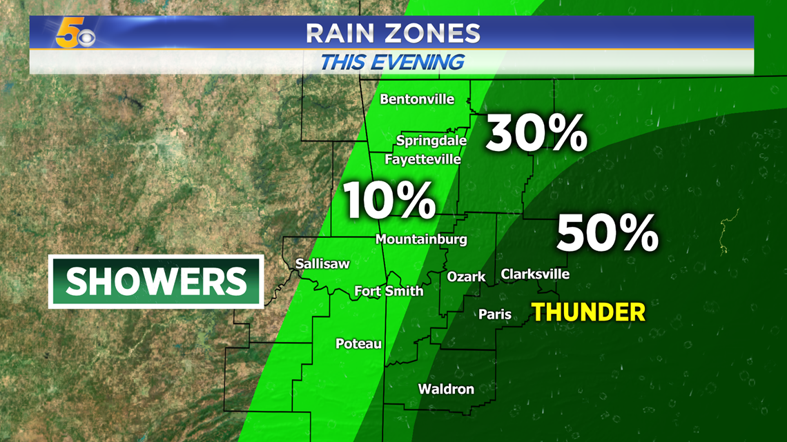
Showers will head northeastward and strengthen this afternoon. Some of them will have some gusty winds and lightning, but they'll become much strong farther east of our area in parts of central Arkansas. The best timing for thunder in Northwest Arkansas and the River Valley will be from 4-8PM.

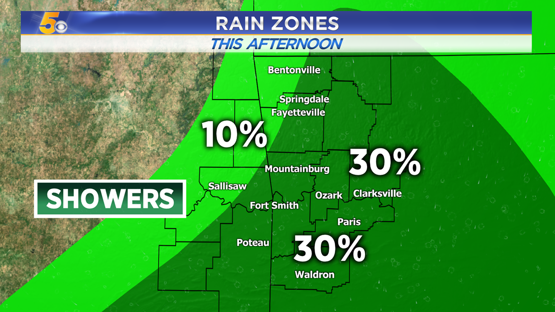
RAIN ZONES
Late Morning: Most of us will stay dry in the morning but a quick sprinkle is possible before heavier showers arrive in the afternoon.

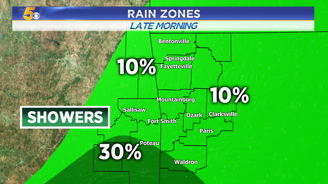
Afternoon: Showers will continue to spread north and west.

This Evening: Showers become stronger as they push east and a few may turn into weak thunderstorms. Rumbles of thunder will be possible, especially in the River Valley.

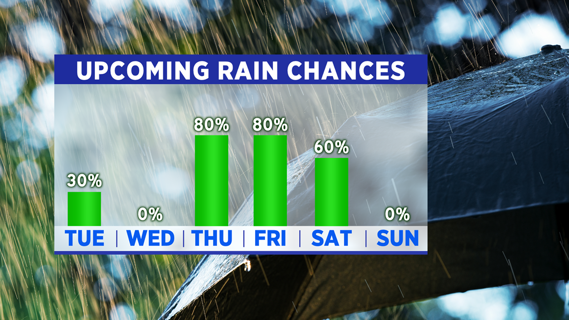
MORE RAIN AHEAD
Heavy rain will move in for Thanksgiving, Black Friday, and Saturday.

-Matt