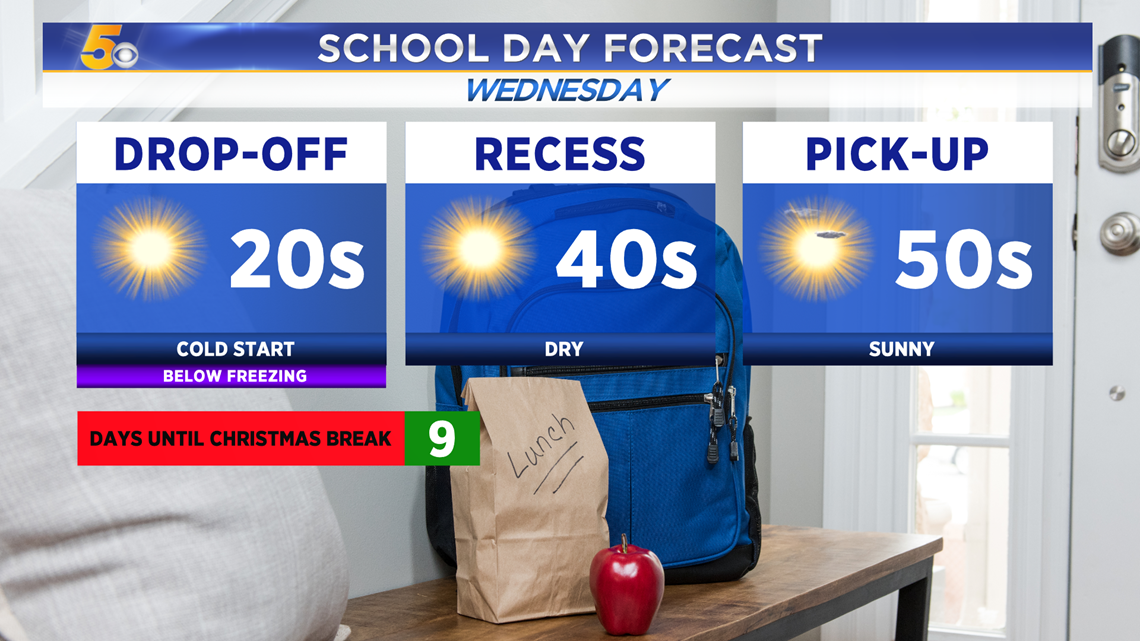
A cold start on Wednesday will turn into a cool but sunny afternoon. Highs will reach near 50 degrees by 1-2PM. We’ll stay fairly dry the next few days. On-and-off clouds will return by Thursday and last into the weekend. Our next chance for precipitation arrives Sunday. A wintry mix is possible for some.


VIDEO FORECAST

COOL WEDNESDAY
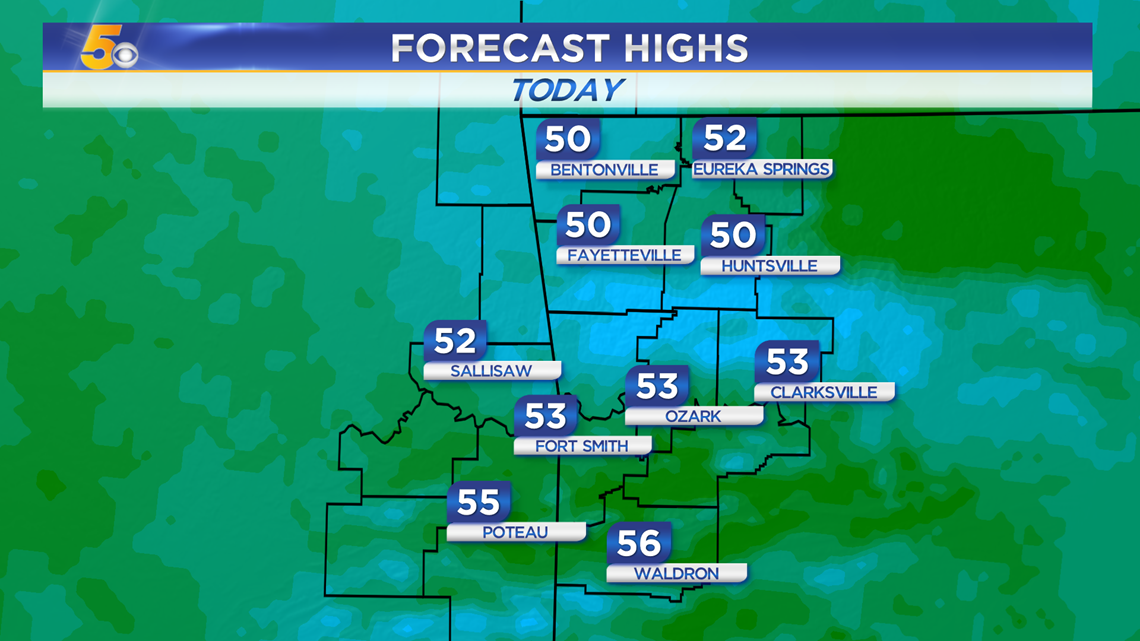
Once the sun lifts above the horizon a bit, we'll quick warm up into the upper 40s and low 50s this afternoon with mostly sunny skies.

Wednesday Highs

LOOKING AHEAD
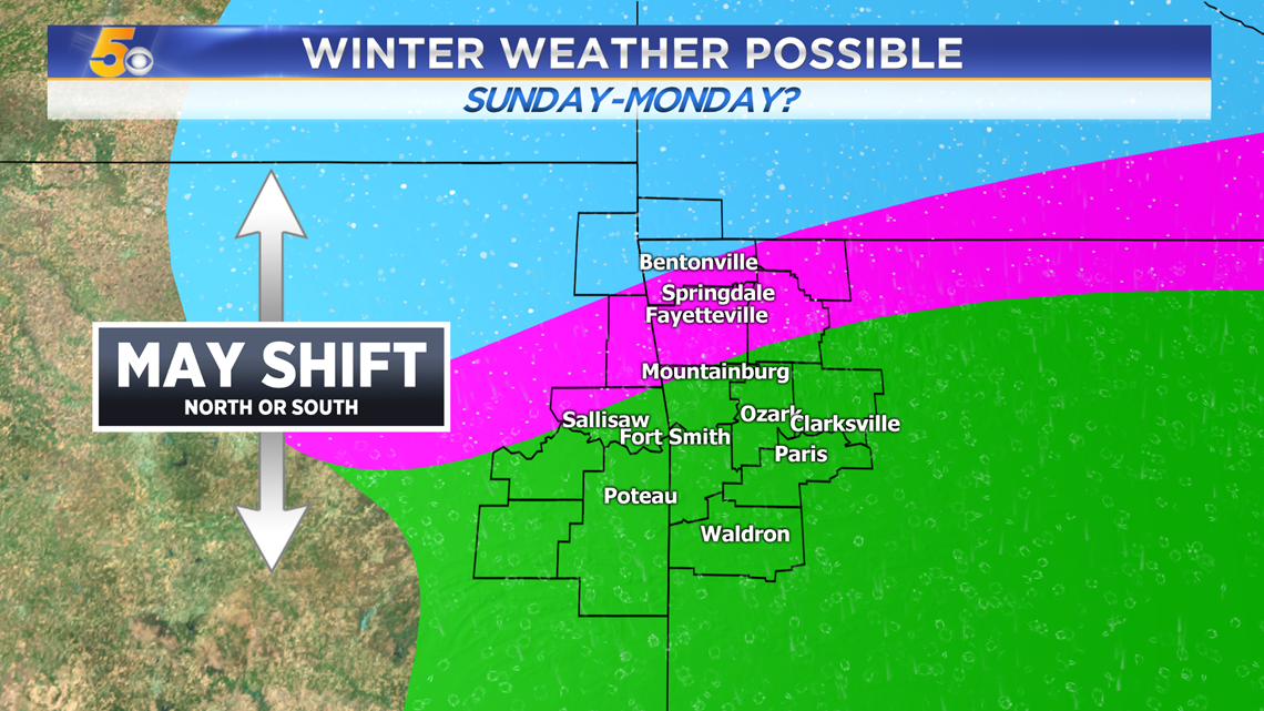
We should stay mainly dry the rest of the week! By Thursday and Friday a weak upper level disturbance arrives but there should not be enough moisture return to squeeze any showers out. Much better chances for precipitation arrive by Sunday and Monday.

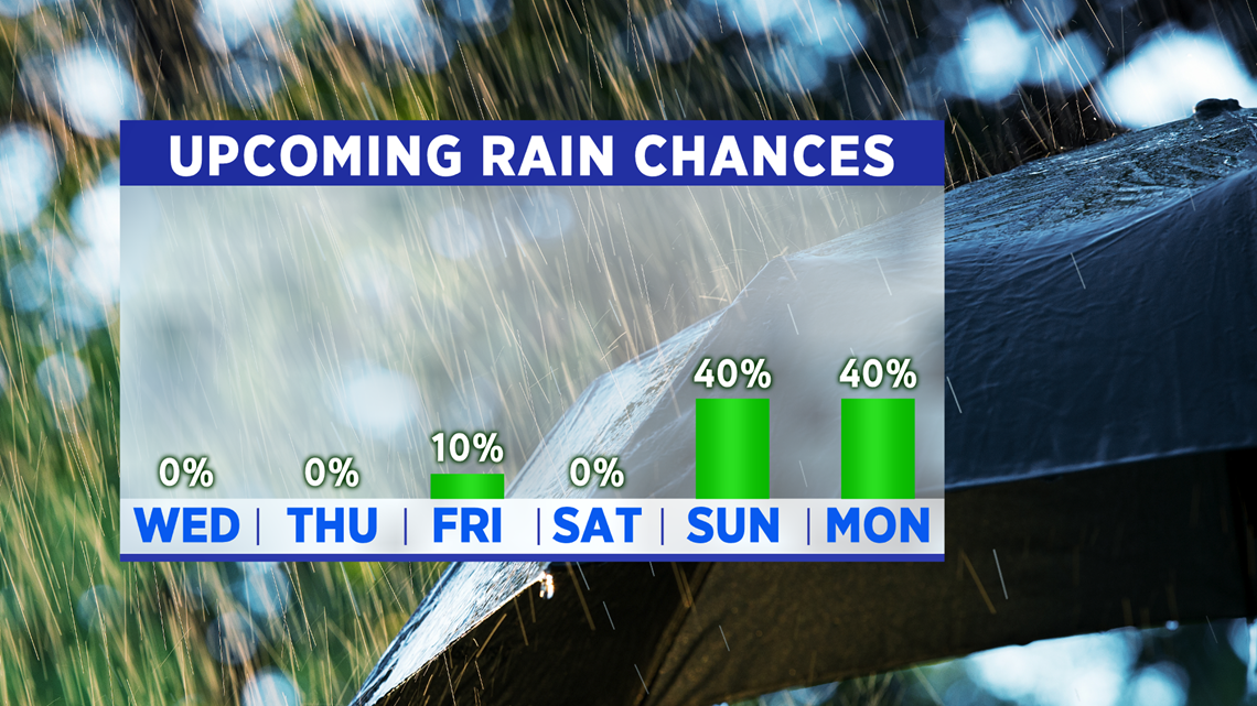
Wintry weather may cause slick spots Sunday night as temperatures near the freezing mark. This forecast will change over time.

-Matt