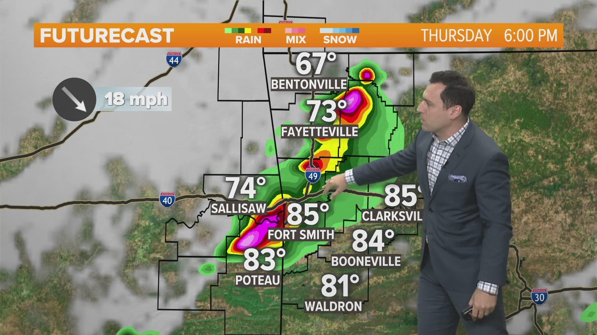
FRIDAY STORMS
A few showers on Friday morning will head to bouts of heavy rain and scattered storms Friday afternoon. After sunset, a line of strong storms will develop in Oklahoma and march east towards the AR-OK state line. Damaging winds are likely with an isolated, small, rain-wrapped tornado possible. There could be a few locations with hail.

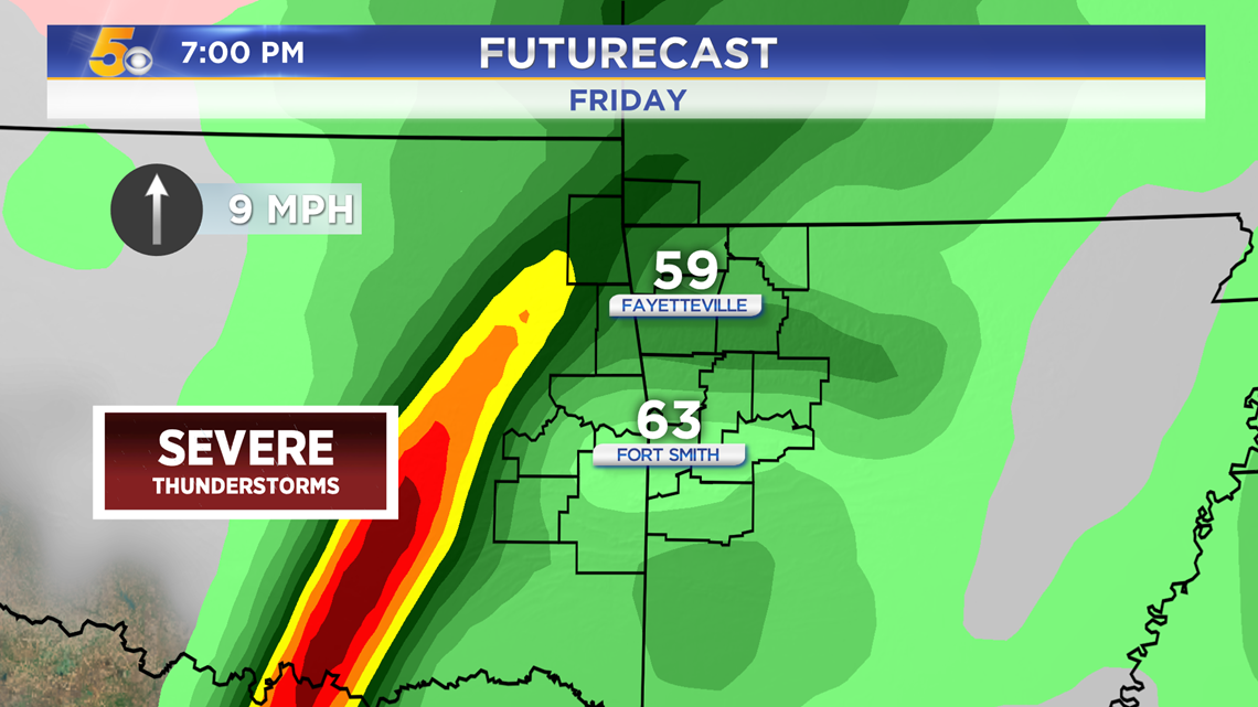
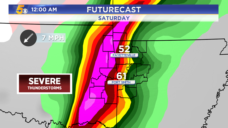
The line of severe storms will cross the state line after 10PM, hitting both Northwest Arkansas and the River Valley.

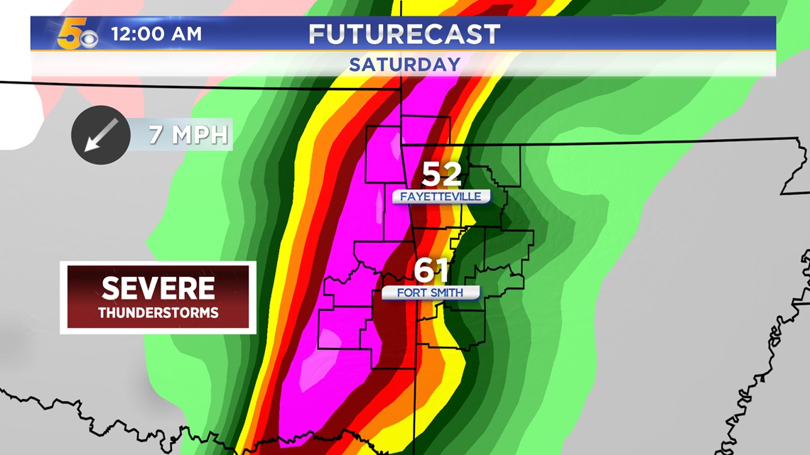
The strongest storms are likely to impact the River Valley with a Level 3 Severe Risk (Enhanced) mainly south of I-40. Fort Smith and areas north into NWA are under a Level 2 (Slight).

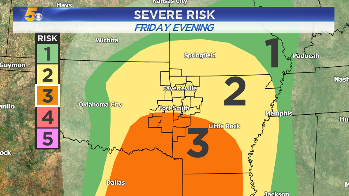
The greatest threat will be damaging winds as the main line swings through Friday night. A brief tornado is possible, as well as some pockets of hail. The flash flooding threat is now increasing with rainfall amounts possible over 2 inches.


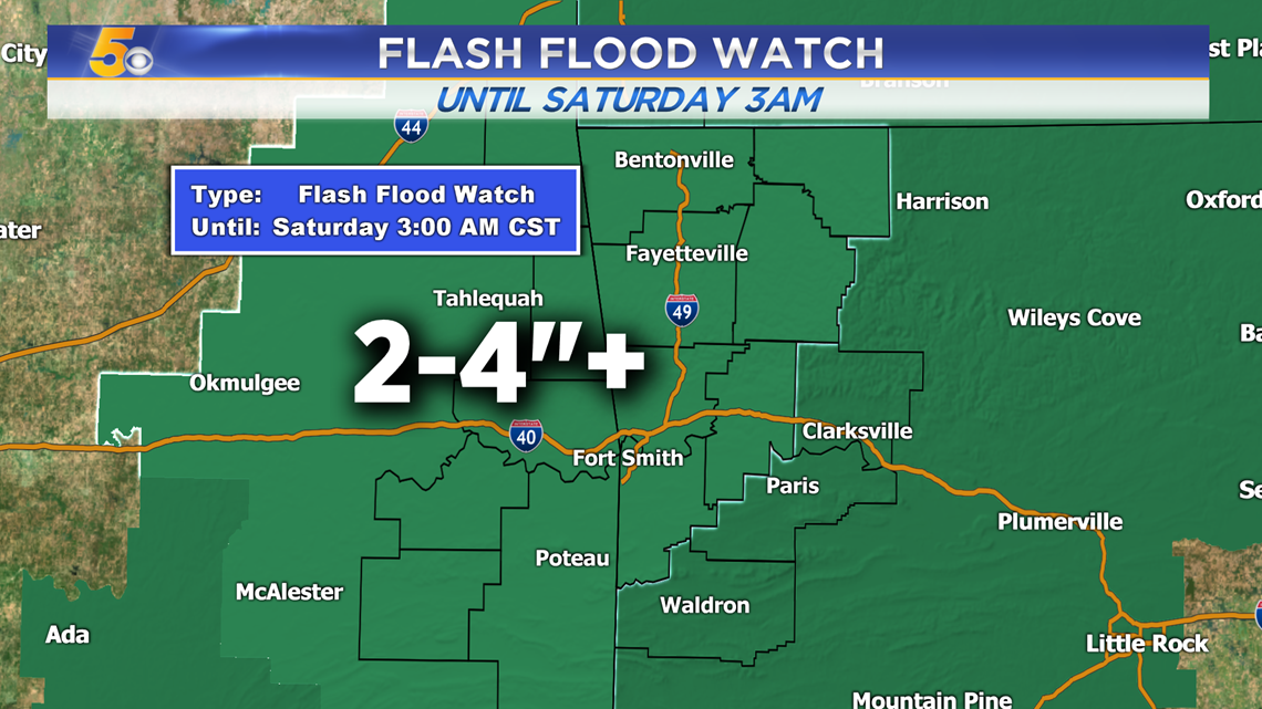
Flash Flood Watch: Friday Morning – Saturday 3AM
Two to four inches of rain (or more) are likely to fall.

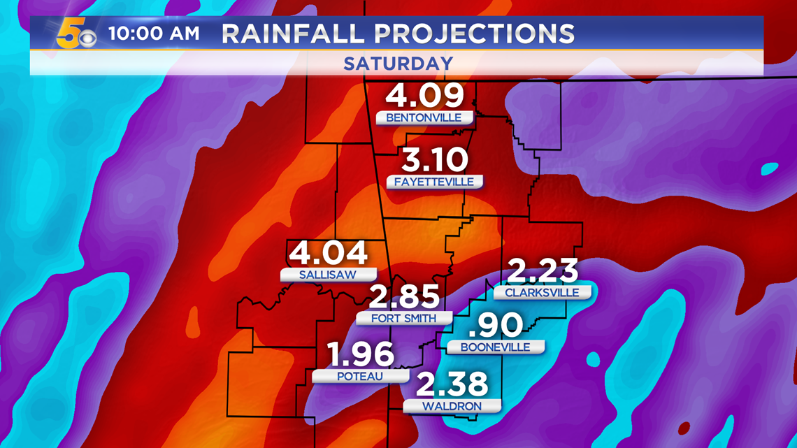
Rainfall Projections:

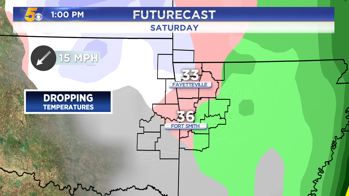
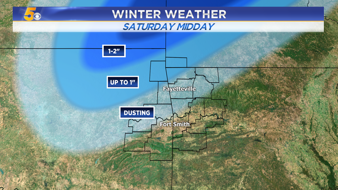
SATURDAY SNOW?
There may be a quick round for flurries with sleet. The best chance for snow will be in NWA and eastern Oklahoma.

Snowfall Projections:
-Changes likely moving forward-

-Matt