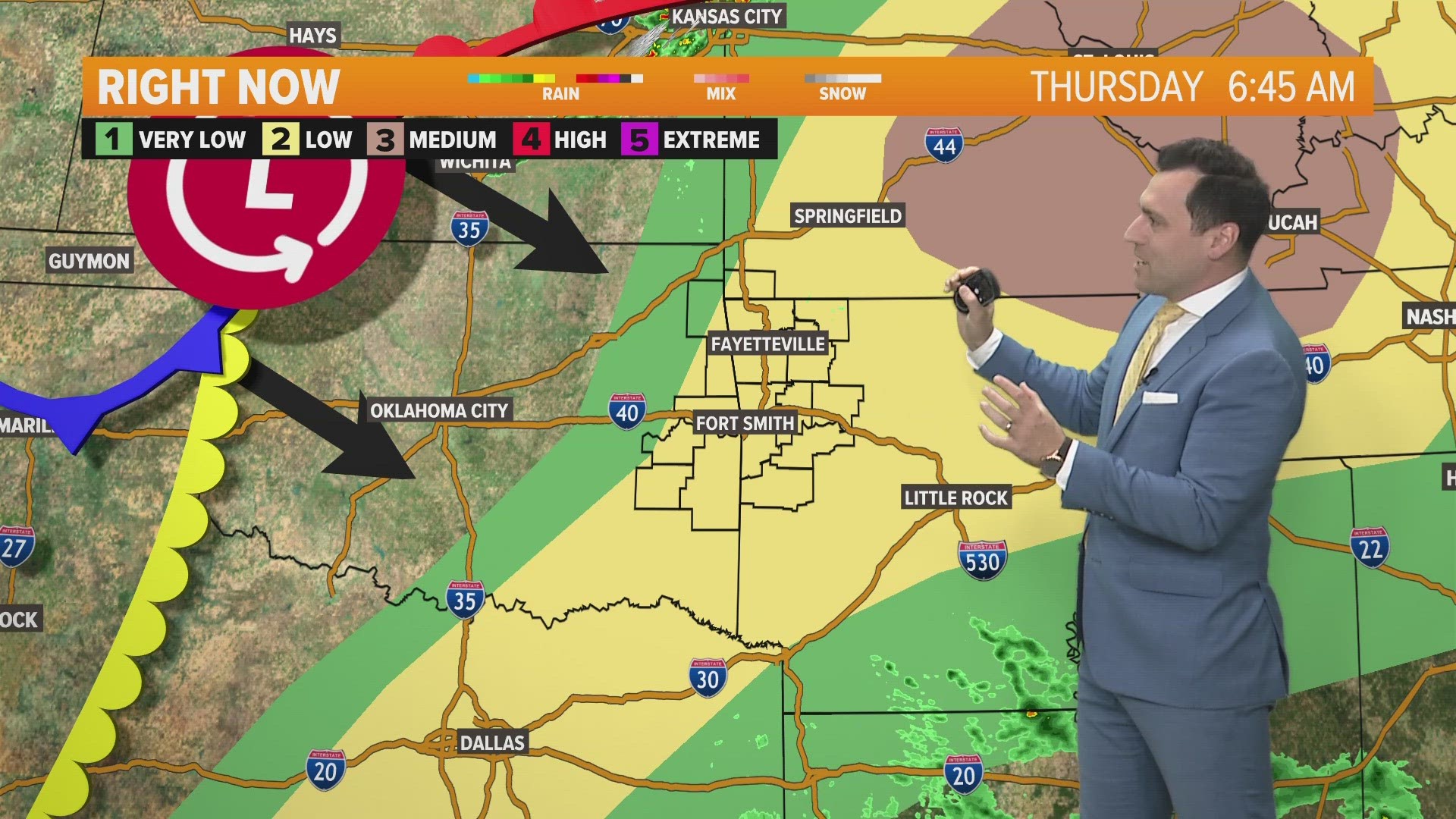
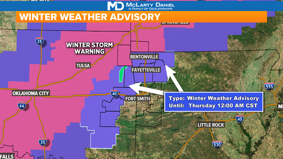
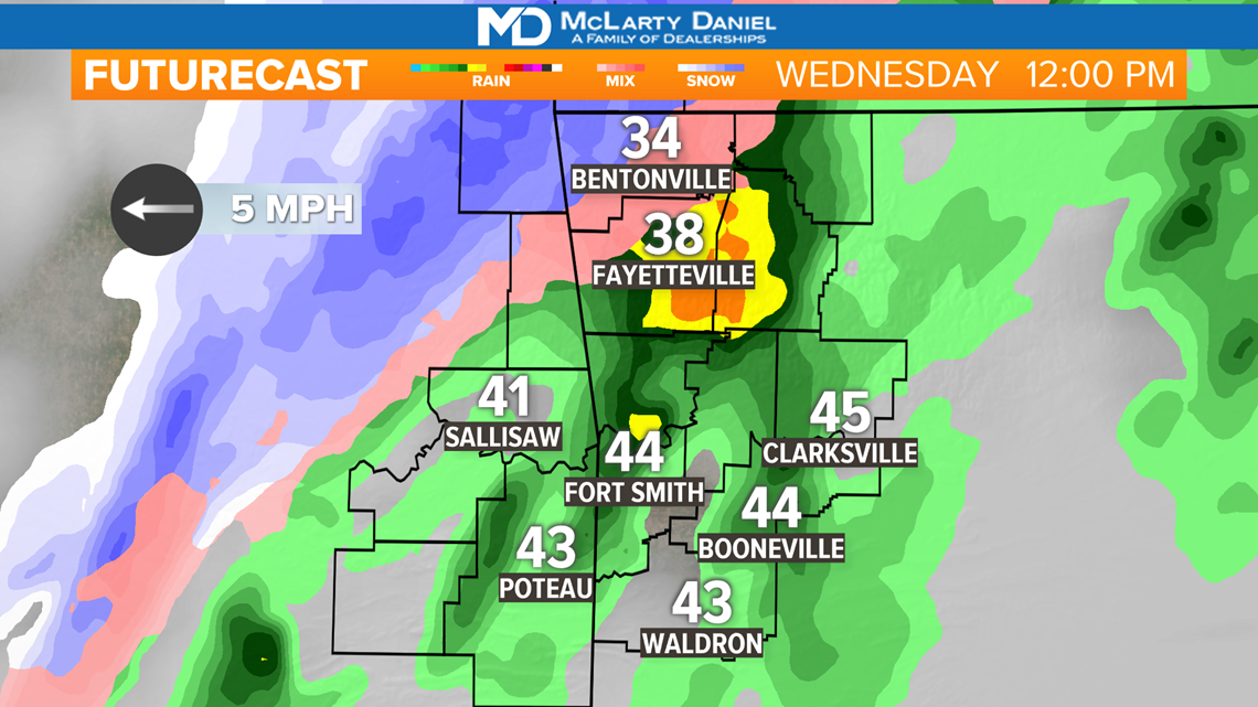
A winter storm is pushing through the Plains and Ozarks today. A wintry mix of rain/sleet/snow is falling in Northwest Arkansas and parts of eastern Oklahoma, while a cold rain soaks the River Valley. The rain-snow line will slowly move east throughout the day as temperatures cool.

VIDEO FORECAST
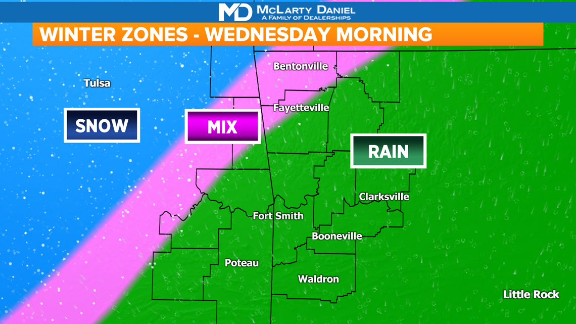
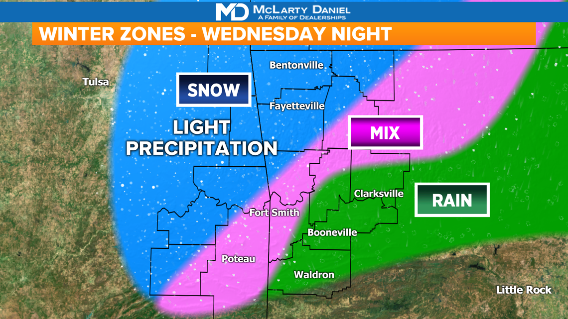
WINTER ZONES
The rain-snow line will slowly creep east into Arkansas throughout the day. The faster it does, the more snowfall we could receive. The majority of snow will fall in Oklahoma however.
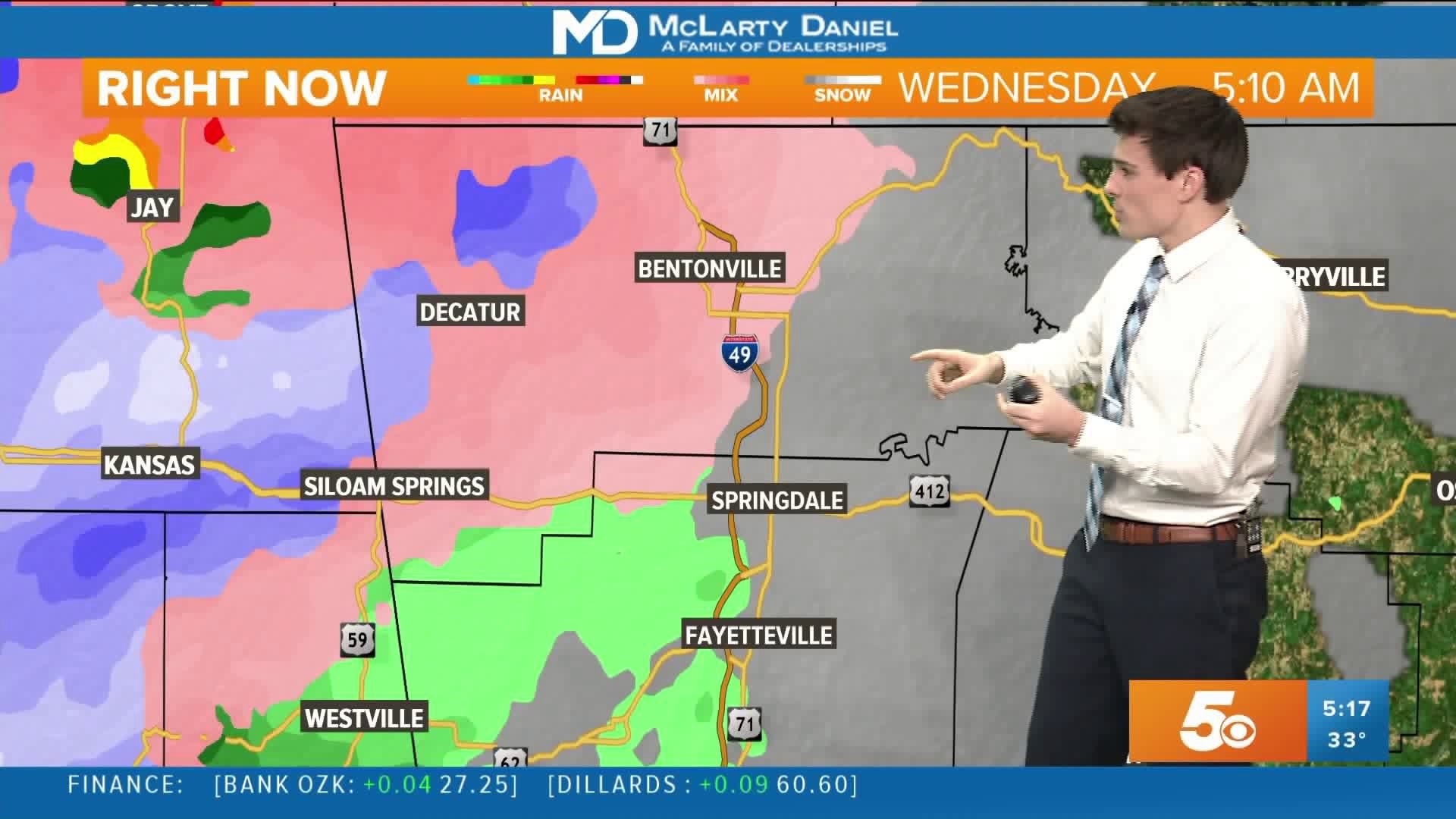
WEDNESDAY MORNING: We'll get cold rain with some sleet and snowflakes mixing in as well. Heavy snow will lie just west of the AR-OK state line.

WEDNESDAY AFTERNOON: More chances for a wintry mix and even some snow will move in from the west as temperatures try to fall by a degree or two.


WEDNESDAY NIGHT: Light flurries and sleet will wrap up the night into Thursday morning. A quick dusting for locations that were snow-free throughout the day will be possible.

SNOWFALL FORECAST
A dusting is possible for many of us in NWA and eastern Oklahoma, while heavier snow could set up along AR-59 in western Benton County. These snowfall ranges may move east or west based on temperatures throughout the day.

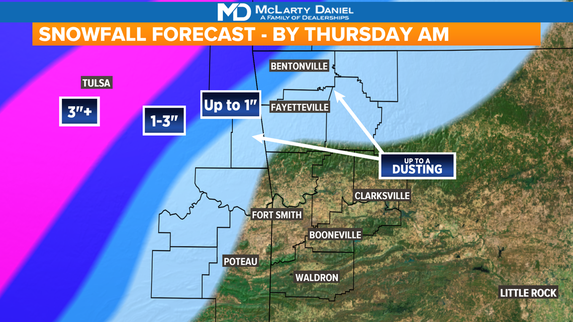
The faster the rain-snow line moves east, the higher snowfall totals will be.

-Matt