Thunderstorms could become strong enough to cause damage, power interruptions and interfere with holiday travel from the eastern Texas Panhandle to the southern parts of Illinois and Indiana and western portions of Kentucky, Tennessee and Alabama Tuesday and Wednesday.
The weather system behind the feisty thunderstorms is the same storm set to produce heavy snow in the Colorado Rockies and a broad area of light to moderate snow over the Upper Midwest on Tuesday.
A major outbreak of severe weather is not predicted. However, some of the storms are expected to bring winds strong enough to knock down trees, trigger power outages and cause turbulence for airline passengers. Brief, torrential downpours associated with some of the storms can create hazards for motorists ranging from excess water on the roads to sudden poor visibility.
A small number of the strongest storms will have the potential to produce large hail and perhaps even spawn a couple of tornadoes.
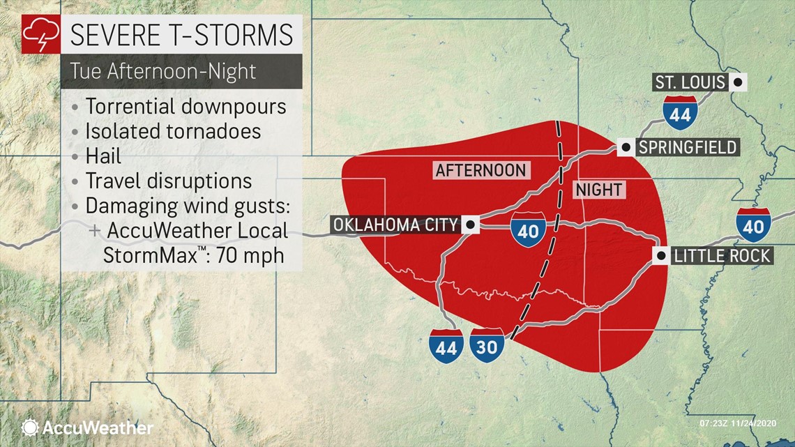
"During Tuesday afternoon and evening, storms are forecast to erupt from northeastern Texas, western Oklahoma and southeastern Kansas to western Arkansas and southwestern Missouri," AccuWeather Senior Meteorologist Brett Anderson said.


Cities at risk for severe weather, power outages and travel delays on Tuesday afternoon and evening include Oklahoma City and Tulsa, Oklahoma; Fort Smith, Texarkana and Little Rock, Arkansas; Springfield and Joplin, Missouri; and Shreveport, Louisiana.
The severe weather threat, including the tornado potential, will remain active during Tuesday night as storms push into northwestern Louisiana, central Arkansas and southwestern Missouri.
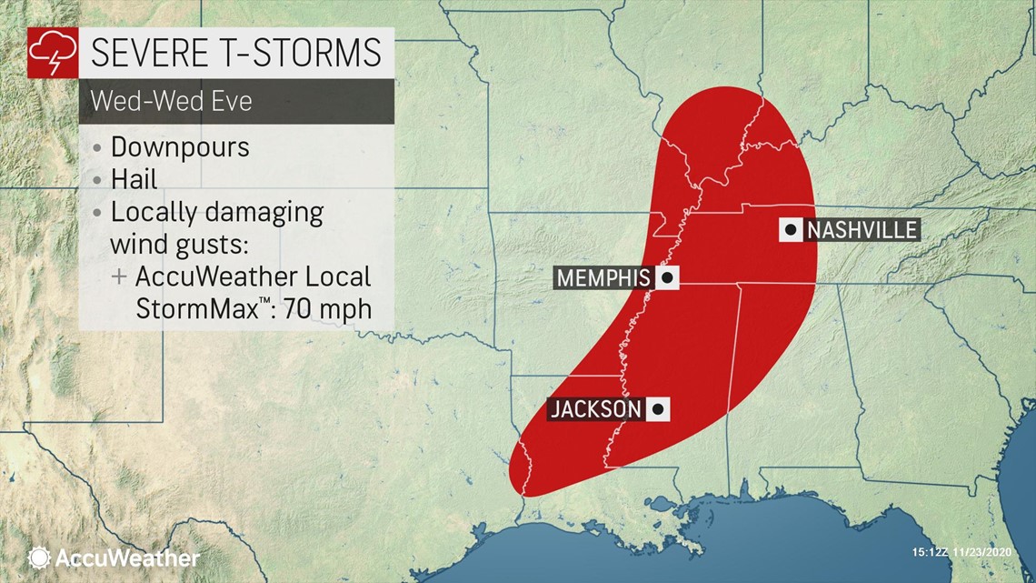
"On Wednesday, the storms are forecast to progress eastward across the Mississippi River and reach portions of southern Illinois, southwestern Indiana, western and middle Tennessee, northern and western Mississippi and northwestern Alabama," Anderson said.


By Wednesday, the storms are likely to become organized into a solid line that will progress from west to east at a steady pace. Strong to severe storms may roll through cities such as Memphis and Nashville, Tennessee; Jackson, Mississippi; Cape Girardeau, Missouri; Huntsville, Alabama; and Paducah, Kentucky, during Wednesday.
Potent storm systems during the autumn can spawn severe thunderstorms. In fact, the fall is considered a secondary peak time for severe weather across parts of the South. This is due to a stark temperature contrast from north to south or west to east, depending on the weather pattern, and the usual presence of a strong jet stream overhead.
There is a chance that another round of severe weather will erupt from Sunday to Monday. However, the severe weather potential is highly dependent on the development of a strong storm system, which may take a path from the southern Plains to the Great Lakes.
Such a scenario could bring violent thunderstorm winds, including the risk of tornadoes, from the South Central states to parts of the Midwest and East. But, if a much weaker storm forms or if no storm system develops at all, no severe weather would occur. Instead, a simple transition to cooler or colder conditions would likely occur.
Regardless of whether or not a a severe weather outbreak occurs by early next week, a round of drenching rain is forecast to evolve along the Gulf Coast from Friday to Saturday. Enough rain is projected to pour down to slow travel and hinder outdoor activities as well as raise the risk of flooding from coastal Texas to Georgia and northern Florida.


