
ARKANSAS, USA — Light snow chances are on the way for parts of Arkansas and eastern Oklahoma! Snowflakes mixed with light showers early Wednesday morning, with more wintry precipitation expected. Tap HERE to track the snow showers coming in from the northwest. In terms of intensity and impacts this is a minor event!
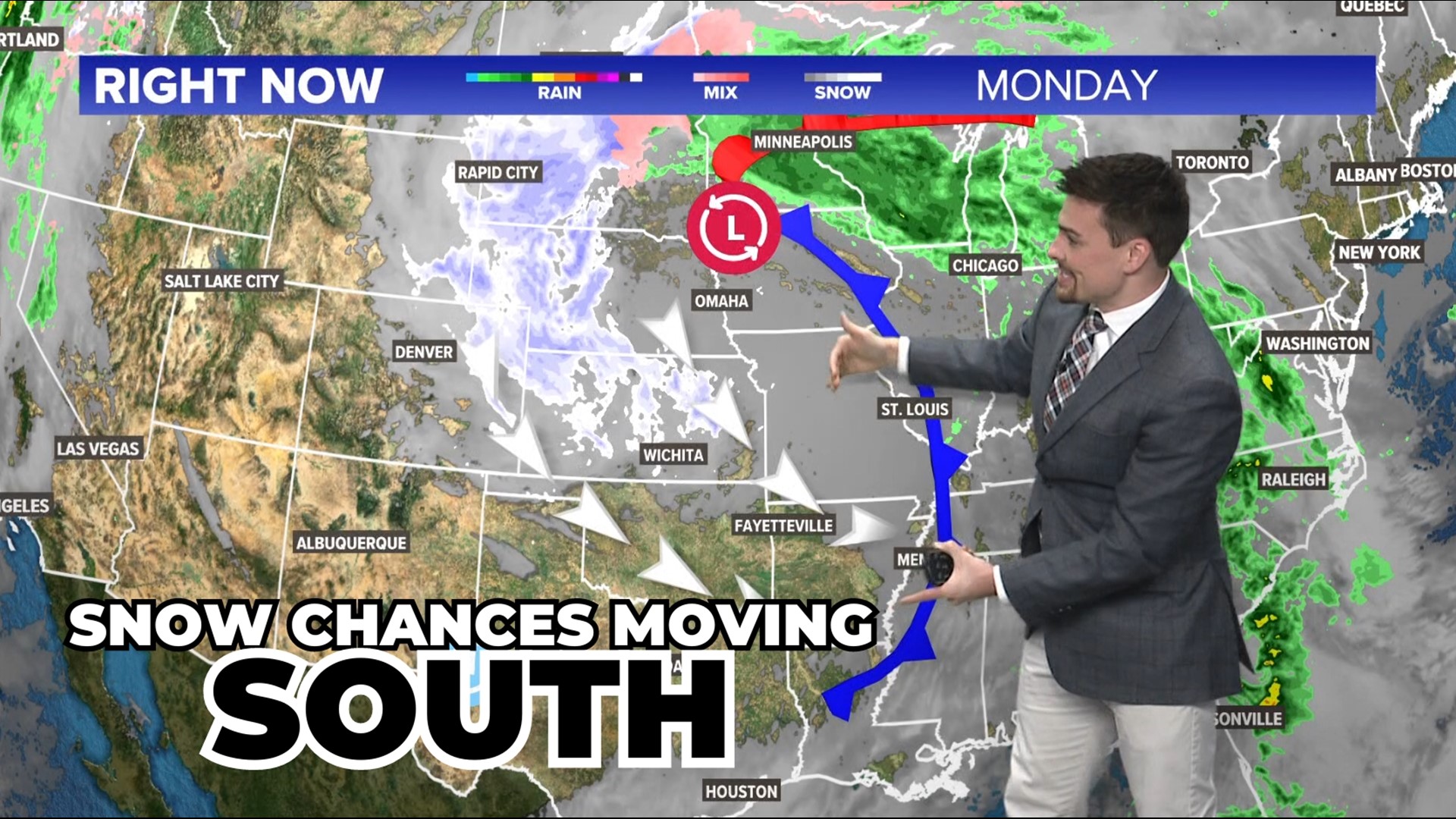
Christmas may not have been white for 2023, but northwest winds are bringing some snow showers for the week between Christmas and New Years. A blizzard hit the northern Plains but some leftover atmospheric energy is driving south toward Arkansas and eastern Oklahoma Wednesday and Thursday. (scroll down for accumulation information)
WEATHER SETUP -- BLIZZARD TO THE NORTH
The placement of surface low pressure and surface high pressure is creating a wind highway across the central United States from Christmas night through Wednesday. These winds have a NW tilt and will help bring more cold air from the snow-covered Plains to Arkansas and Oklahoma.
The cold air has had a head start to get established before the moisture moves in. Temperatures are above freezing here at the surface, but we do not have to go far above our heads to get below freezing. That's why snowflakes are expected to survive the trip from the frigid clouds to the ground.

WHO GETS THE CHANCE FOR SNOW SHOWERS?
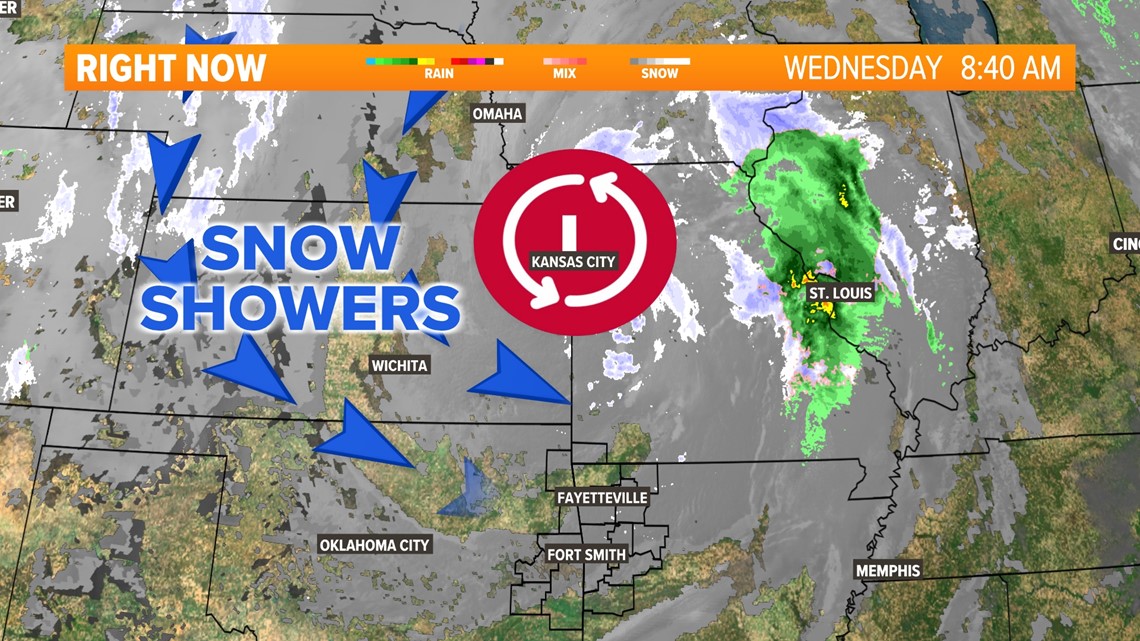
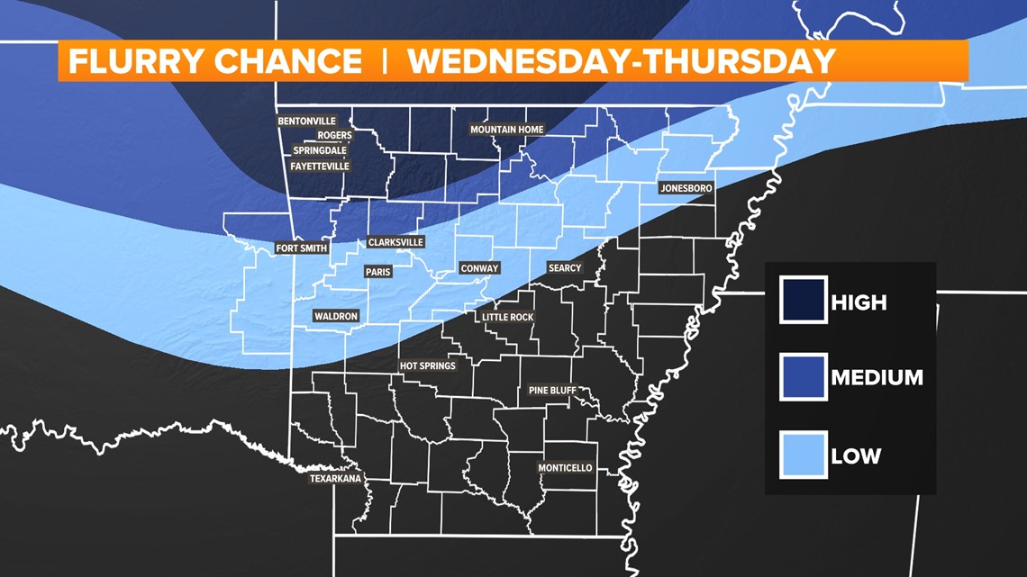
Snow showers will be coming in from the northwest sky. With higher pressure to the south, snow showers will likely break up as they move south. The farther north you live, the colder the temperatures will be and the higher the chance for some on-and-off light snow. NW Arkansas, eastern Oklahoma, the Boston mountains, and north-central Arkansas will have the best chance at seeing some snowflakes. Light snow showers will likely mix with some light drizzle across parts of the River Valley.

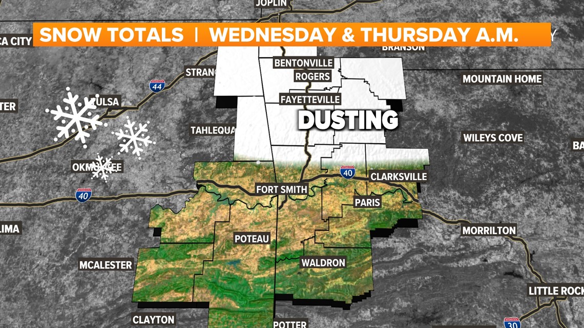
The map below shows the chance for seeing snow showers, not necessarily accumulation. The best chance for seeing snowflakes Wednesday will be in Missouri and northern Arkansas.

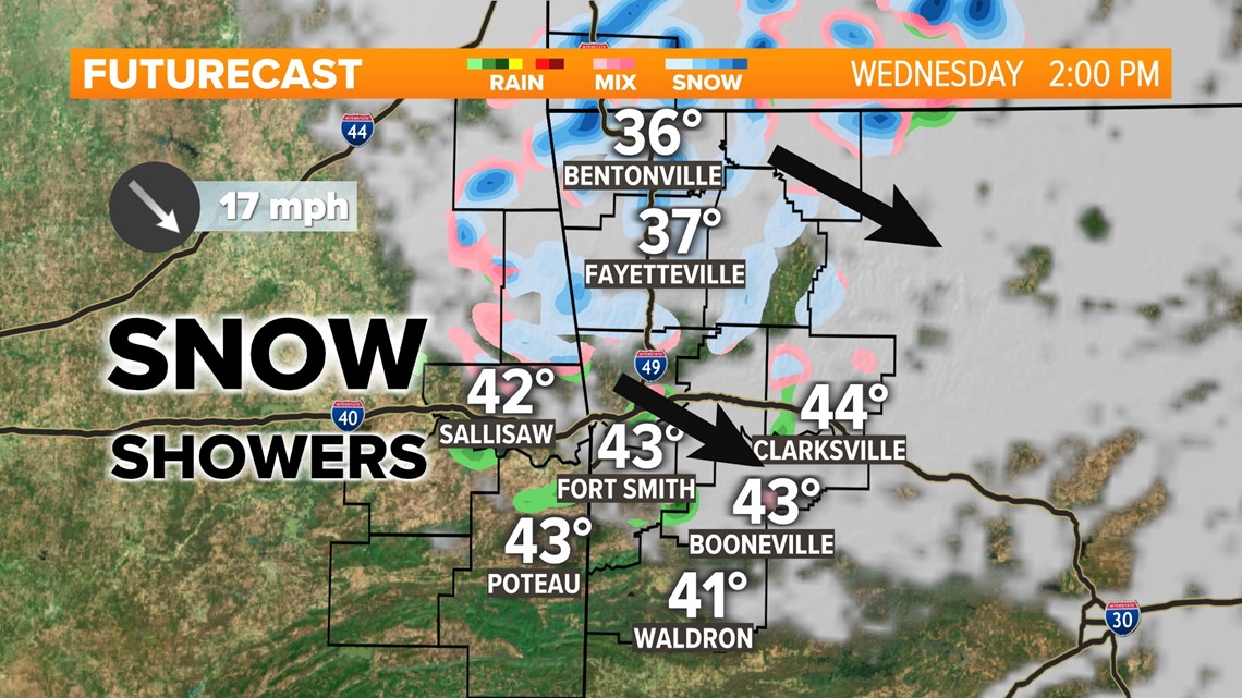
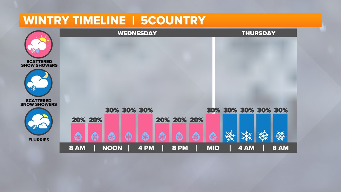
TIMING THE LIGHT SNOW CHANCES
Everyone will get something different... different times of flurries, different intensities, different temperatures. But in general expect on-and-off flurries in western Arkansas and eastern Oklahoma Wednesday through Thursday morning. A few more are possible Thursday afternoon.

HOW MUCH SNOW WILL ACCUMULATE?
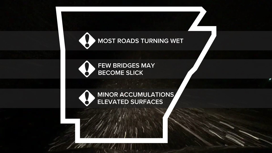
Most likely not much, if any at all. First we are trying to figure out how many of us will see snow showers or not. Snow showers are expected to stay isolated throughout the day on Wednesday and Wednesday night so accumulation will be limited. If you do see some flurries, impacts would likely be minimal. Roads may turn wet as snowflakes mostly melt upon impact. However, if some stronger flurries linger Wednesday night, there may be some slick spots that ice up on bridges and overpasses in NW Arkansas and the mountains.
Where you may see some snow stick:
- vehicles
- mailboxes
- roofs
- grass
- trees


This will not be a winter storm... just a chance for flurries and some light snow in spots. Stay tuned!
-5NEWS Chief Meteorologist Matt Standridge