FAYETTEVILLE, Ark. — After starting the month off with well-above-average temperatures, we will be reminded that it is still winter this weekend into next week. A large polar air mass will send much of the eastern half of the United States into a deep chill. While the brunt of this cold will stay to the north, we will still feel our fair share of cold air across NW Arkansas and the River Valley.
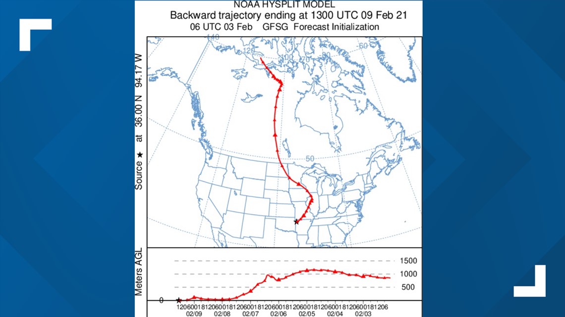
We can see where this air will originate by tracing the backward trajectory of the air mass. And as you can see from the image below, the red line shows this cold air is coming from northern Canada for the beginning of next week!


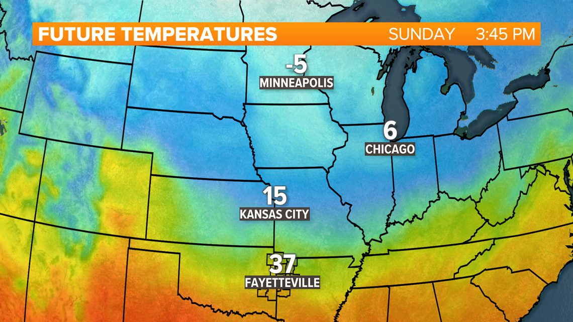
How cold will it get? Right now, temperatures don't look as cold this weekend across NW Arkansas and the River Valley. Highs will still drop below-average in the 40s on Sunday. A lot of the Upper Midwest will not be as lucky.
Forecasted Sunday Highs:
- Fayetteville: 43°
- Fort Smith: 47°
- Kansas City: 20°
- Chicago: 8°
- Minneapolis: -4°


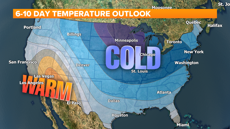
The coldest air will looks to arrive next week so don’t expect a big warm-up to return. This weather pattern will continue, with models bringing reinforcing shots of colder air. Below-average temperatures will continue with an elevated chance for wintry weather. The Climate Prediction Center has also noticed this chilly trend with their outlooks featuring below-average temperatures in blue.


Long story short, keep the winter jacket, hats and gloves handy through the middle of February.


