ARKANSAS, USA — For nearly three years, La Niña reigned supreme along the equatorial Pacific. But in the past few months, ocean temperatures have risen into the neutral range with above average temperatures forecast for summer. Is El Niño on the way?
If El Niño arrives by summer and continues through the year, it could have impacts on seasonal temperatures and precipitation and the upcoming Atlantic hurricane season. Here's what we know now:
CURRENT STATUS
After lingering in the La Niña range for much of the past three years, sea surface temperatures in the tropical Pacific have risen into the neutral range. Along the equator just off the coast of South America, ocean temperatures are noticeably higher and the general warming trend is expected to continue.

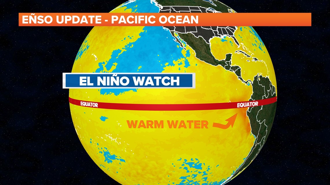
EL NIÑO FORECAST
Global forecast models are indicating that the warming is not done yet, and that temperatures will reach the El Niño stage by the summer. Because of the forecasted rise in sea surface temperatures in the Pacific, an El Niño watch has been issued by the National Oceanic and Atmospheric Administration (NOAA).

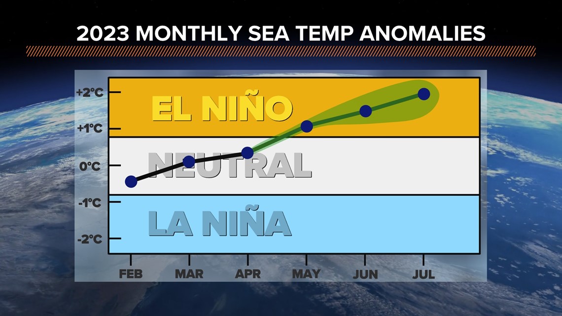
POTENTIAL IMPACTS
Now to the important part: What does this mean for the U.S? Well, it largely varies on location. Here in Arkansas and Oklahoma, we normally see slightly wetter and cooler conditions during El Niño in the summertime.

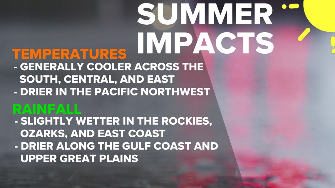
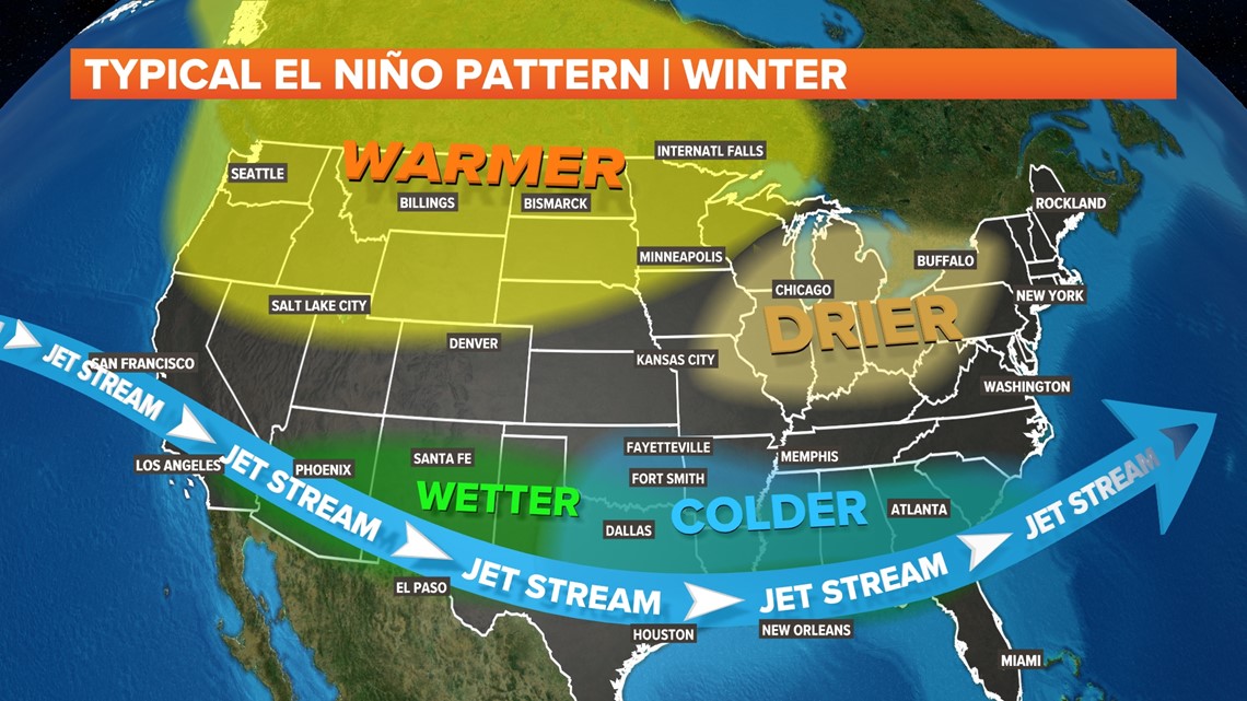
The impacts are more defined during the winter but cooler and wetter conditions still persist. It also limits thunderstorm potential across the region by a small margin.

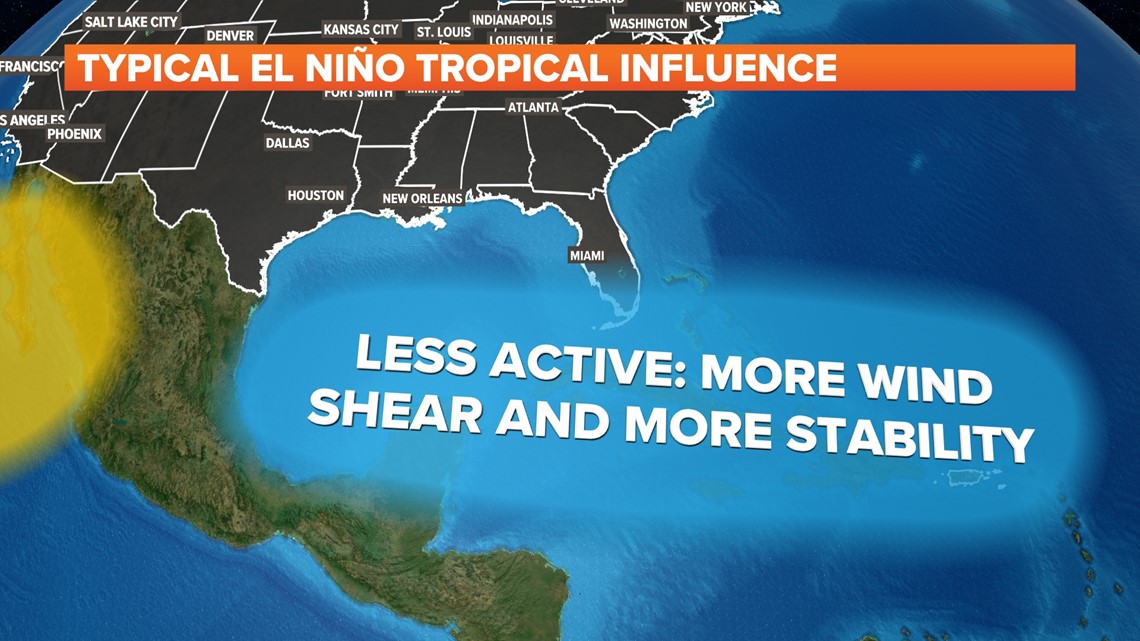
The most commonly associated impact of El Niño on the U.S is the decrease in activity during the Atlantic Hurricane season. More wind shear and more stability are a result of stronger westerlies caused by the warmer Pacific Ocean.

Over the next few months, we will continue to monitor the Pacific Ocean to see if El Niño develops. From a day to day perspective, the effects might not be noticeable, but over a season the changes could become rather impactful.

