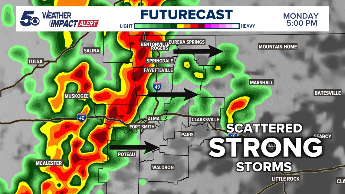
ARKANSAS, USA — It's a Weather Impact Alert Day for Arkansas and Oklahoma as severe weather chances remain elevated. Strong to severe thunderstorm will be on the increase this afternoon and evening as a cold front moves out of Oklahoma into Arkansas. Download the 5NEWS app to receive weather alerts and to stream our live weather coverage as these storms roll through.
Here's a look at current radar across Northwest Arkansas and the River Valley.
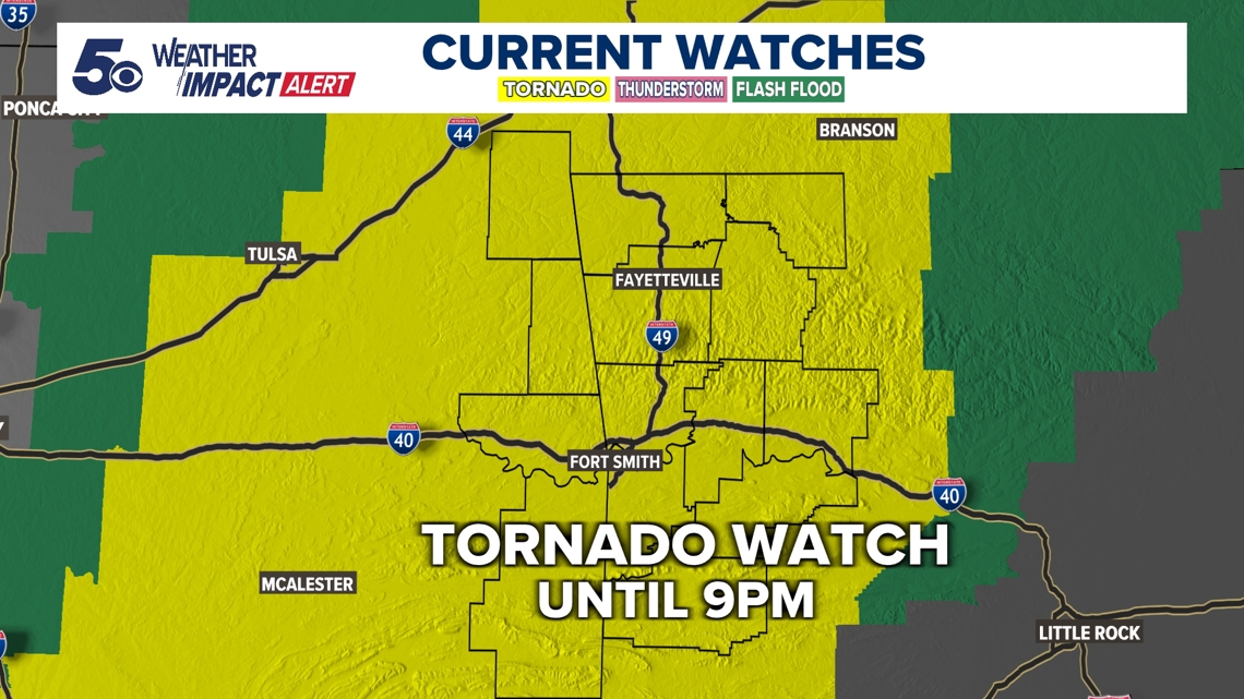
A Tornado Watch has been issued through 6pm Monday for eastern Oklahoma.
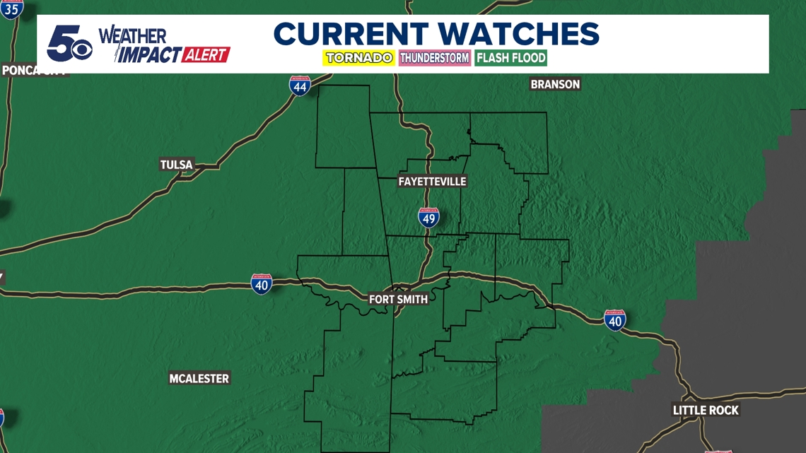
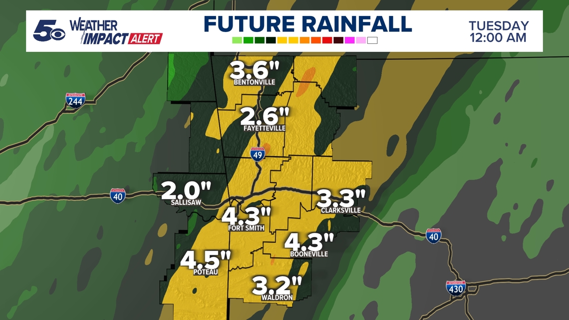
A Flash Flood Watch has been issued through Tuesday morning for Northwest Arkansas and the River Valley.


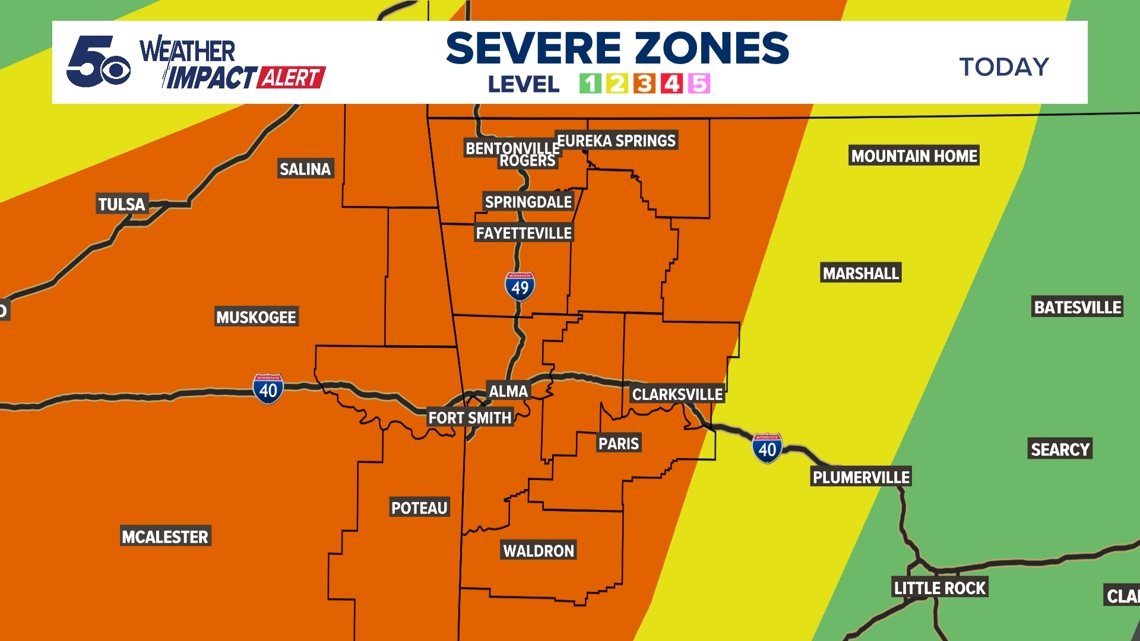
Today poses the greatest severe weather threat yet. The Storm Prediction Center has placed both Northwest Arkansas and the River Valley under a level 3 out of 5 risk. This means we anticipate some strong to severe storms to impact parts of eastern Oklahoma and western Arkansas.
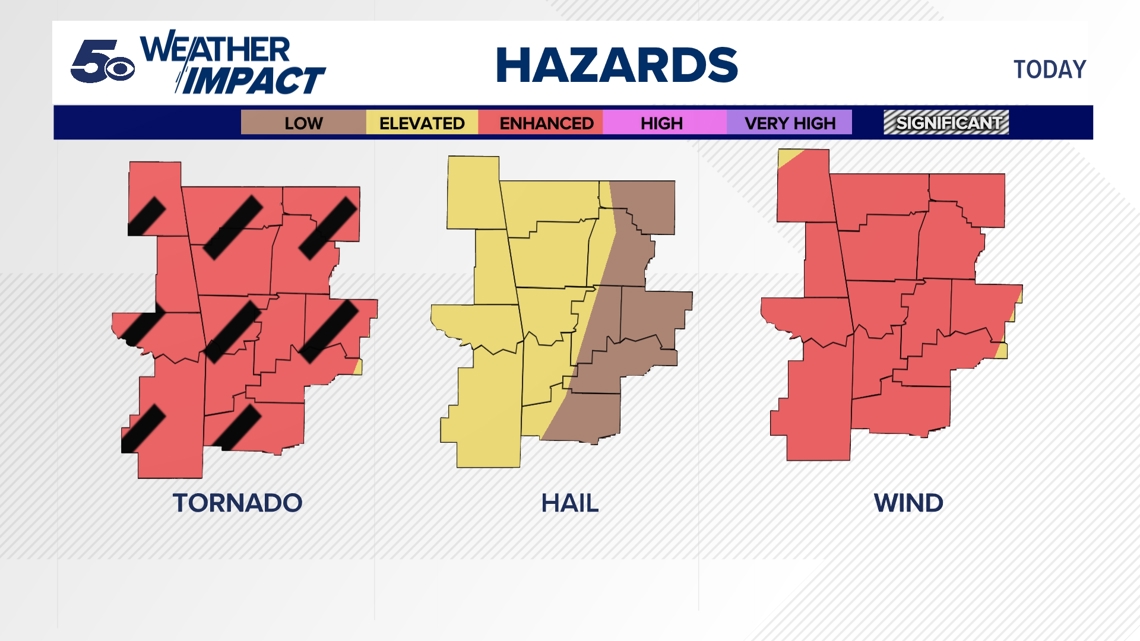
All severe weather threats are possible this evening with a specific emphasis on damaging wind gusts, a few tornadoes, and flash flooding. The tornado threat remains our most prominent threat within storms today with an enhanced risk stretching across the area. Not everyone will see tornadoes and severe weather, but the environment is conducive for a storm or two to produce a strong tornado. Pockets of wind speeds between 60 to 80 mph are also possible within the advancing line of storms.

Although isolated showers and thunderstorms can be expected through the day, the best chance for severe weather development is after 3 pm. With plenty of fuel and a jet stream overhead, storms are likely to continue through the evening hours before pushing out overnight. A few lingering light to moderate showers will be possible Tuesday morning.

An additional 1 to 3 inches is possible across the region Monday. Soils across the area are saturated with most having received 2 to 5 inches of rainfall since Saturday night. Locally higher amounts have fallen in parts of the River Valley and Northwest Arkansas. As heavy rain moves into your area, watch for flash flooding in low lying or poor drainage areas. It's important to "turn around, don't drown" and never drive through flooded roadways.
Drizzles and scattered light showers may linger through Tuesday morning, but clouds should break up over the course of Tuesday afternoon.


Watch 5NEWS on YouTube.
Download the 5NEWS app on your smartphone:
Stream 5NEWS 24/7 on the 5+ app: How to watch the 5+ app on your streaming device
To report a typo or grammatical error, please email KFSMDigitalTeam@tegna.com and detail which story you're referring to.

