

FAYETTEVILLE, Ark. — Several severe thunderstorms developed from Kansas to Texas late Saturday afternoon before pushing into Northwest Arkansas just after midnight Sunday morning. The heat and humidity that built up Saturday afternoon primed the atmosphere across 5COUNTRY for severe weather. Once a strong storm pulsed up over Tulsa, all that energy acted as fuel for a single long-tracked supercell to bring severe weather into Northwest Arkansas. On the thunderstorm spectrum, supercells are the least common type of thunderstorms. These are rotating and often violent storms capable of producing large hail, swaths of damaging wind gusts, and long-tracked tornadoes.
To view our live weather radar, click here.
TIMELINE FOR SEVERE STORMS
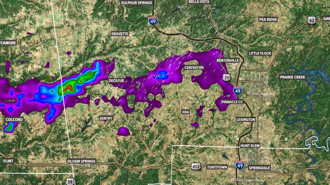
The fast moving supercell, that already had a history of producing tornadoes in Oklahoma, crossed into Benton County around 1 am in the morning and quickly dropped a funnel cloud over the western side of the county. Tight rotation and debris signatures acted as signs of a radar confirmed tornado on the ground just west of Decatur. It is possible that there were two separate areas of rotation at this time, with one centering over Cherokee City and another further northwest near Ionia.
At the same time, reports of quarter to golf ball sized hail stretched across the area alongside locally heavy rainfall. The storm updraft continued to strengthen and began dropping large hail all over the county.
The storm continued east into the heart of Benton County with rotation this time tightening once again over the Centerton area. A mix of damaging wind gusts and a potential tornado produced damage around the Centerton and Bentonville communities.
Around 2 am as the Centerton circulation was weakening another area of rotation rapidly tightened heading into the west side of Rogers near West Walnut Street leading to another radar indicated tornado heading deeper into Rogers.
As the supercell blasted across Benton county, damaging straight-line winds fanned out from the storm littering most of the county with tree debris. Wind damage to trees and homes ranged from as far north as Bella Vista to as far south as Lowell.
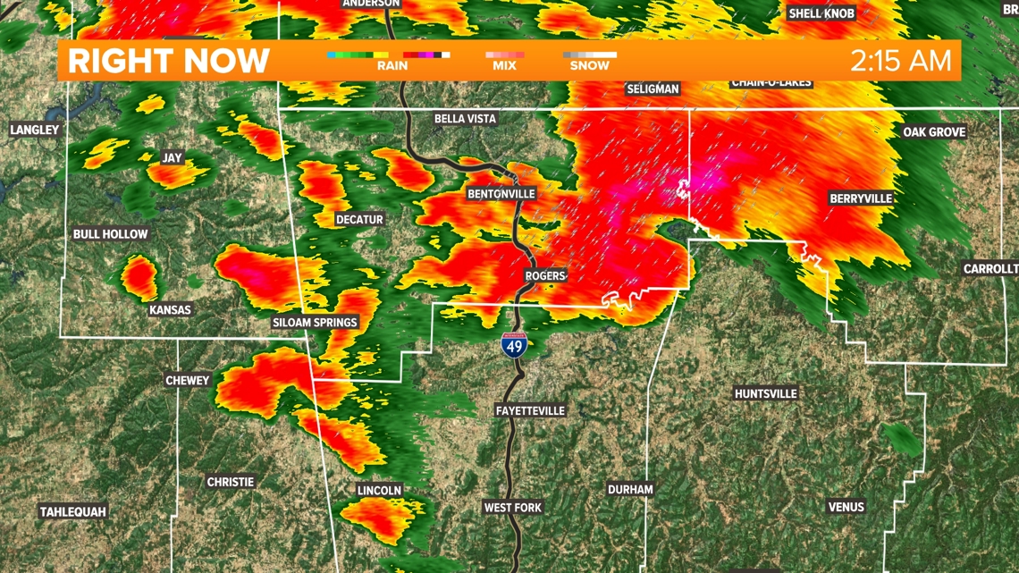
Tornado warnings continued as the storm moved into Carroll and northern Madison counties a little after 2:15 am. Survey crews will be out looking at potential tornado and straight-line wind damage in those areas.
As the severe supercell moved out of NW Arkansas, another strong thunderstorm dipped south into northern Benton county. Although this storm lacked tight, organized rotation, it did have strong straight-line winds and another round of small hail. Straight-line winds spread across both Benton and Carroll counties before settling around 5 am.
Simultaneously, flash flood warnings covered both counties as lingering showers continued to drop rain behind the storm. The last of the showers cleared out around 6 in the morning. Skies cleared quickly behind the storm.
ROTATION TRACKS 1 AM - 2 AM


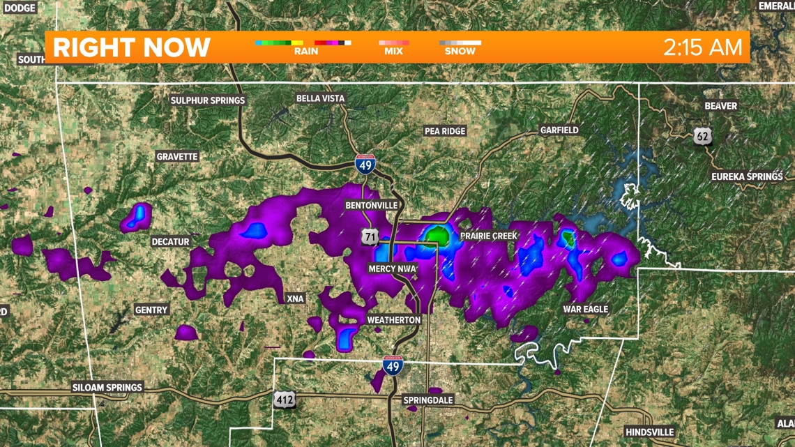
RADAR AT 2 AM

ANOTHER SEVERE RISK?
After an extremely active overnight/early Sunday morning, the atmosphere over 5COUNTRY is in recovery mode. Sunshine and humidity building this afternoon is leading to another chance for isolated severe thunderstorms, with a few of those storms having a chance to be severe. The window for storms will be from 4 pm to 10 pm as cold front moves through. Currently, all of 5COUNTRY is under a level 2 out of 5 risk for the evening. This means not everyone will be impacted, with just isolated severe weather possible. Severe storms Sunday will be capable of producing damaging hail, damaging wind gusts, and a few tornadoes.
- Meteorologist Bella Grace & Meteorologist Zac Scott
Watch 5NEWS on YouTube.
Download the 5NEWS app on your smartphone:
Stream 5NEWS 24/7 on the 5+ app: How to watch the 5+ app on your streaming device
To report a typo or grammatical error, please email KFSMDigitalTeam@tegna.com and detail which story you're referring to.