ARKANSAS, USA — A parade of quick moving winter systems have hit the Natural State, but how much more ice could accumulate?
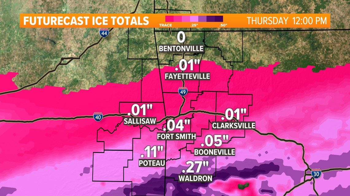
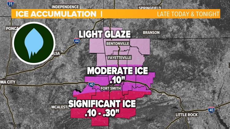
Monday and Tuesday were a mess across the area as freezing rain and sleet impacted travel. Wednesday will offer the next round of winter weather as more ice and sleet target the River Valley with sleet in Northwest Arkansas as well.
Track the incoming winter weather by tapping HERE.
What is the timing of the ice?
We are tracking a final system for Wednesday into Thursday. Temperatures are looking warmer for Wednesday and Thursday, but freezing rain is still expected for parts of the River Valley.


Northwest Arkansas could also see some frozen precipitation, but the recent models are trending towards drier air moving in. This means that Northwest Arkansas will likely miss out on the worst of the ice accumulation.
Overall, most of the northern half of Arkansas could see winter weather over the next few days, with the heavier ice totals near the center and northeast of the state


More updates to come
Last week we had several inches of snow across the state, and this week we could see some accumulation of ice. It takes several inches of snow to cause major impacts, but a few tenths of an inch of ice can cause serious problems.
With these types of systems it all depends on the track and the temperatures. As we get closer to arrival on Monday we will have a better idea of what to expect for potential ice totals. If the track changes course, Arkansas could see more rainfall.
Overall, be prepared for potential wintry mix, snow, and ice potential between Monday and Thursday. With several rounds of potential precipitation, this system is going to play out much differently than our last where we saw snowmelt within 24 hours. This event could have a multi-day impact.
Stay up to date with the 5NEWS Weather Team for more information!


