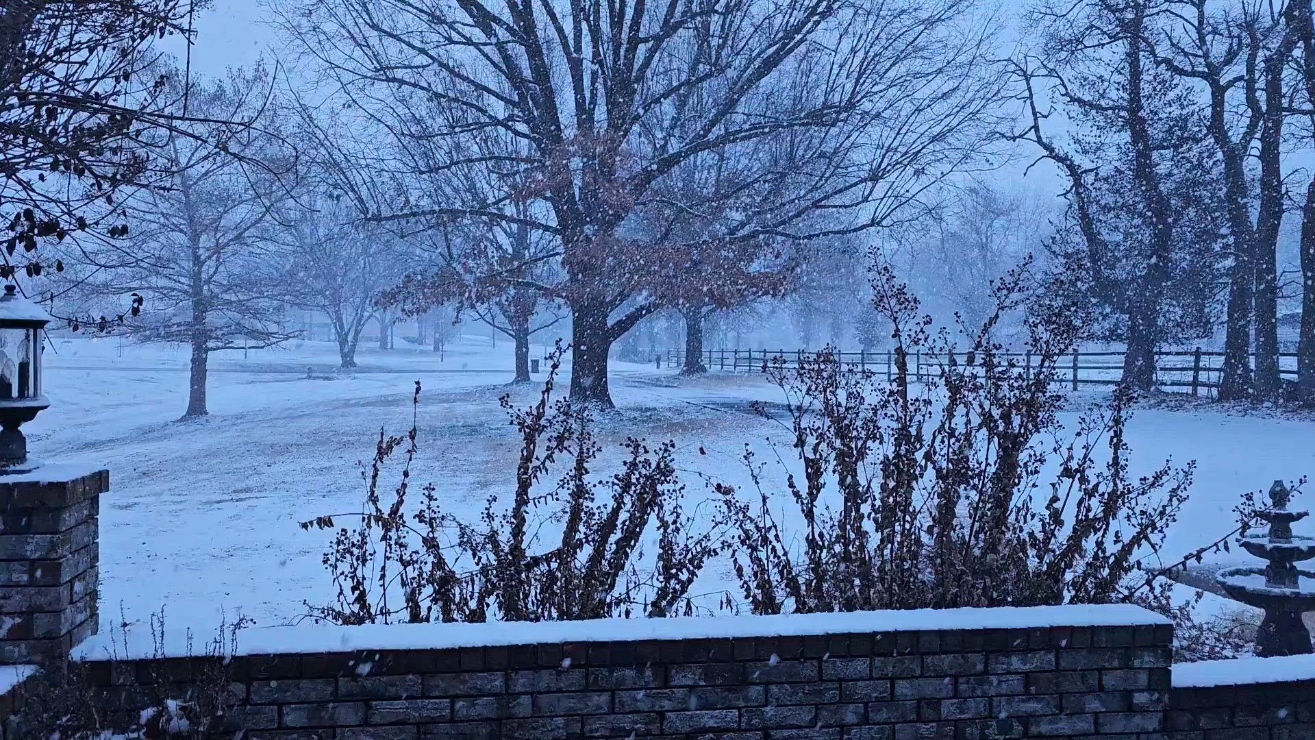
ARKANSAS, USA — Large fluffy flakes flew across eastern Oklahoma and western Arkansas during the morning commute on Friday, Jan. 5. It was about a three-hour window when the burst of heavy snow came down.
The snowfall rates were about 1-2 inches per hour at times which overcame the road treatments and caused several crashes and travel delays from 6 a.m. to 8 a.m.
School parking lots quickly became snow-covered around 6:30 a.m., leading to several school closures and delays. Our storm chasers reported that turns were slippery.
So how much did we get? We have your reports!
Tap here for our live interactive radar to see where the snow is going next.
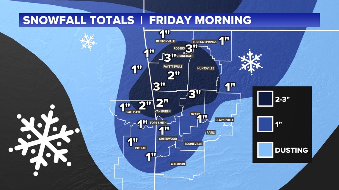
Most of the region received around half an inch to an inch and a half. The big winners with our first snowfall of the season saw upwards of three inches.
Benton County
- Centerton 1.1"
Carroll County
- Near Grandview 1.0"
Crawford County
- Mulberry 2.0"
- Van Buren 2.0"
- Mountainburg 2.5"
Franklin County
- Altus 1.0"
- Cass 3.0"
Le Flore County
- Near Poteau 1.5"
Madison County
- Near Kingston 2.50"
Sequoyah County
- Sallisaw 1.0"
Washington County
- Fayetteville 2.0"
- Tontitown 3.0"
- Springdale 3.0"
- West Fork 3.0"
The highest snowfall accumulated on the grass and trees. It stuck for a couple hours but most of it was gone by noon. Any leftover snowfall will melt over the next few hours. Roads are still damp in spots. Re-freezing chances will be low tonight as we will only fall to the low 30s thanks to the clouds.

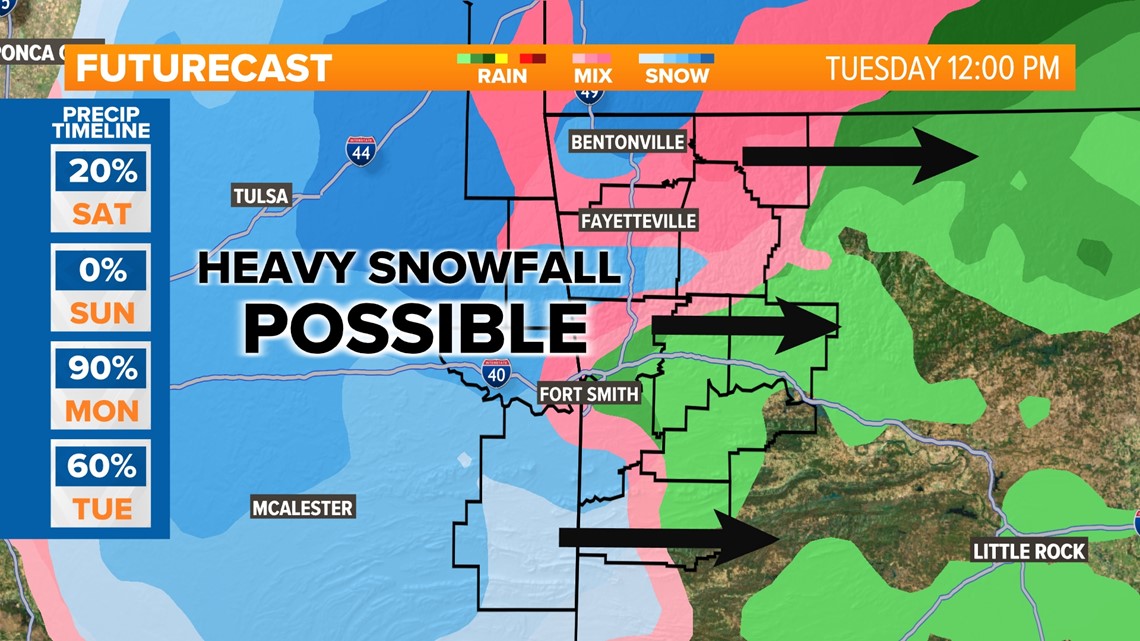
What!? More snow?
More accumulating snowfall is possible early next week for Oklahoma and Arkansas as a strong storm system sweeps through. Heavy rain will first move through Monday before colder air slides in Tuesday, with a band of snow showers. This storm is several days out and many details will need to be ironed, but more impacts are possible.