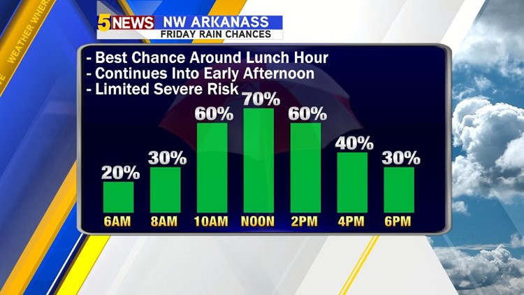
A cold front will move into the area from the northwest to the southeast during the day on Friday. Scattered showers and storms are expected along and behind the front. There will be enough instability for severe weather with the primary threat being damaging winds gusting to 50mph+. The threat quickly ends by evening with much lower humidity arriving from the north.
- Storms strongest from Noon-6pm
- Damaging winds main risk
- Threat over by 9pm
- Turning cooler and drier for the entire weekend
Here’s how it plays out…

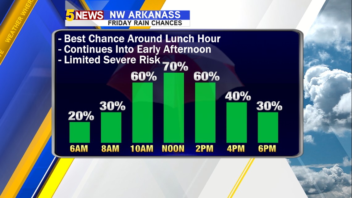

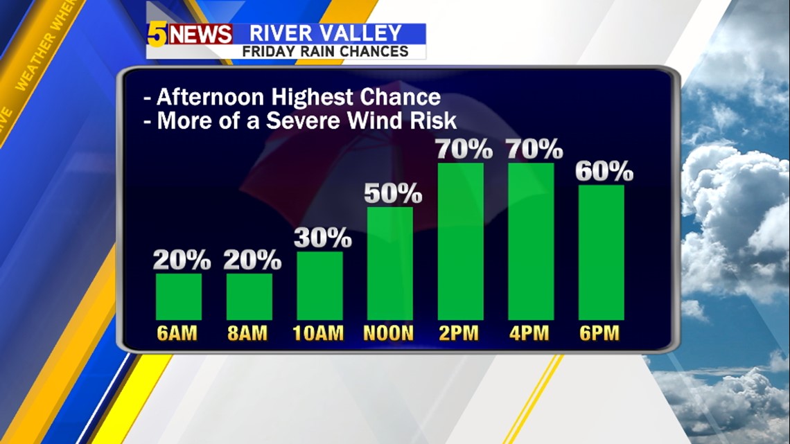
Rain chances will start first in Northwest Arkansas and then spread south during the day affecting the River Valley in the afternoon and evening. Because instability builds with daytime heating the stronger storms may develop south of the tunnel in the afternoon hours.

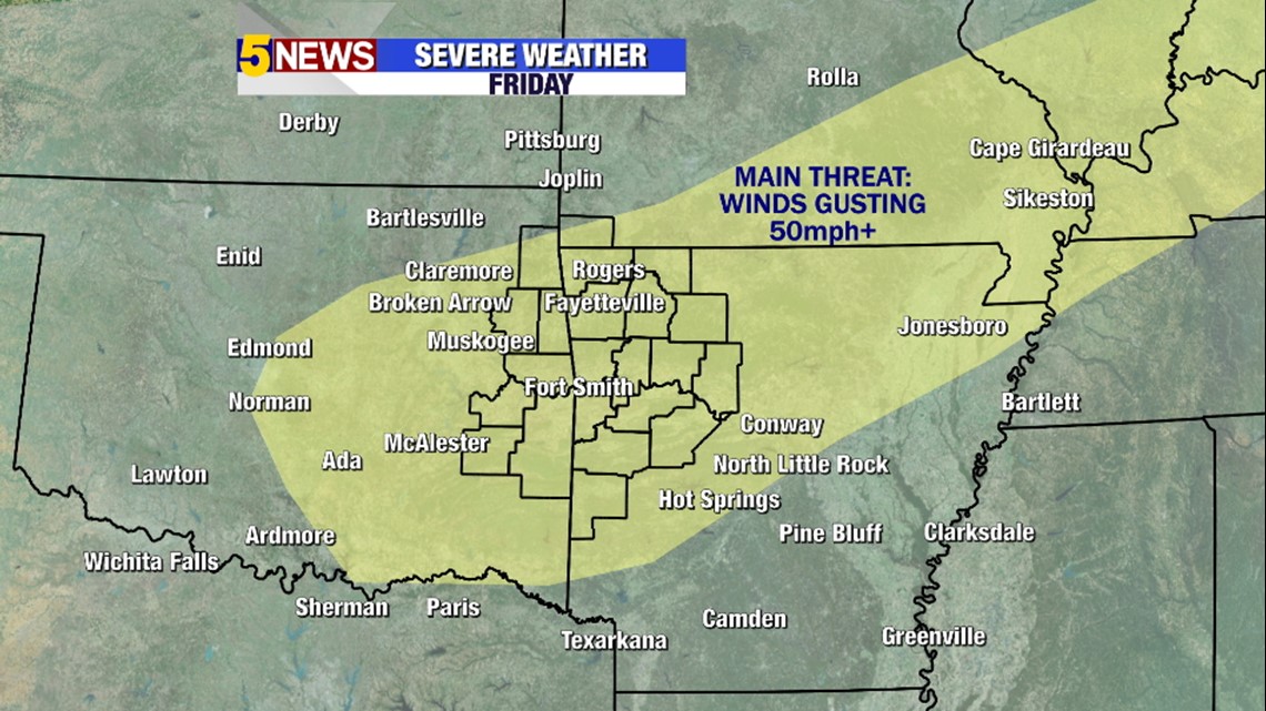
The main severe risk is damaging wind and the entire area is under a threat.

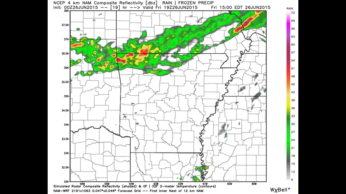
10am Friday: Storms should be underway across the Ozarks. There is a potential for delays at the LPGA Tournament due to storms.

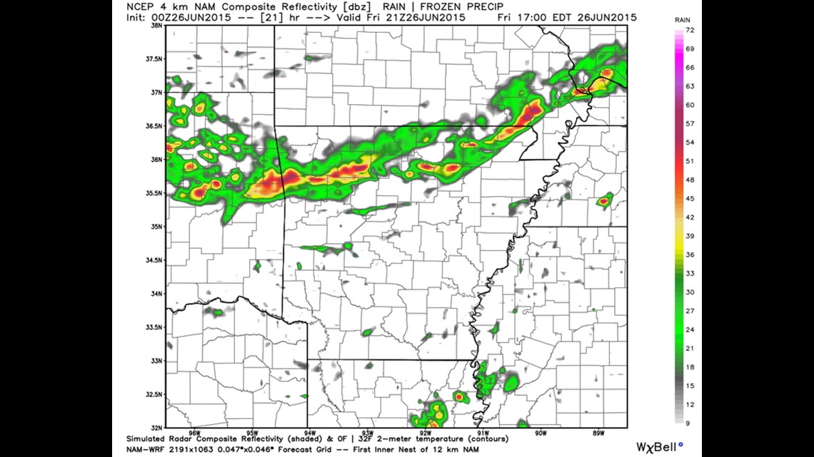
Noon Friday: Storms will continue to develop and move south.

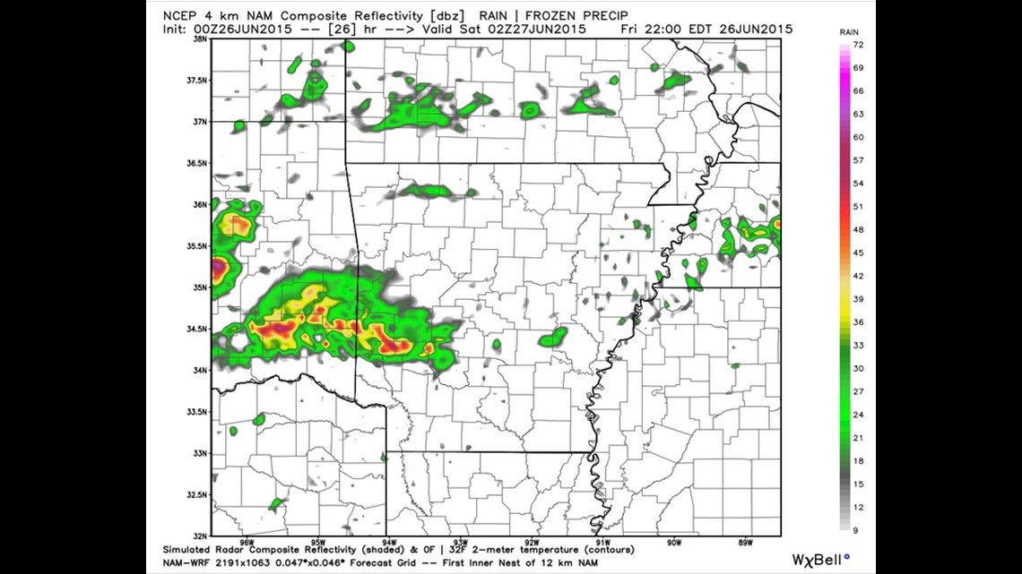
5pm Friday: The heaviest storms will move south but a few lingering showers may affect our area into the overnight. The rain is expected to be gone by Saturday morning. Right now, it appears the worst of the rain will be over for the Friday night Home NWA Naturals Game.

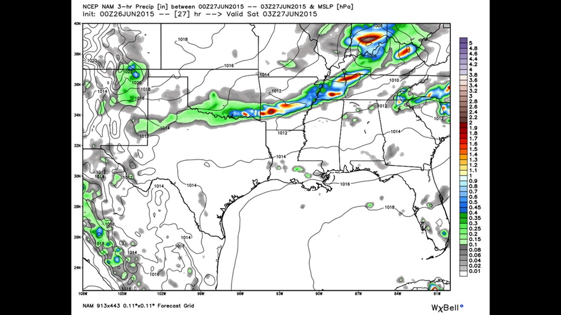
9pm Friday: Most data is showing the majority of the storms out of the area by this time with only a few lingering pockets of rain.

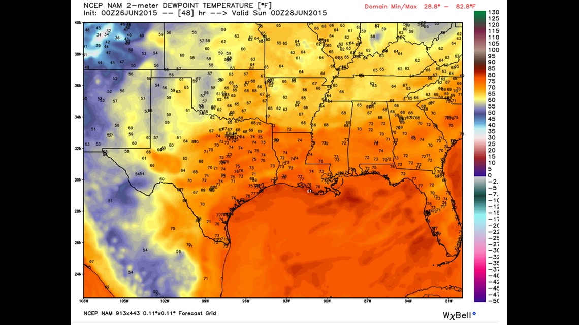
This is probably my favorite map. This should the dewpoints or humidity in the atmosphere. Dewpoints in the low 60s will make both Saturday and Sunday some of the most comfortably cool days we’ve seen in a while.
As far as the severe risk goes… on a scale of 1-10 with 10 being the worst. This is around a 3. Some severe storms are likely but overall risk will be limited.
-Garrett


