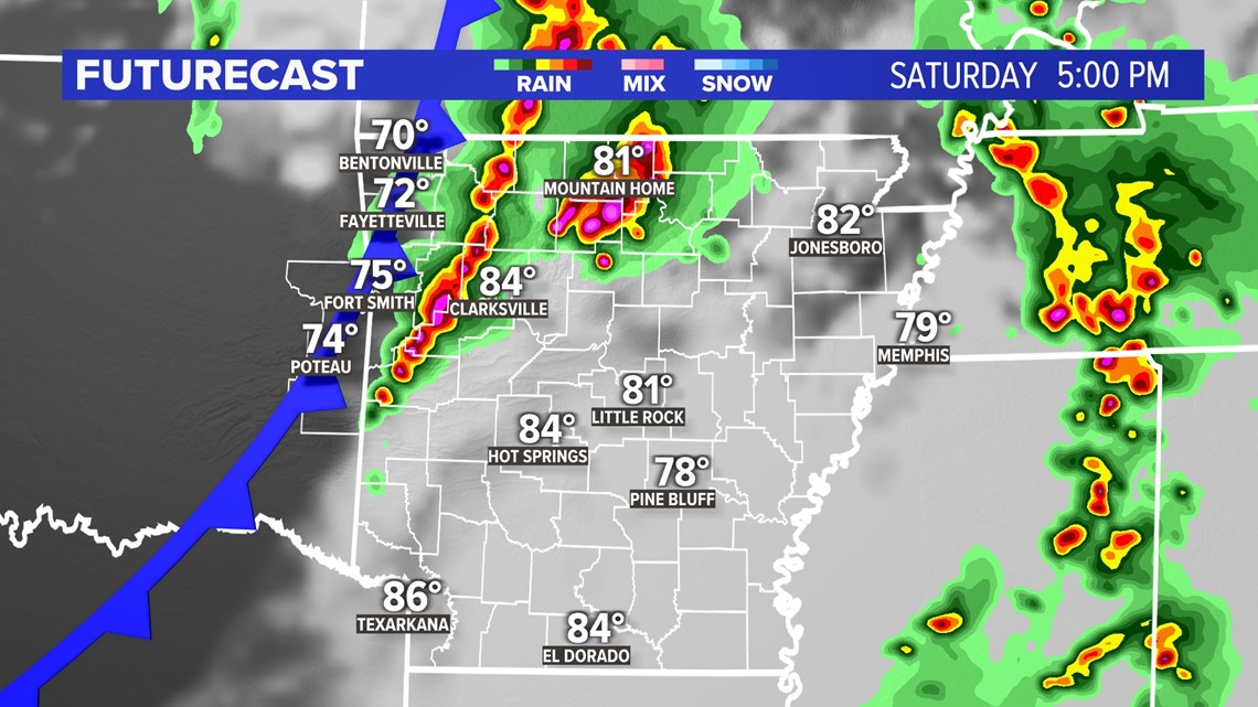
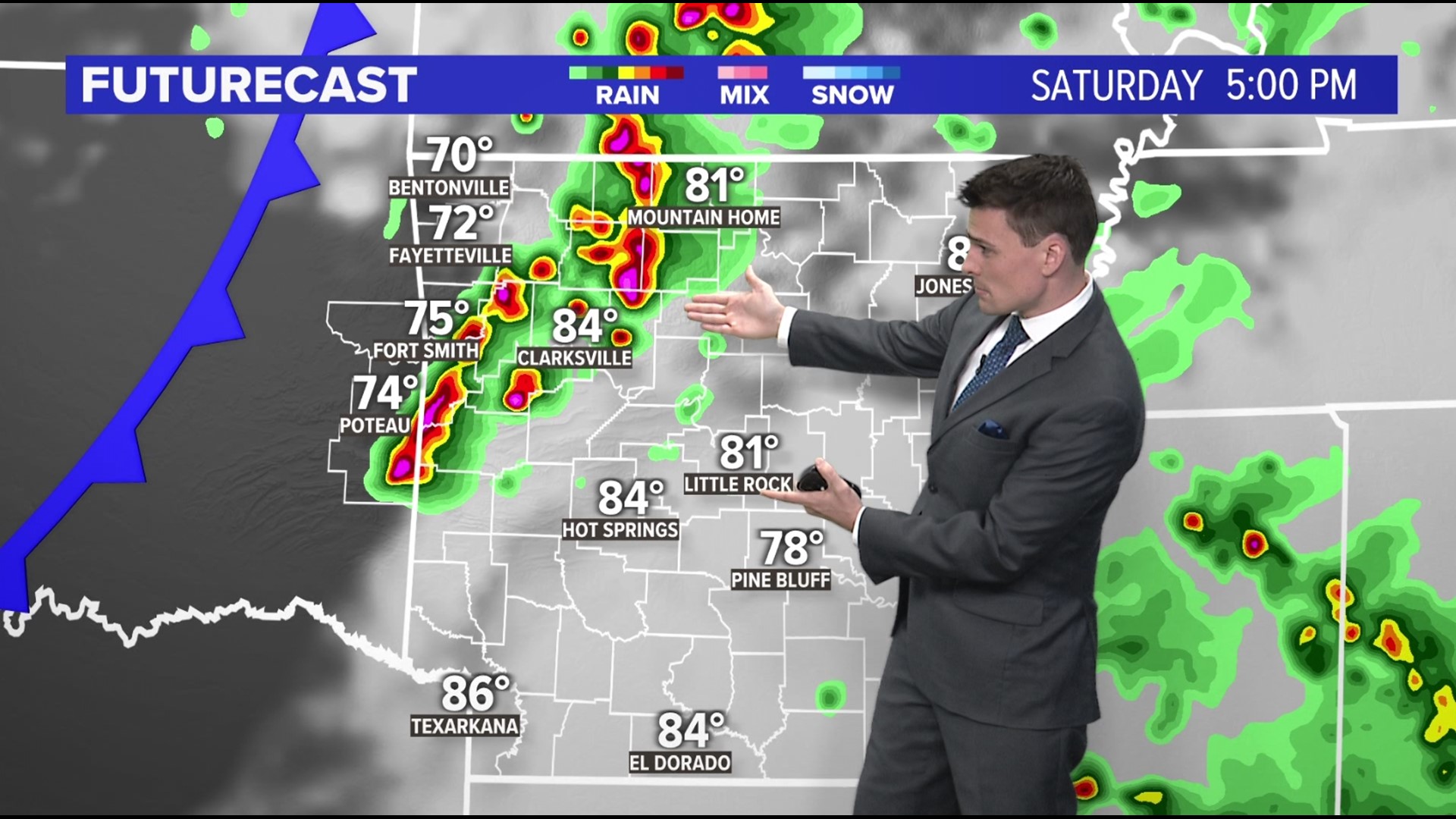
ARKANSAS, USA — After several days of warmth and sunshine, thunderstorms are back in the forecast across Arkansas. A cold front will move in, sparking isolated hail storms in western Arkansas. Over time they will get larger and more widespread, pushing across the rest of the Natural State. The highest severe weather chance will be in central Arkansas.
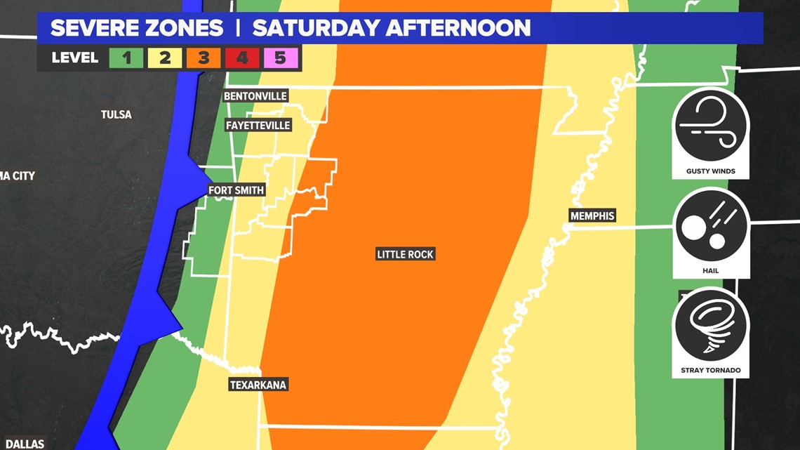
SEVERE ZONES
The threats greatly increase in central Arkansas. They could also cut off quickly to the west where the storms will first fire up. Expect them to be hit-or-miss. Isolated storms will fire up near 2- 4 p.m. from Fort Smith to Fayetteville, and then get stronger once they push east toward Clarksville, Russellville, Conway, and eventually Little Rock.


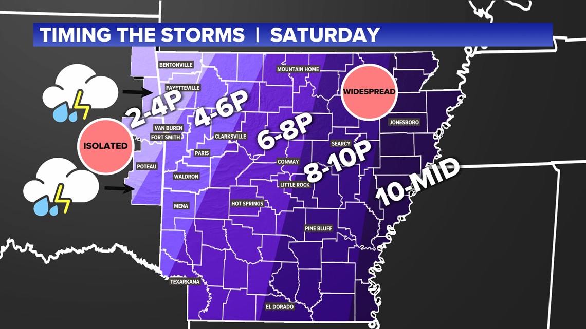
TIMING THE STORMS
Western Arkansas - Eastern Oklahoma: 2 - 4 p.m. (isolated)
River Valley from Fort Smith to Clarksville: 4 - 6 p.m. (scattered)
Central Arkansas Near Little Rock: 6 - 8 p.m. (widespread)
East of Little Rock: 8 - 10 p.m. (widespread)
Near the Mississippi River: 10 p.m. - Midnight (widespread)


Over time, storms will go from being hit-or-miss to more widespread later into the afternoon. When the storms hit your town, if they do, they should only last an hour or two at most.
The primary threat will be hail west of Little Rock. That includes 5COUNTRY from Clarksville to Fort Smith to Bentonville. Areas east of Little Rock will have a higher wind and tornado threat.


AFTER THE STORMS
Drier air will quickly rush in from Oklahoma after the storms. There may even be some dust in the air. Temperatures will quickly drop to the 60s. Saturday night we will cool off to 30s and 40s. Sunday looks mostly clear with lots of sunshine.

