
ARKANSAS, USA — It's been a stormy week, and it may end with more thunderstorms going into Father's Day morning. A weak cold front is pushing south into the Plains and Ozarks for Saturday evening and Sunday morning, bringing high chances for wind and hail.
GENERAL TIMING
Oklahoma: 8PM Saturday to 2AM Sunday
Arkansas: Midnight Sunday to 8AM Sunday
Tap HERE for our interactive radar to track storms approaching.
Tap HERE for new updates on the severe threat.
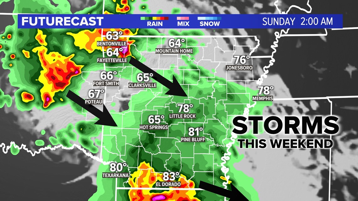
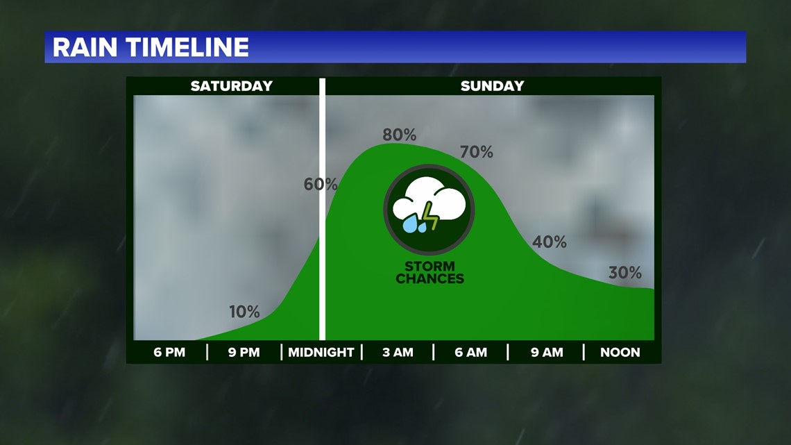
After severe storms, there may be lingering showers and storms through early Sunday afternoon. Father's Day will end up being cooler with storms, rain, and clouds, especially to start the day.

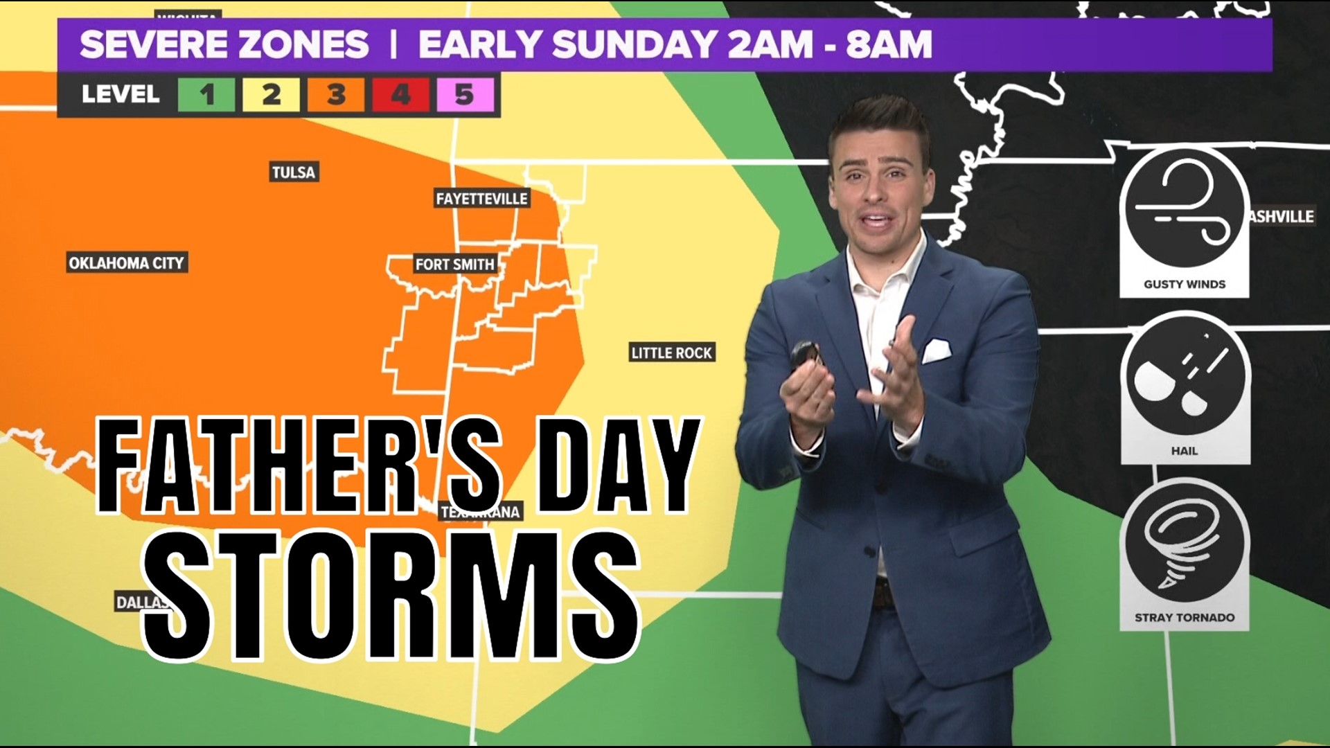
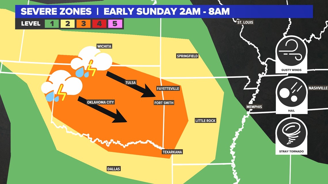
SEVERE THREAT LEVELS
As of Friday night, a Level 3 was issued for most of Oklahoma and western Arkansas for Saturday night and Sunday morning. A Level 2 was issued for central Arkansas and north Texas.

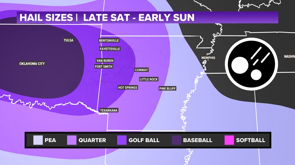
HAIL THREATS
Up to baseball-sized hail is possible across much of Oklahoma where hail storms will fire up first. Over time they will march east, eventually increasing the wind threat and slowly reducing the hail threat to the east. For western Arkansas there may be golf ball sized hail.

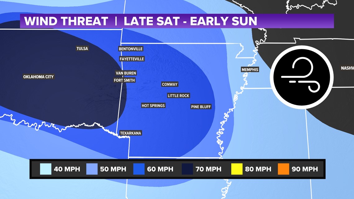
WIND THREATS
Hail storms will also produce wind. Overtime storms will become wind-dominant and push east into Arkansas. A large swath of Oklahoma and western Arkansas may have up to 70 MPH winds. Eventually storms may slow to 60 MPH winds across the rest of Arkansas.

TIMING THE STORMS
Watch for rain and storms chances from 10PM Saturday to the early afternoon on Sunday. The main time to watch severe weather will be near midnight to 8 AM. Timing may adjust by a couple hours. Check back for updates.

Until the storms, enjoy a sunny and warm Saturday!
-5NEWS Weather
How is El Niño impacting our summer weather?