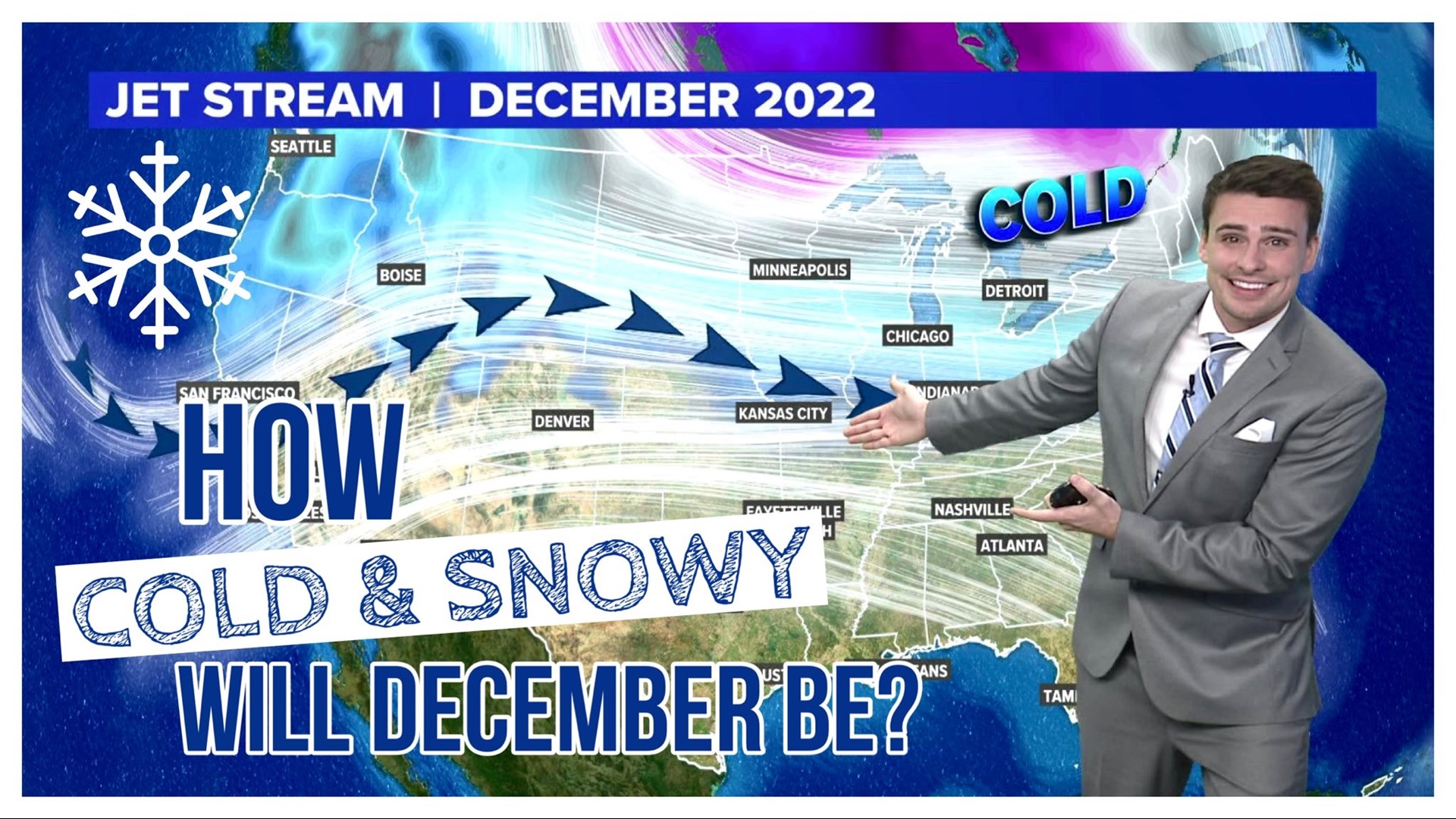
ARKANSAS, USA — December is the darkest month of the year, and marks the beginning of winter (December 21st). The jet stream starts to become increasingly active as ice and snowpack across the arctic and Canadian Plains sends frigid airmasses south into the United States. How is this December looking?
Tap HERE to see if snow is coming to your neighborhood.
JET STREAM
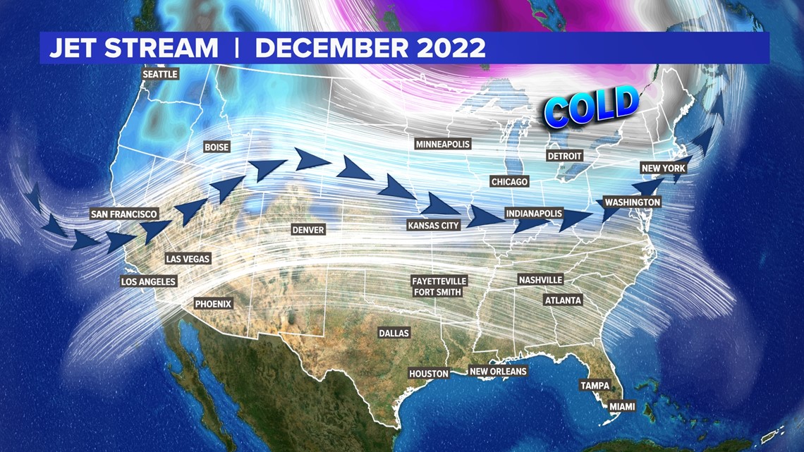
Both the polar jet and subtropical jet will be active. These streams of wind flow generally separate the coldest air from the warmest air. When the jet stream dips south, it brings colder air south and can help spark severe weather too. Generally for December 2022, we will see some swings, but they may not be drastic. Many times we are expect a zonal jet, or a more west-east orientation. This means it will keep cold air over the northern U.S. for longer periods of time, and warm air over the southern U.S. for longer periods of times. We are generally expecting a much more drastic than normal difference in temperatures from north to south. This may help bring several cold fronts across the Plains this winter. Lots of moderate swings are expected in Arkansas and Oklahoma.
Forecast: Several moderate swings. More drastic cold fronts will hit by January. But expect several temperature changes this month.

TEMPERATURE FORECAST
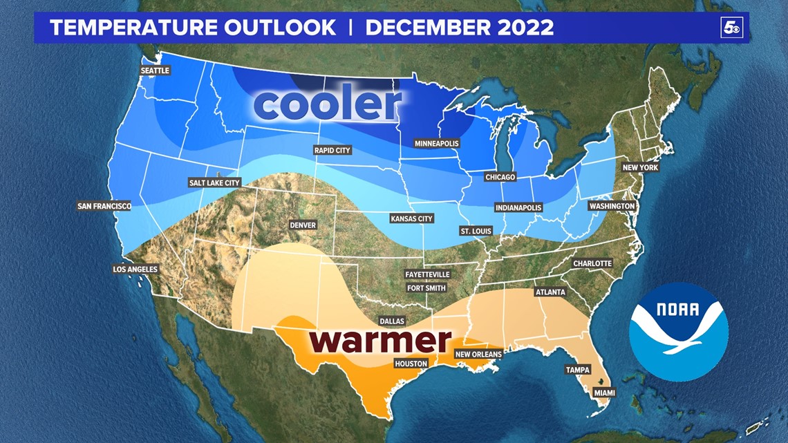
Expect colder-than-normal air across the northern U.S. from the Great Lakes to the Pacific Coast. It may not be as cold along the Atlantic Coast. The Gulf states will be slightly warmer than normal in December. Cold fronts that come in may not last very long.
Forecast: More drastic temperature changes from north to south.

PRECIPITATION FORECAST
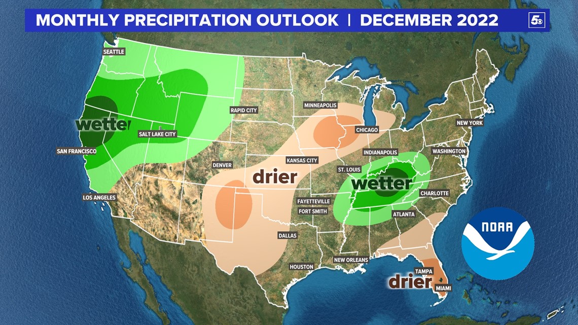
An active jet in the west will help bring several rounds for rain and snow to the Rockies and Sierra Nevada. This is great news for the western drought. The eastern two-thirds of the U.S. will be variable. As fronts move into the Plains, there may just be more temperature changes and not as much precipitation. Better chances for Gulf moisture moving north may bring more rain (and possibly snow) to the Tennessee River Valley. Florida is already normally dry for December, but expect even more sunshine for the Sunshine State.
Forecast: Ranges drastically from west to east

WHAT IS AVERAGE FOR NWA AND THE AR RIVER VALLEY?
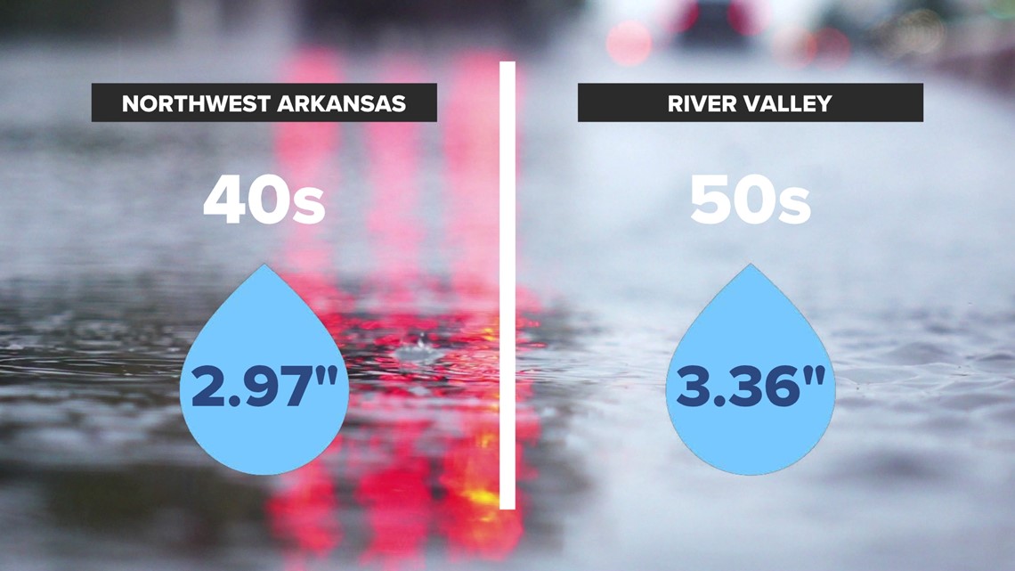
Overall an average December is likely across western Arkansas and eastern Oklahoma. We get about 3 inches of rainfall by the end of the year. From the mountains to NW Arkansas, expect a lot of days in the mid and upper 40s. In the River Valley and the rest of Arkansas, expect 50s.
Forecast: Days mainly in the 40s and 50s

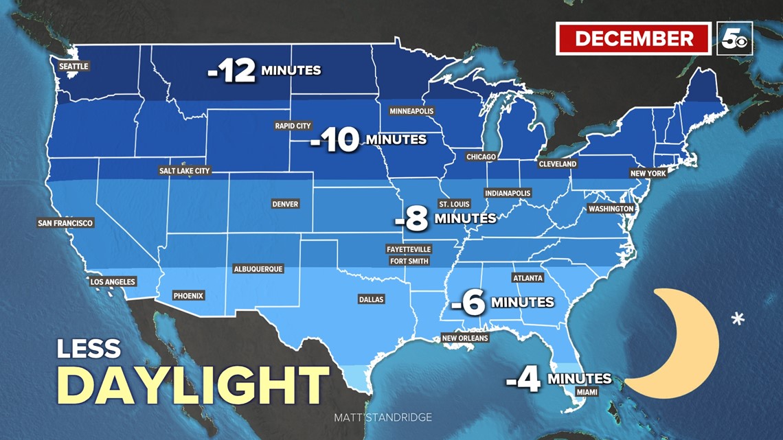
DAYLIGHT LOSSES
December is the darkest month of the year, but only a few more minutes are left to be lost! On December 21st, the winter solstice, the northern hemisphere will start to regain daylight. At first it will be very slow, fairly unnoticeable. Most the U.S. will lose 5 to 10 minutes of daylight this month.

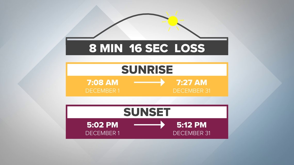
WESTERN ARKANSAS DAYLIGHT
Expect to lose about 8 minutes of daylight from month's beginning to month's end. Times below are for Fayetteville, Arkansas.

NIGHT SKY
The darkest time of the year means we get the maximum time for viewing the night sky, if you are willing to brace the cold...
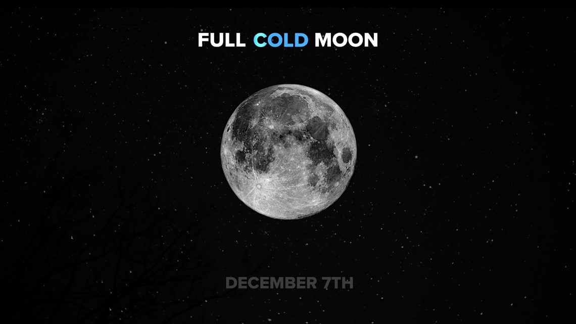
The full moon takes place on December 7th. It's is known as the cold moon, very fitting...

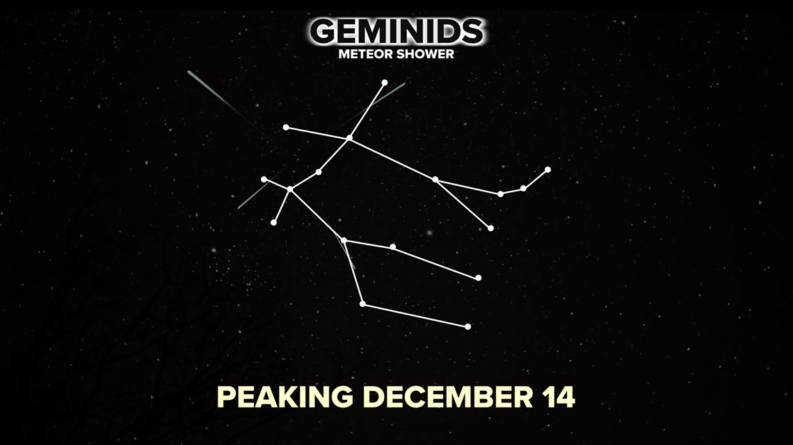
A lot of shooting stars are expected this month. The Geminids meteor shower is known as one of the best chances of the year to see the shooting stars. It will peak December 14 but much of mid-December will have meteors flying across the sky.
The radiant will be near the Gemini constellation. You can see the two twin stick figures in the eastern sky after sunset. By sunrise it will move to the western sky.

-5NEWS Weather

