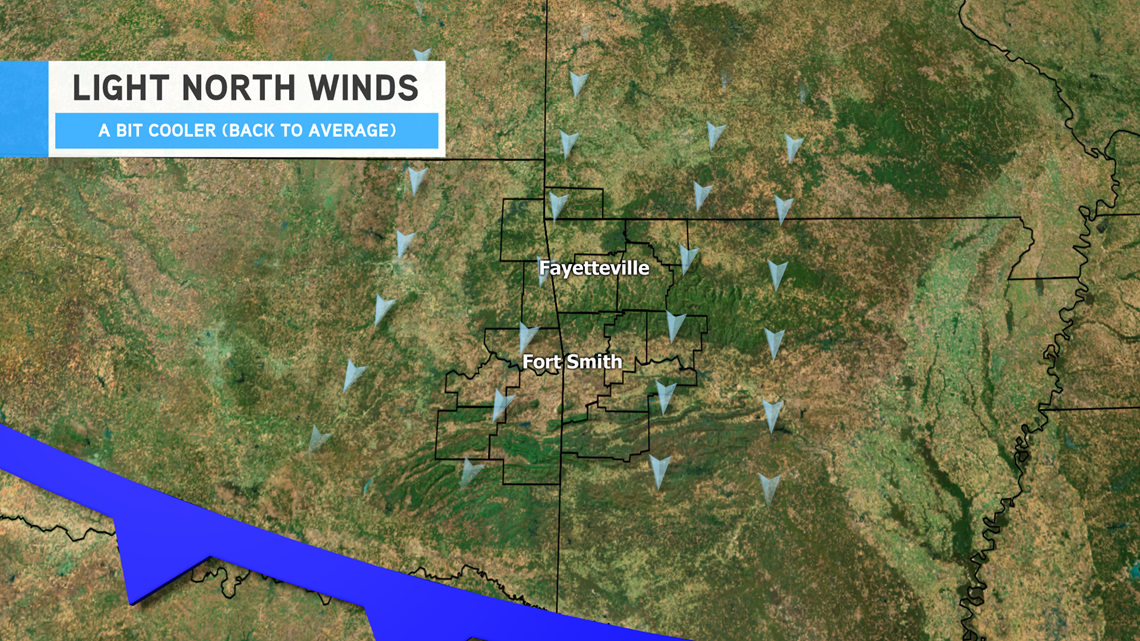
After Friday's intense storms, a weak cold front has pushed south across Arkansas and Oklahoma. Northerly winds will reduce storm chances and also help bring us a bit of relief from the heat and oppressive humidity. Highs should get back into the upper 80s and low 90s, with dew points staying mainly in the 60s.

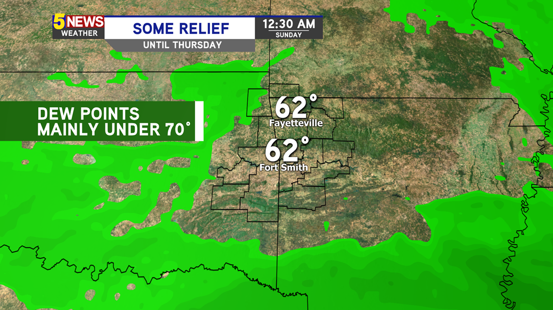
The green areas show dewpoints of 70 degrees, which is a decent indicator of oppressive humidity. It looks like a lot of this will be pushed south. It will still feel hot and a little muggy, but nothing like we've had the past several days.

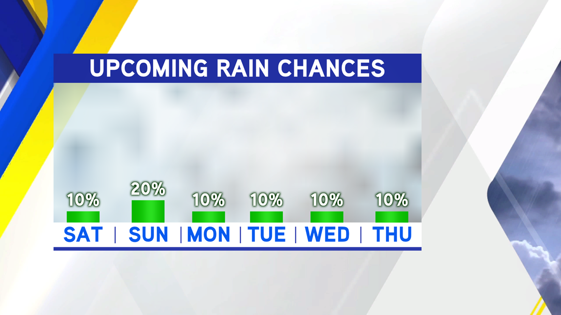
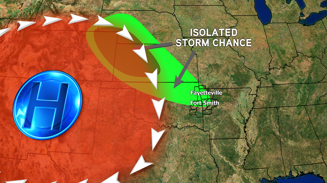
Rain chances are low, but not quite zero. There is a slight chance for a shower Sunday afternoon/evening, and then much better chances come by the end of this upcoming week by Friday.

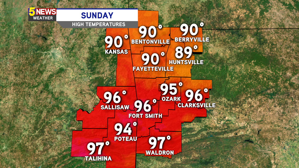
Sunday's highs look warm, but about average for this time of year. Most of us should stay under the century mark.

Because dominant high pressure is just west of us, we will be watching little disturbances in the Northwest Flow that could give us the chance for an isolated storm or two the next several days. However, most of us should remain quite dry!

-Matt

