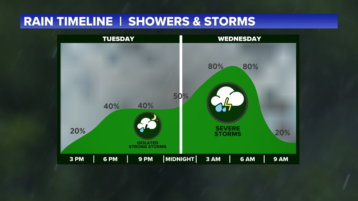
ARKANSAS, USA — Severe weather is targeting Arkansas and Oklahoma again as a cold front approaches and uses the warm, humid air to create thunderstorms. Storm chances will increase overnight. The strongest storms are likely to fire 1 a.m. to 6 a.m.
Tap here for our interactive radar to track the storms.
Storms will have the potential to create tornadoes, damaging winds, and hail. Over time the atmosphere will become more supportive of thunderstorm development. Expect severe chances to increase as the night continues.
(Scroll down for an in-depth forecast)
What has happened so far? (listed by most recent event)
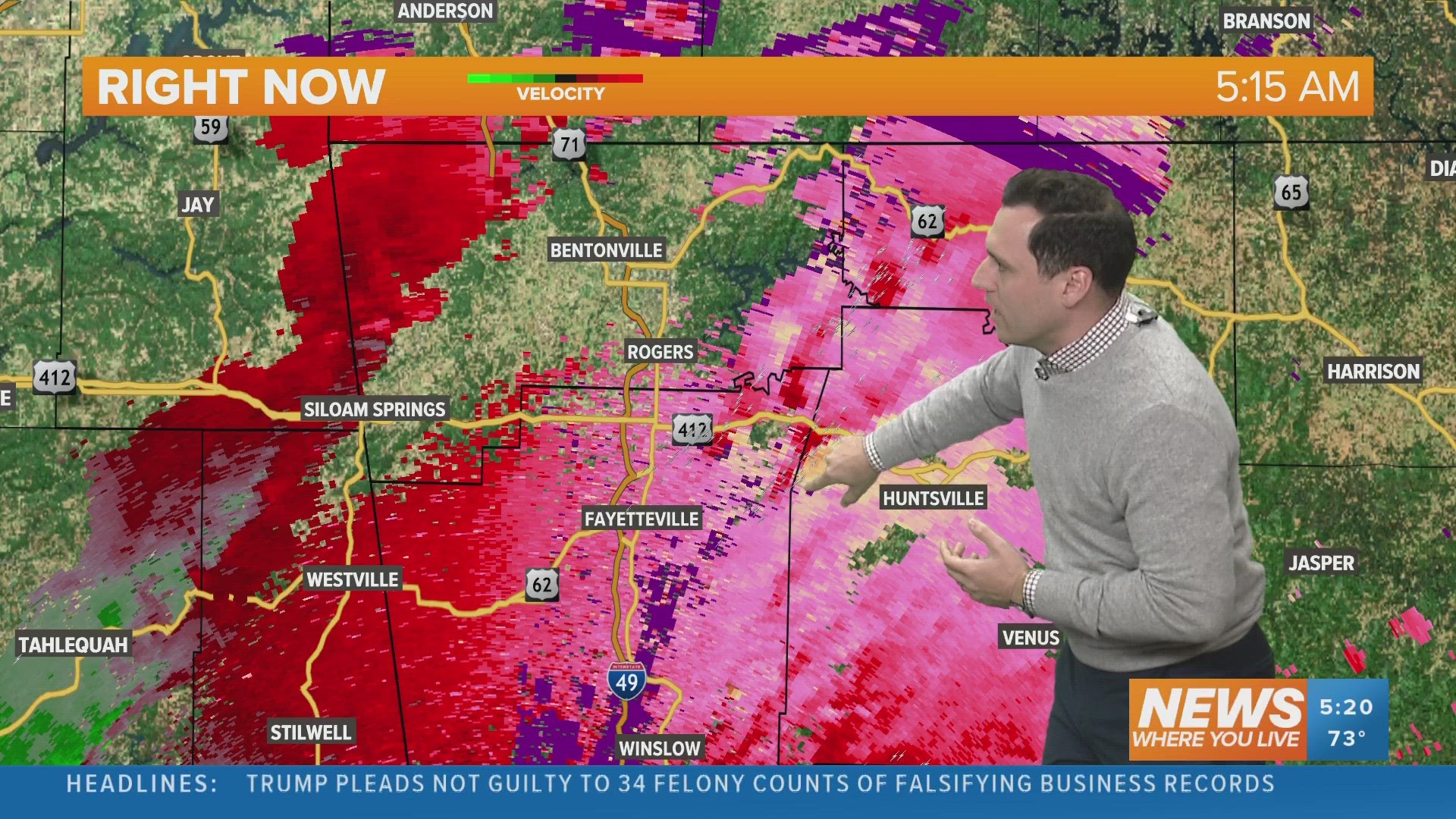
- 6:20 a.m. - Reports of hail across Washington County and slowing traffic due to accidents in Benton County.
- 6:08 a.m.- Severe Thunderstorm Warning continued for Benton and Washington counties until 6:45 a.m. Now expired.
- 5:42 a.m. - Severe Thunderstorm Warning issued for Benton and Washington counties until 6:30 a.m. Now expired.
- 5:30 a.m. - Tornado Warning issued for Madison County until 6:15 a.m. Now canceled.
- Wednesday, 5 a.m. - Severe Thunderstorm Warning was issued for River Valley counties (Crawford, Franklin, Le Flore and Sebastian) until 5:45 a.m. Hail up to 1 inch was reported with winds up to 60 mph. Now expired.
Tuesday, April 4.
- Midnight - Cells are slowly starting to pop-up with pockets of lighting, mainly in the mountains.
- 10 p.m. - Few rumbles in the mountains but not severe weather yet.
- 8 p.m. - Stray showers have popped up across the mountains, no severe weather yet.
- 6 p.m. - Isolated showers and downpours have developed across western Arkansas and eastern Oklahoma. Very small hail developed around Beaver Lake. Many areas are still dry.
- 4 p.m. - Very warm and humid, but dry. No storms yet.
Forecast (Tuesday)
Gradually storm chances will increase as cells become more widespread and rotate even more. There is a tornado potential across Arkansas and eastern Oklahoma late tonight. Hail and wind may also hit communities as well.


- 9 p.m. - Midnight: Isolated storms are possible. Some supercells may develop but remain hit-or-miss.
- Midnight - 3 a.m. - Isolated storms are still possible. Rotation is increasing, but you still need to pop a storm first before you can use the rotation.
- 3 a.m. - 6 a.m. - Scattered, widespread storms are possible as the cold front forces the development of more thunderstorms. Hail, wind, and tornadoes are possible.
- 6 a.m. - 9 a.m. - Scattered storms will weaken and push east. There may still be some heavy rain across the eastern River Valley from Fort Smith to Clarksville. Gradually the storms will push east toward Conway and Little Rock. Central Arkansas' storm threat will go up in the mid-morning.

