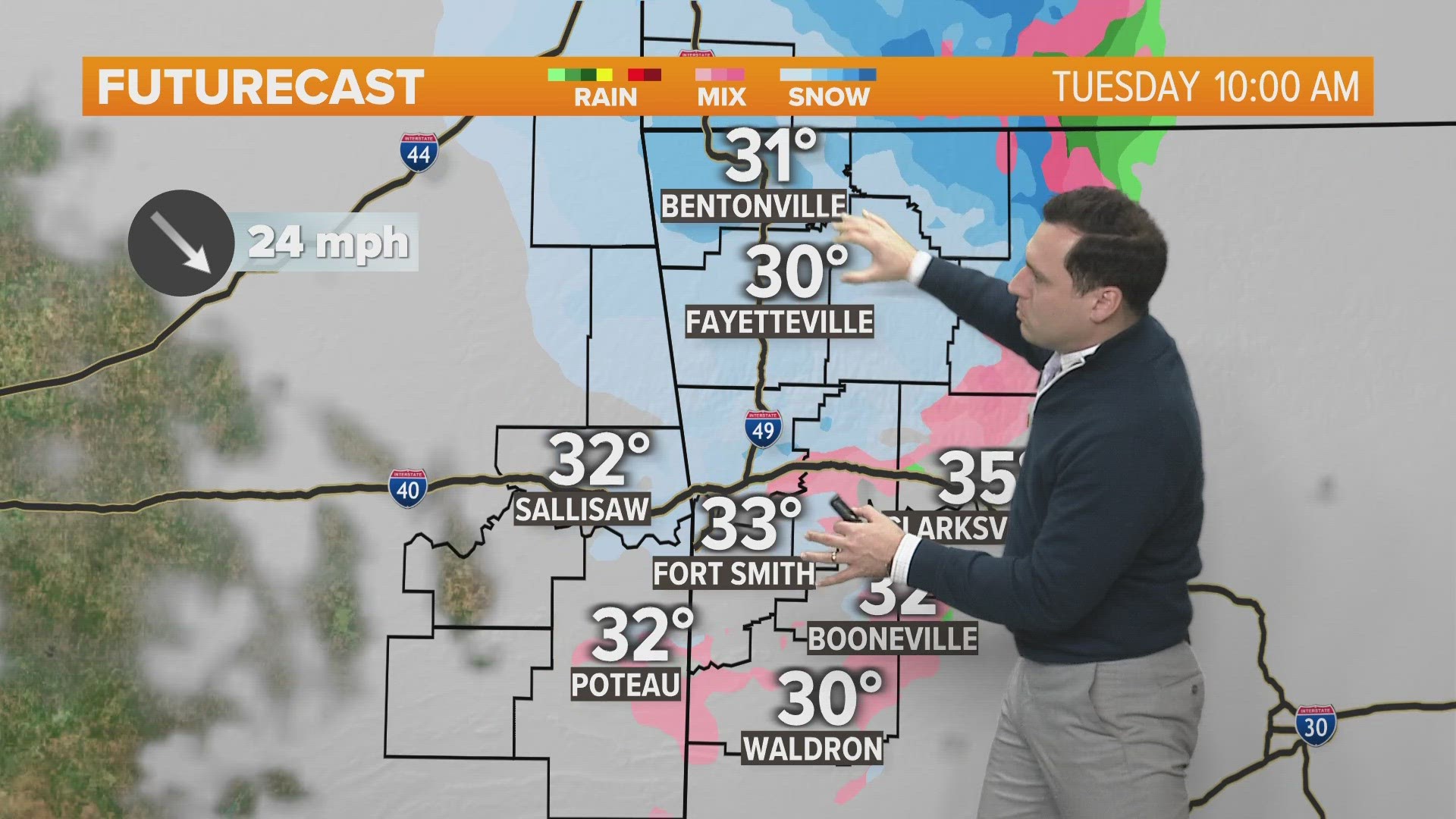
ARKANSAS, USA — Snow showers are on the move Tuesday morning crossing from eastern Oklahoma into western Arkansas. We're seeing light accumulations as well as travel problems. But how much?
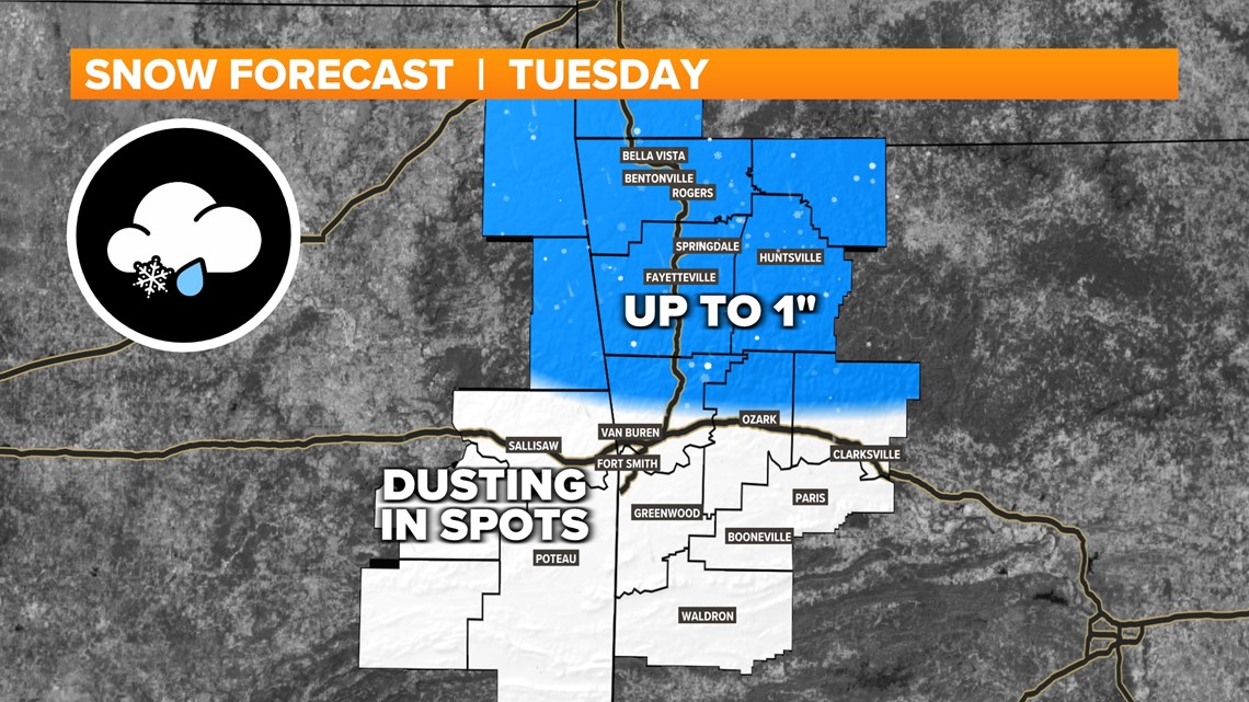
Update: As of 10AM Tuesday snow totals of a dusting up to 1 inch has fallen around NW Arkansas, with a dusting in the River Valley.
Tap here for our interactive radar to track the snow coming in from the west.
The jet stream is set up to bring a wintry system every 3 to 4 days to Arkansas and Oklahoma, continuing into the start of next week. Our current storm has mainly brought rain with a wintry mixture at times Monday into Monday, now the transition to snow is expected Tuesday.

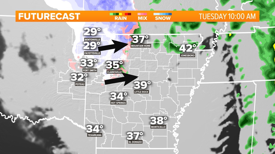
How much snow will fall?
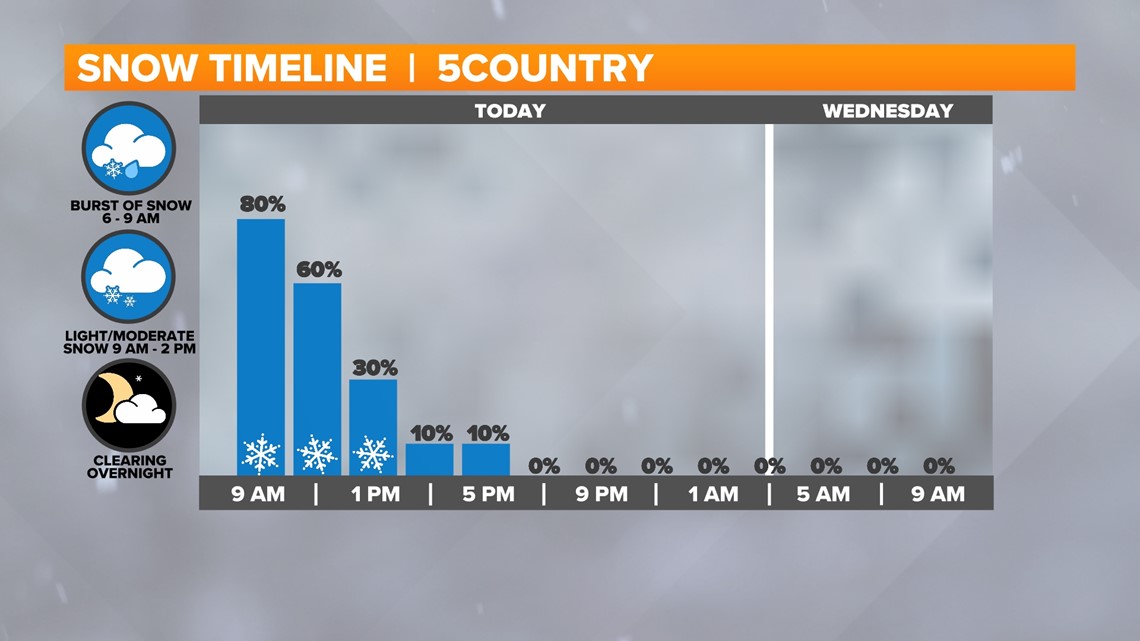
A handful of hours of snow showers will cross the AR-OK state line Tuesday morning. The snow will mostly be light to moderate, but at times a burst of snow will come in, helping the flake accumulate. Lighter snow flurries will linger into the early afternoon hours.
Because the storm will have pushed far north into the central Plains, the farther north you go, the more concentrated the snow showers should be. NW Arkansas will have the highest chance for accumulation, plus a few higher elevations around the River Valley. Accumulation will mostly be confined to grassy surfaces.

When will it snow?
For 5COUNTRY, expect snow showers from 4 AM to 2 PM. The peak snow showers may be 8AM-10AM. Due to the chance of snow showers throughout the morning commute, travel and school disruptions are possible. Check with your local school district.
We will have crews out monitoring the roads Tuesday to help you plan your commute.

How will the roads be impacted?
During this whole storm, expect slick spots on the roads, especially on bridges, overpasses, and any travel into the mountains. Temperatures are hovering in the upper-20s and lower-30s, plus there are high winds so travel will be unpleasant for a while. There’s a chance some of the roads will have snow patches at times during the heavier bursts, but many times the snow will try to accumulate more on grassy surfaces.
A winter weather travel advisory has been posted for Benton, Carroll, Madison, and Washington counties for widespread chances of slick spots. Sequoyah, Crawford, and Franklin counties in the River Valley have been added to the winter weather advisory.

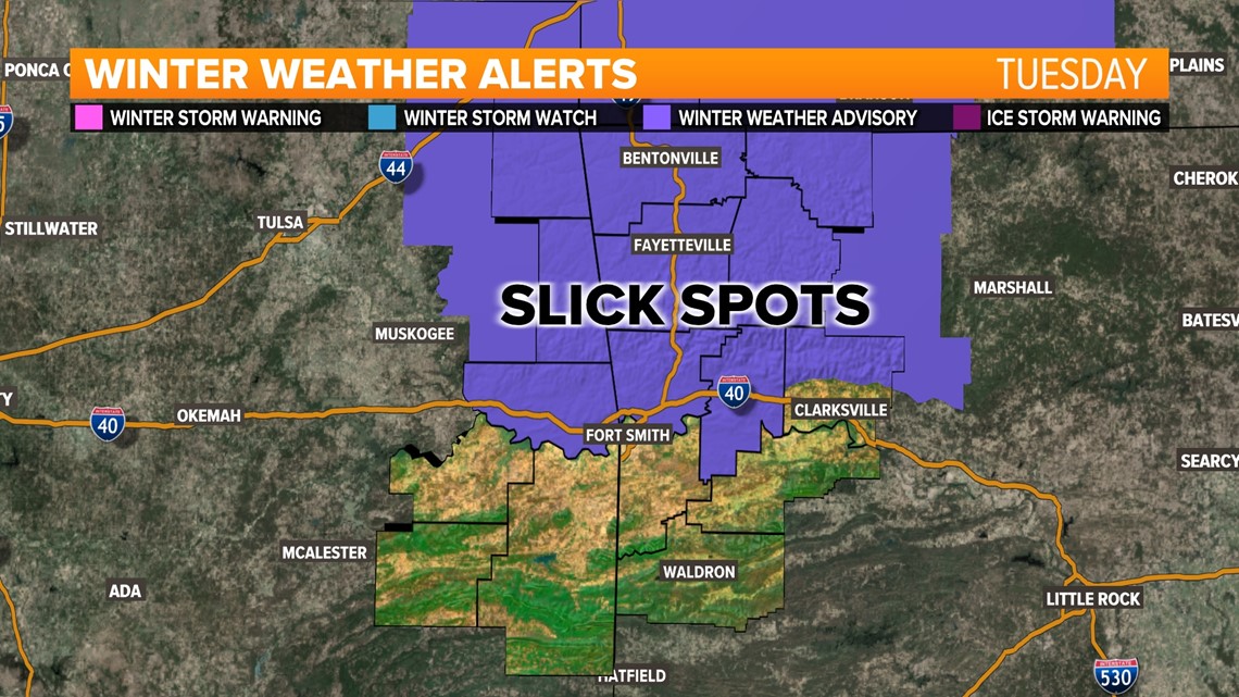
As for the Tuesday morning and lunchtime commutes, expect snow showers to move in and stick to the roads, especially on rural roads and bridges.
This snow will probably not melt as quickly as last Friday’s storm. Temperatures will steadily cool Tuesday morning to around freezing and then settle there during the afternoon, which may prolong the impacts on the roads.
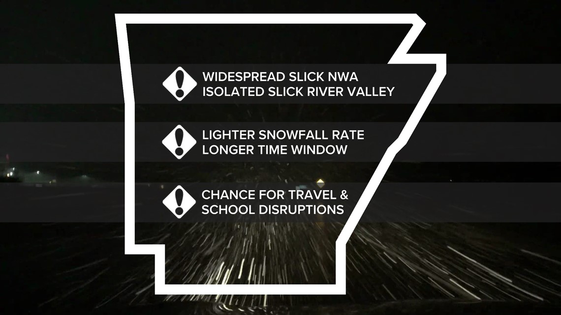
Northwest Arkansas: Expect higher impacts on the roads due to colder temperatures.
River Valley: At times the roads may become slick, but less accumulation is expected.

Last minute thoughts
- Snowfall forecast is always tough. Expect slight changes. Your neighborhood may get more or less than the forecast.
- Always be prepared for roads to be slick, at least at times. Crews will treat before the snow arrives, but how the treatment reacts with the snow is also a guess.
- School disruptions will be possible, but check with your local school district.
- During the storm, the 5NEWS crews will be out monitoring the roads so check for last-minute information before heading out or making decisions for you, your family, and your business.
-5NEWS Weather Team
Watch 5NEWS on YouTube.
Download the 5NEWS app on your smartphone:
Stream 5NEWS 24/7 on the 5+ app: How to watch the 5+ app on your streaming device
To report a typo or grammatical error, please email KFSMDigitalTeam@tegna.com and detail which story you're referring to.

