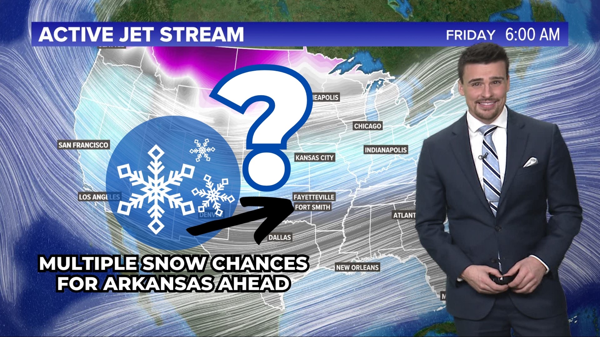
ARKANSAS, USA — UPDATE: Winter weather travel advisories have been expanded for all of western Arkansas, including all of the River Valley east of the state line.
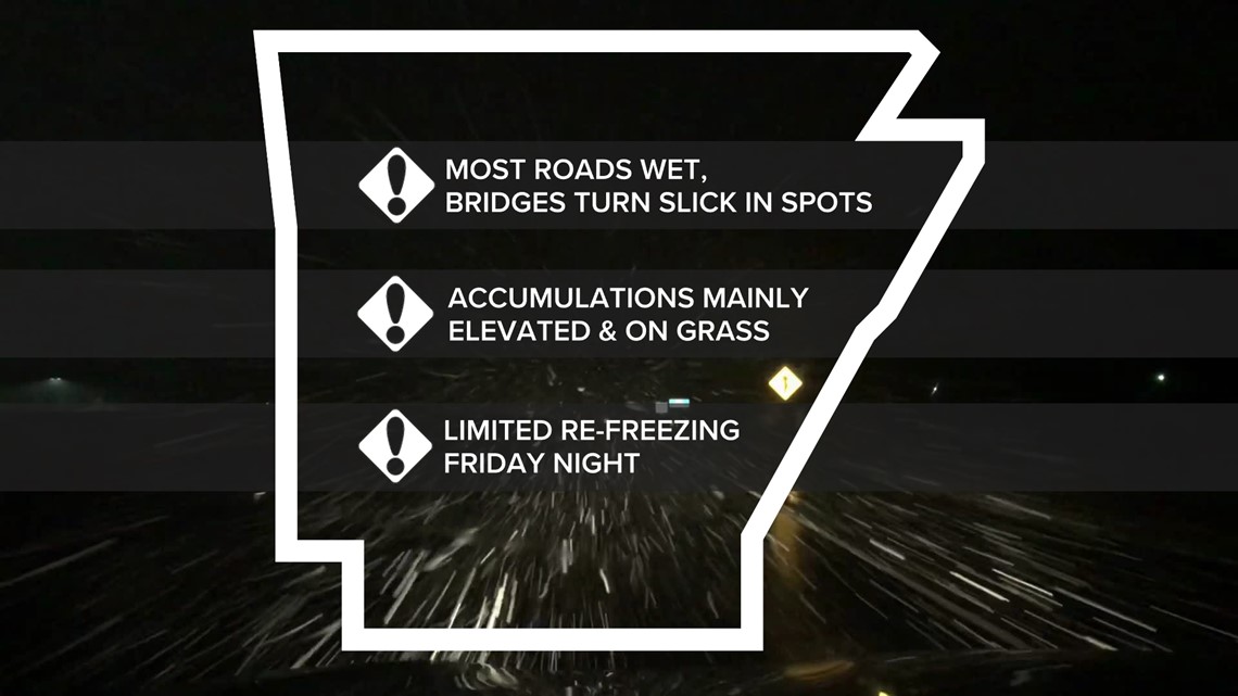
Snow showers are moving in for the Friday morning commute. Small bursts in the snow may lead to light accumulations across Northwest Arkansas and the River Valley. Most of the snowfall will only stick in the grass and off of the roads, but on some bridges, overpasses, and low-trafficked roads, there may be some slick spots that develop.
Scroll down for a more detailed road forecast and the chance for school closings if your school is back in session.
Tap here to track the snow coming in with our interactive live radar.
For the latest 5NEWS complete weather forecast, tap here.
Winter weather travel advisory counties on Friday from 4 a.m. to noon:
- Benton
- Carroll
- Crawford
- Franklin
- Johnson
- Logan
- Madison
- Newton
- Scott
- Searcy (southern)
- Sebastian
- Washington
- Van Buren (western)
What does a winter weather travel advisory mean?
This alert is the lowest activated alert for winter weather sent out by the National Weather Service (NWS). It generally means that roads will likely have slippery conditions at times, especially bridges and overpasses.

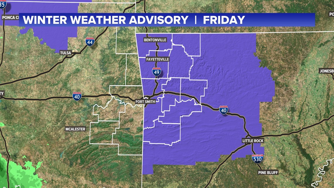
Your drive may end up being a little slower than normal, taking into account those slick spots. If your travel becomes impacted a bit, an advisory will be activated by the NWS.
The vast majority of accumulation will be on grassy surfaces, vehicles, trees, mailboxes, roofs, etc.
Snowfall forecast
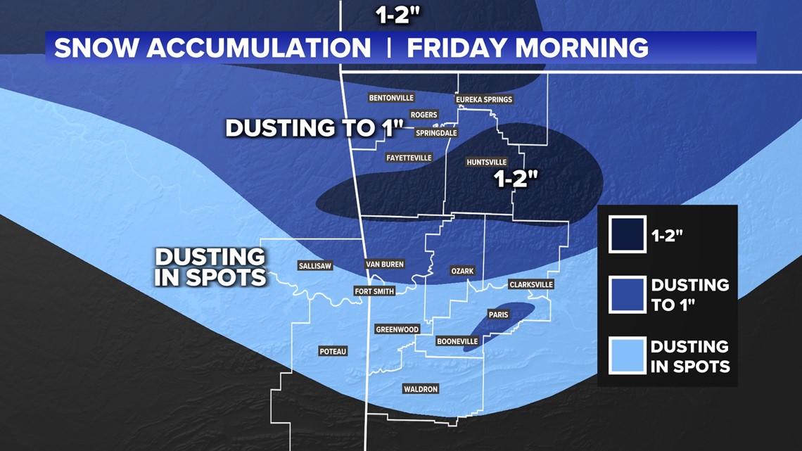
Most of 5COUNTRY will have a chance at some light accumulation, at least in spots. Generally, you need to be north of the Arkansas River to get a better chance of dusting.
In Northwest Arkansas and the Boston Mountains, you may be able to expect a dusting to an inch. A few locations may even get a quick two inches. The snow will likely not last long—expect it to melt throughout the afternoon.

When will the heaviest snow fall?
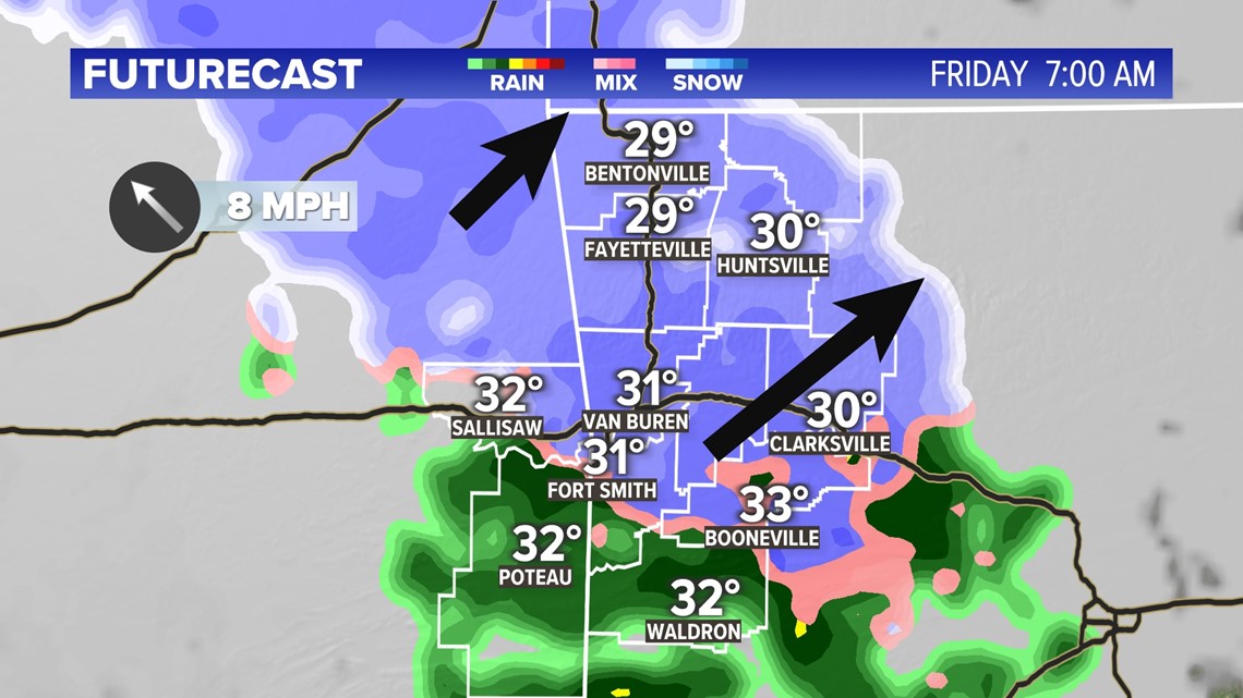
The travel advisory is posted from 4 a.m. to noon on Friday. However, the snowiest part of the morning will be 6 a.m. to 8 a.m. That is during the morning rush hour, which may cause traffic delays and crashes, especially on bridges and overpasses. The late morning hours will see scattered flurries. A stray snowflake is possible in the afternoon, but do not expect more accumulation.
This is a quick hit. The snow will not last long.

How will the roads be in the morning? School closings?
These are the two biggest questions we get. It's tough to forecast what will fall out of the sky and where. It's even tougher to figure out how much of it actually sticks and what the impacts will be.
Here are our best guesses:
- Most roads will be wet
- Some bridges and overpasses may develop slick spots
- The shoulders on roads may get a temporary slim coating of snow during the heaviest snow bands
- Expect some travel incidents Friday morning during the rush hour
- There is a low chance of schools closing in Northwest Arkansas and a very low chance of school closings in the River Valley. There may be a slightly higher chance of school disruptions in the mountains. The drive to school may be tricky in some spots. The drive home from school should be fine.
- Check with your local school district for closings and delays, and watch 5NEWS for those updates as well

Snow-lovers rejoice. Some of us will get a little coating tomorrow morning.
-5NEWS Weather Team
Watch 5NEWS on YouTube.
Download the 5NEWS app on your smartphone:
Stream 5NEWS 24/7 on the 5+ app: How to watch the 5+ app on your streaming device
To report a typo or grammatical error, please email KFSMDigitalTeam@tegna.com and detail which story you're referring to.

