ARKANSAS, USA — Forecast outdated. Tap HERE for the newest winter storm forecast.
The end of January will bring a winter storm to Arkansas and eastern Oklahoma, with some spots picking up a few inches of snowfall by Wednesday morning. This will be a very wet snow, however the latest timing may bring in a longer window of wintry mix, which may reduce snowfall totals, especially in lower elevations.
Tap HERE for the latest forecast from the 5NEWS Weather Team.
(scroll down for our snowfall projections)
This will most likely be Arkansas' best chance for snow for the rest of winter. The final two weeks of January typically are our snowiest, and this statistic will likely become true for 2023.
WINTER STORM SETUP
Snowfall forecast in the south is all about timing and track. Let's start with the track, which is roughly depicted by the pink line. The pink line also shows the general area between those who have a chance for at least some wintry weather (north), and those who will remain mostly rainy (south).

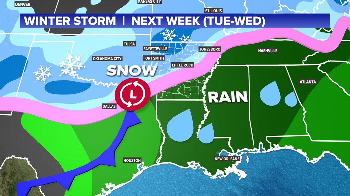
The track of the low pressure will likely swing across central and southern Arkansas, bringing decent snow chances to NW Arkansas and the River Valley, mainly west of Russellville. However, the timing of the entire storm may bring a longer window of wintry mix at first.
TIMING THE WINTER STORM
Generally expect a wintry mess to arrive Tuesday afternoon from 2-5 PM across the Natural State. This is a slower timing than previously thought. The delay may allow some warmer air to build across Arkansas in the midday hours, which may bring more rain and mix at first, event for higher elevations. By sunset and nightfall, that mix will start to change over to snow as temperatures cool, north and west of Little Rock.

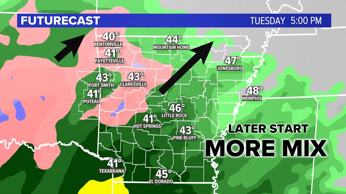
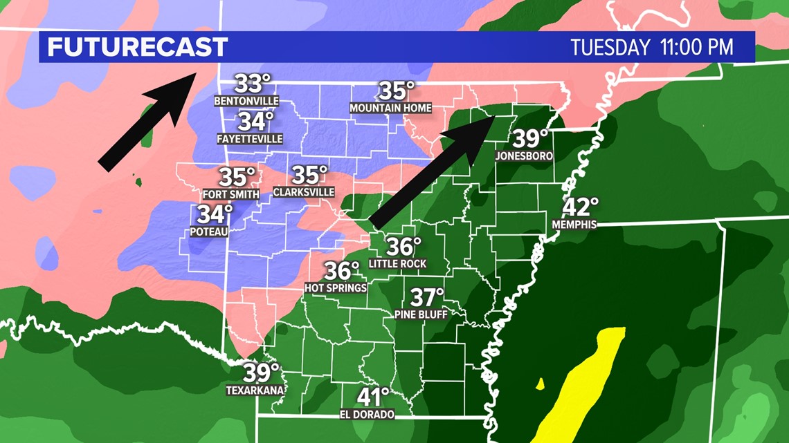
Later into the night, much of western Arkansas will be hit with heavy snow. There may be still some wintry mix along the Arkansas River thanks to warmer air still trapped in the lower elevations.
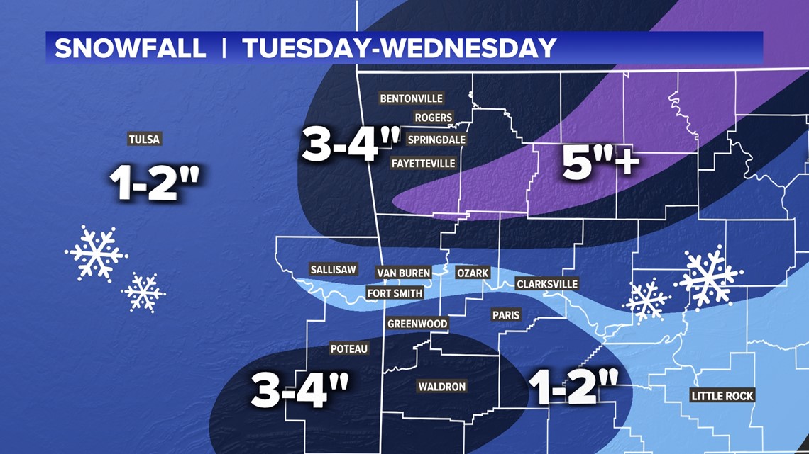
From 7PM Tuesday to 4AM Wednesday, the snow will likely be heavy across Northwest Arkansas, eastern Oklahoma, and parts of the southern River Valley (Greenwood to Poteau to Waldron to Paris).

LATEST SNOWFALL PROJECTS
(expect changes to the forecast)
Snowfall is all based on temperatures due to elevation. The best chance for accumulations will be areas above 480-500 feet above sea level.

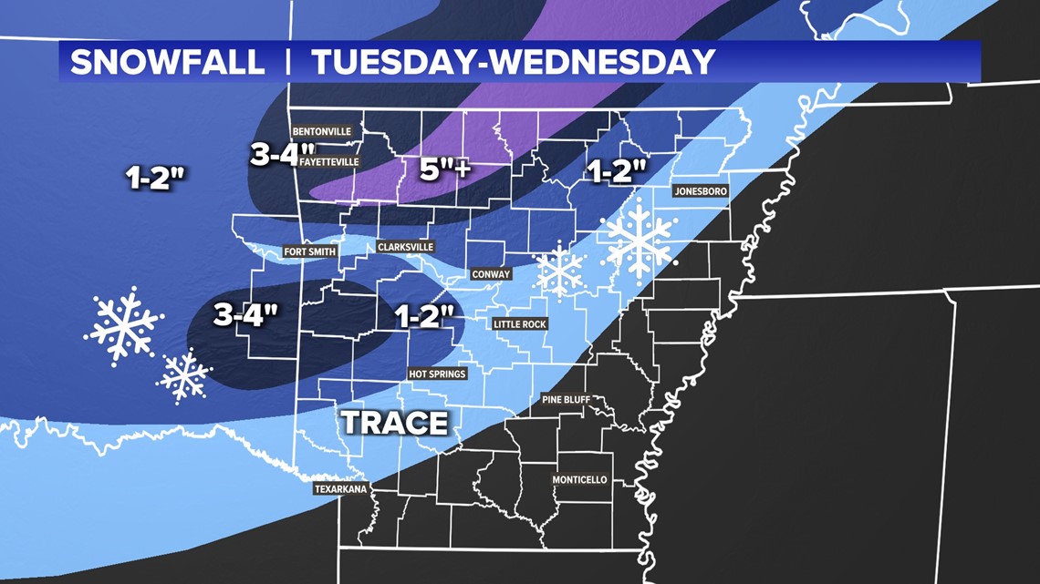
General snow forecasts by region:
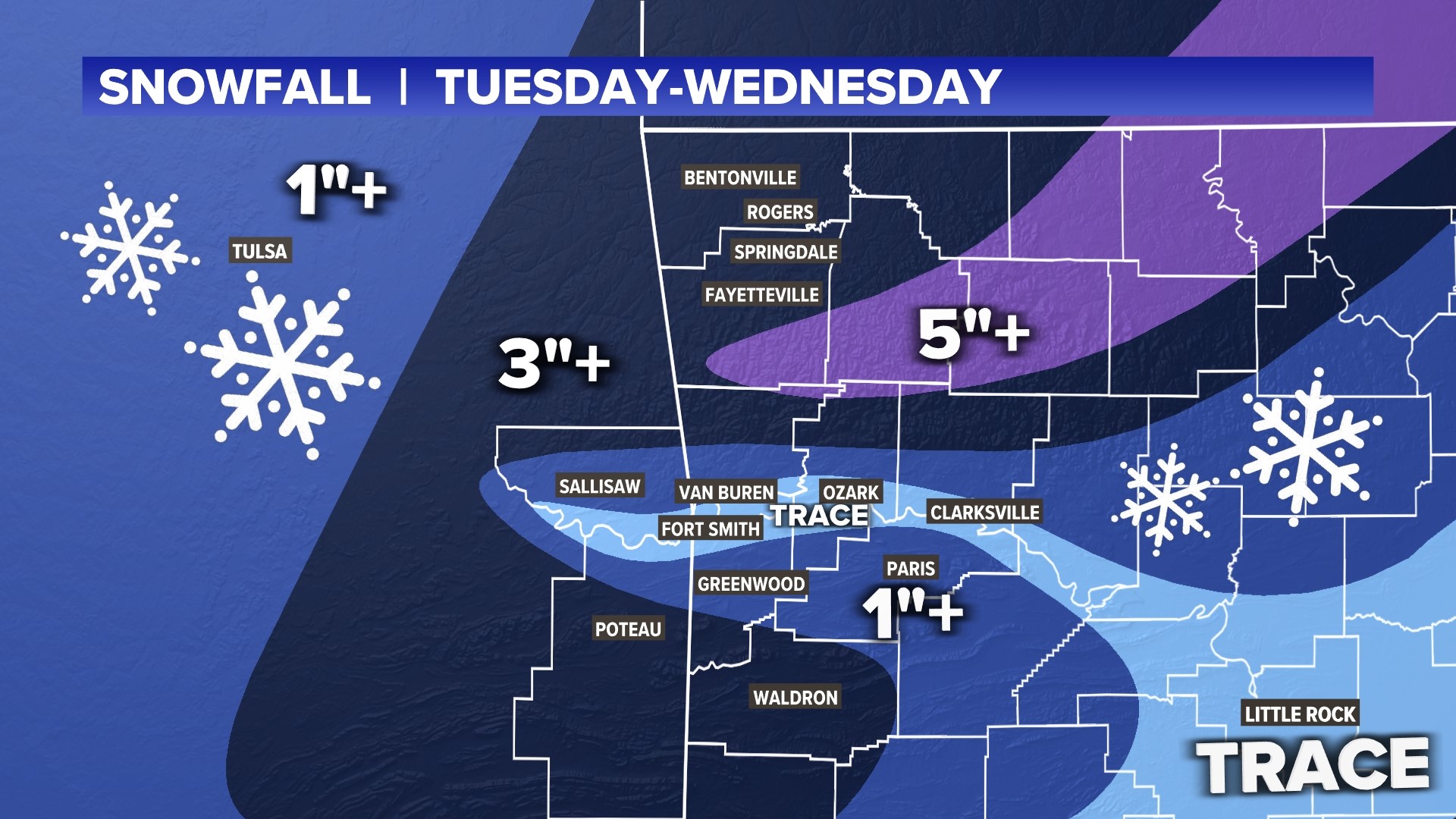
- Northwest Arkansas: 3-4 inches (locally 5+ inches in spots)
- Eastern Oklahoma: 2-3 inches (locally 4+ inches in spots)
- Boston Mountains: 4-5 inches (locally 6+ inches in spots)
- River Valley (within 10 miles of the Arkansas River): Trace
- River Valley (10+ miles from the Arkansas River): 1-3 inches
- Central Arkansas: Trace to 1 inch
- Northeast Arkansas: Trace to 2 inch
- Southern Arkansas: Mostly likely no snow, mainly rain
This is a closer look at 5COUNTRY (western Arkansas and eastern Oklahoma).

IMPACTS
Expect treacherous travel Tuesday evening and overnight. Bridges and overpasses will likely become slick and even snow-covered. Areas with lots of snow will still be difficult to travel and navigate on Wednesday.
The good news is that the wintry mix will not bring freezing rain or ice. The wintry mix will generally be made up of mostly-melted snowflakes.
There may be some re-freezing by Thursday morning for roads that remain wet or snow-covered.
Stay tuned for the latest information!
-5NEWS Weather Team
Our latest winter storm update:

